Saturday 18th November 2017
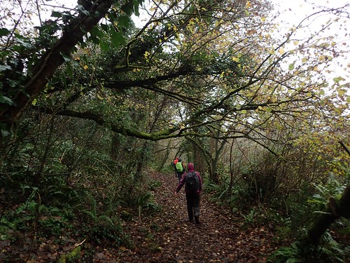
Saturday had come and, with it, the opportunity for another inland walk around one of Pembrokeshire’s many pockets…
However, a number of us were more enticed with the idea of a coastal walk, in spite of the commonly-known weather forecast.
This walk began from the Youth Hostel (YHA) at Manorbier, where the vast majority of walking group members were staying. For me, it was only a ten-minute drive from my private accomodation in St. Florence… Plus a small allowance for buying a sandwich from the local shop and the success in again completing the journey without reaching for a SatNav.

Within minutes of leaving the Youth Hostel, we were following the Wales Coast Path. For me, this was my second outing along this trail of the weekend – and my first ever steps along the Pembrokeshire Coast Path.
Overall, the Wales Coast Path is well over eight-hundred miles in length; dwarfing the South West Coast Path, along with many others. To find the time to walk all of it (although, numerous people have) seems like a challenge.
On its own, the Pembrokeshire Coast Path measures in at 186 miles in long… More manageable but still, probably a fortnight of walking, in a linear fashion. I think that distance exceeds Offa’s Dyke but falls twenty-odd metres short of the Severn Way.
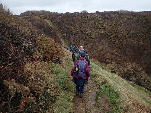
Passing the opportunity to visit Lydstep Point, we would walk eastwards or anti-clockwise in this circuit; climbing steeply up and then straight downhill to walk along Lydstep Haven.

Already, we could see that these rugged waves had an energy of their own.
I’ve never researched closely in to why the weather gets worse at this time of year… But I believe it’s due to the Earth’s ‘slanted’ axis (relative to its orbit of the sun) and its distance from the star. Then, there’s the moon orbiting our own rock and, with slightly less of a pull from the sun’s mass, perhaps the moon carries a greater influence on the tidal gravity we experience.
I really need to look in to what causes wind as well. Apparently, the moon has a part.
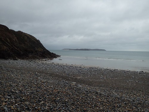
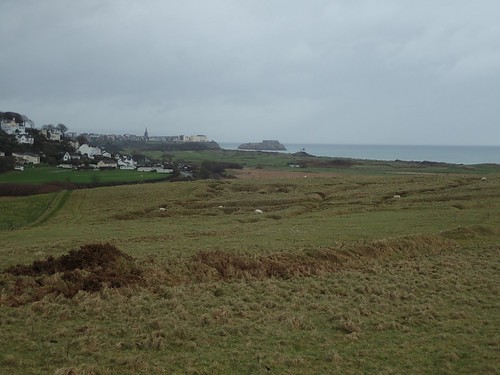
Caldey Island can be seen beyond the shoreline. It looks as though there’s a museum and ruined priory on the island, among other features. It can be accessed by a ferry that sets off from nearby Tenby.
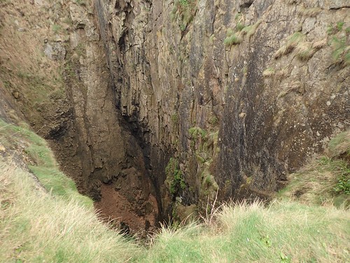
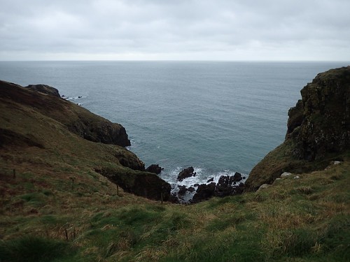
We climbed up from the far end of the beach to continue along the coast path. Down to our left was a huge chasm. In other parts of the UK, this might be referred to as the ‘Devil’s Hole’ or ‘Devil’s Frying Pan’.
It goes without saying that, even early in to this walk, the views were very special. I’ve heard people rave about Pembrokeshire and it’s coast path… But this isn’t anywhere near the very best bits!
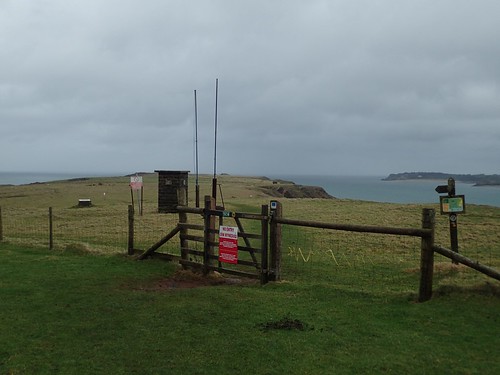
Between Lydstep and Penally, the Wales Coast Path crosses a military firing range. When red flags are raised to prohibit public access, a not-unreasonable detour is available.
It’s not as harsh as, say, the Lulworth Ranges in Dorset, where you’d be looking at a long walk to circumnavigate the range; leaving the coast far behind to follow roads, even.
We were fortunate that no exercises were taking place. Ignoring Tenby in the background; look closer and you’ll see trenches, away from the public right of way (this is not open access land). These trenches were used to train soldiers in preparation for the conditions of war!

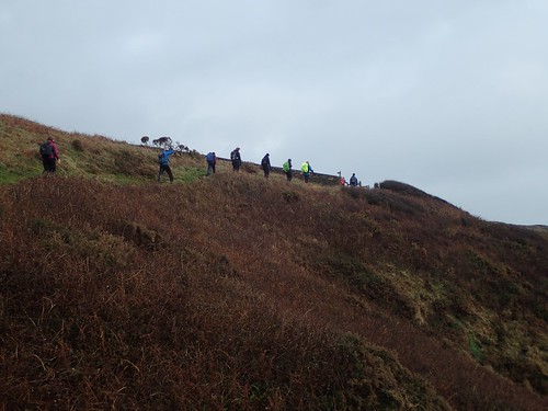
By this point, we’d been walking for close to an hour. Not a drop of rain had fallen but the wind remained intense.

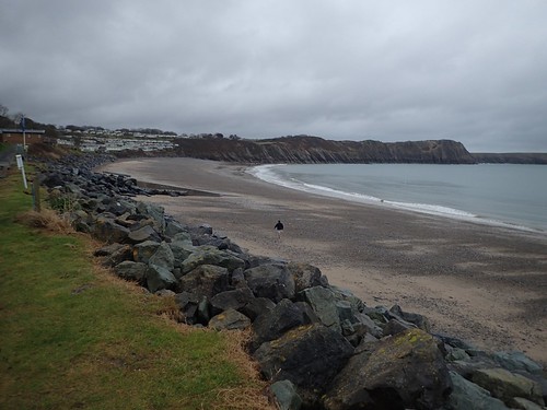
We sought shelter within these dune-like mounds, looking on towards the town of Tenby (our walk would not take us so far).
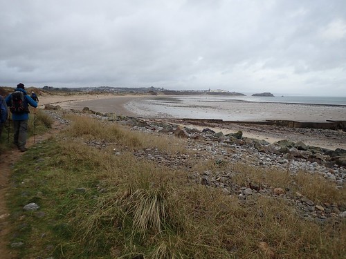
Following our stop, we descended to the beach just east of Penally.
It was along this stretch of sand that we encountered our first jellyfish of the day… And not to be our last!

Quite terrifying, aren’t they? I’d not seen one up close before. Dead or alive! A few people gently poked and stood on the alien-like texture of this lost lifeform. Those “eyes” and the Davy Jones-like features… Night-time beach walks are no longer on my agenda for 2018!
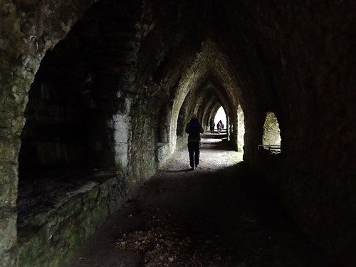
We soon turned in off the beach and left the coast path. Walking through Kiln Park holiday centre, we found ourselves following this very Gothic walkway beside limekilns.
From here, we crossed the A4139 and continued walk inland towards St. Florence. Rain had begun to fall, as we marched on across farmland and the occasional road, listening to the rumble of our stomachs.
Being rational for a moment, we were probably better off being rained on where we were. Out on the exposed coastal path, we’d have also been contending with the wind.

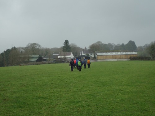
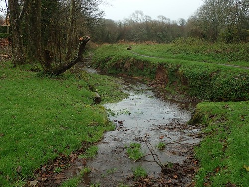
Plodding on and with several people intermittently stopping off for toilet breaks, we did soon reach St. Florence; seeking the designated picnic benches of a roof-less ruin of a building for lunch. After which, we continued along The Ritec as far as a road, with ancient clapper bridge opposite.
I’d already discovered this bridge on my own, two days earlier, as my accomodation for the weekend was only three-hundred metres away!
Heading south now, we would mostly follow country roads in the direction of Manorbier; crossing The Ridgeway*, passing the train station and a place called Buttyland!
*This is not quite the same ‘Ridgeway’ that I’m intending to walk but, from the minimal information I’ve found online, it did once serve as a popular route between the county of Wessex far to the east and Ireland.
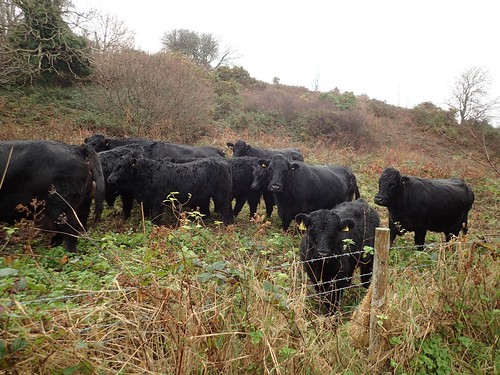
It was probably around Park Farm that we passed the cattle, heading south en route to rejoining the coast.
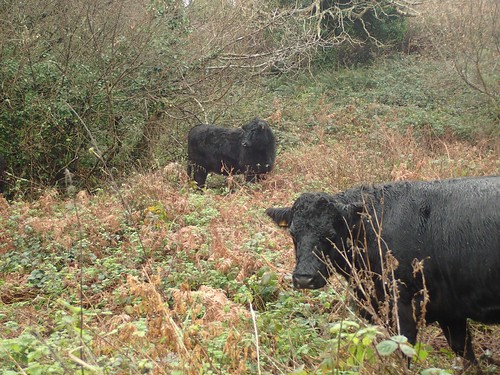
Perhaps it was the weather; they didn’t appear or sound to be best pleased to see us! Fortunately, there was a fence between us.
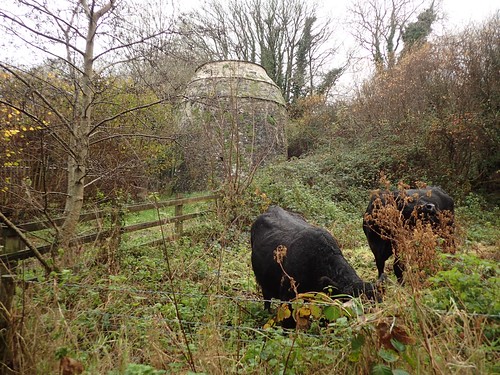
Just beyond the herd was the Dovecote.
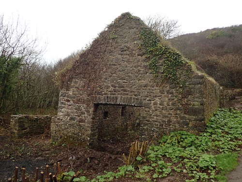
Around the bend; another old stone building just left to ruin.
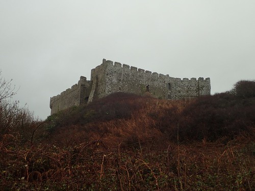
At the head of the hill beside us was Manorbier Castle. On a brighter, warmer day, perhaps we’d have paid a visit.
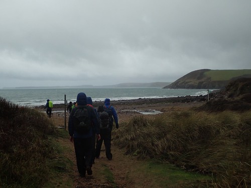
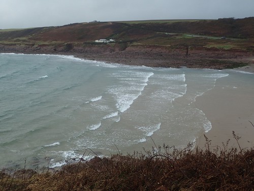
We rejoined the Wales Coast Path at Manorbier Bay.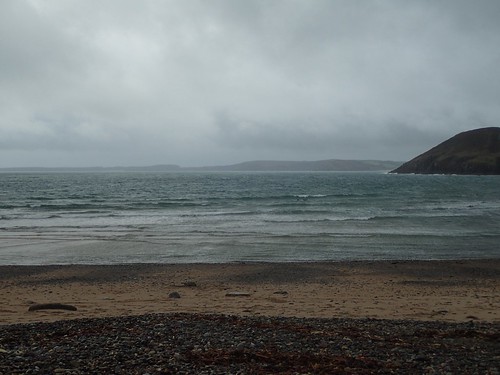
Again, meeting the sea, with its power and presence.
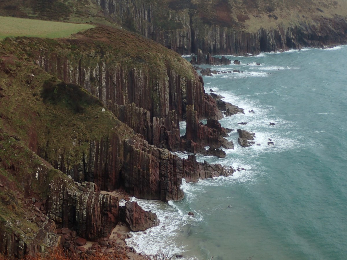
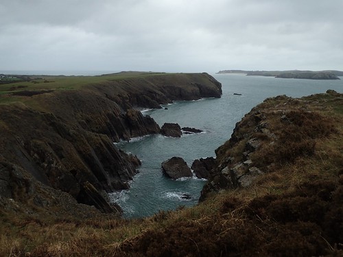
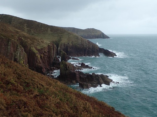
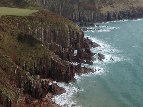
We climb up to follow the cliffs around Parson’s Piece, ever exposing us to the cross-Atlantic breeze.
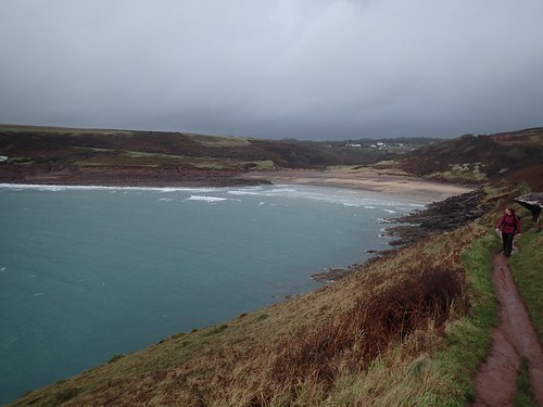
This section was no less spectacular than what we’d experienced at the beginning of our walk.
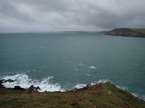
Technically, I reckon we were looking out in to the Celtic Sea and not quite the full Atlantic Ocean beyond. You can just see Stackpole Head in my photo. Perhaps even St. Govan’s Head. I find it staggering to think of the thousands of miles of ‘nothing’ that exists beyond. At least, until the next mass of land is reached (either North, South or Central America).

What few people seem to know is that a great portion of the Wales Coast Path (particularly through Pembrokeshire) also contributes as part of the International Appalachian Trail!
Think about it… How, hundreds and thousands of years ago, the UK would’ve been a tiny part of one ‘super continent’. Iceland and Greenland are also included, along with parts of Ireland.
This was quite a memorable way to end a walk. I found myself thinking of the rugged Cornish coast (of which, I’ve walked no more than fifteen miles) on a number of occasions. To me, it’s not as ‘prisine’ as the limestone cliffs of Dorset.
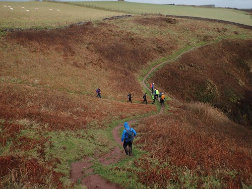
One final ‘down before the up’ awaited us, as we closed in on our return to Manorbier YHA. Just out of shot to the left, Susannah took an unintended slide. I appear to be the only one to have witnessed this although, I have no evidence.
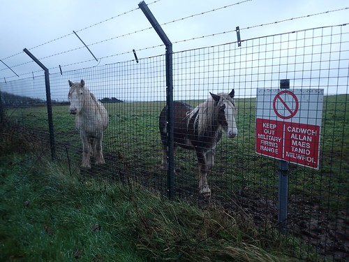
There’s a firing range within walking distance(!) of the youth hostel. Apparently, Manorbier Camp was operational on at least one evening, when various members of the group could hear the sounds of gunfire and explosion.
I always find it funny that we often see livestock beyond the ‘keep out’ signs in such places.
Our second official walk of the weekend and it had been a memorable success, without serious incident. I can reflect upon this weekend now and wonder…
Why don’t more people take to coastal walking in the winter months?
We saw no more than a small handful of other people on this day. I can imagine it being quite different in the height of summer.

You didn’t see it at it’s best on this grey day but yes the Pembrokeshire Coast Path is in my opinion as scenic as the South West Coast Path and also quieter.
LikeLiked by 1 person
Thanks, Jon. I hadn’t thought about it being quieter but, yes, I can see now that it doesn’t have as many Durdle Doors or coves to bring the daytrippers in. I imagine St. David’s Bay and further north might be busier.
LikeLike