
Saturday 21st April 2018
I’d been asked about leading a walk as part of our walking group’s annual ‘Mini Walking Festival’. This takes place towards the end of June every year, on a Saturday and it just so happens that we will be heading south to the Quantock Hills next month.
It’s an event that is open exclusively to members of Brunel Walking Group. We car-share and head south from Bristol to arrive and park in the same place. From there, members will be able to choose one from three grades of walk (1 Boot, 2 Boot or 3 Boot). I’ll be leading the 2 Boot walk and the idea is that we all reconvene near the car park at the end, ready to prepare the barbecue.

I’ve attended two of these events in recent years. Last year’s was set in Marlborough, deep within the midst of a Wiltshire heatwave. Before that (maybe 2015), I attended an event that was also set in the Quantocks.

I’m pleased to have been asked to lead a walk this year, although it may mean managing close to thirty people, in not a few more. Although I live beside the Mendip Hills, further north in Somerset; I often favour the Quantocks for the fact that they’re nestled so close together.
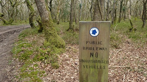
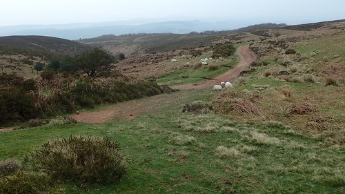
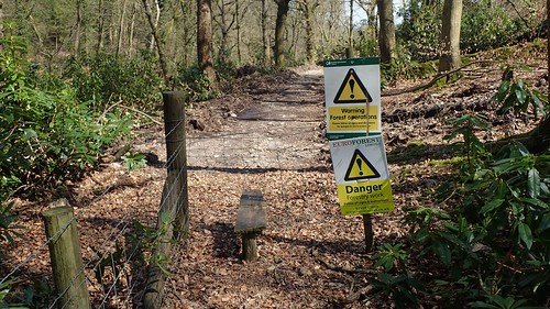
This walk begins at one of the car park’s off Rams Combe (OS grid reference: ST 168 376). As far as I’m aware, it’s free to park beside the toilet block (yes, actual toilets in the middle of the woods)… I may be wrong though, as many of the other nearby locations bear pay-and-display meters (…Yes, still in the middle of these woods).
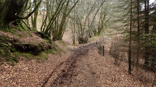
My immediate goal from here was to head north-west to the Dead Woman’s Ditch car park. There’s a more direct approach that involves a sharp uphill ascent, while I ‘zigged’ on in favour of the gentle forest track, before ‘zagging’ my way up to the top (the first of three groups back to the car park is also expected to begin food preparation duties).
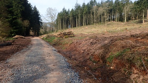
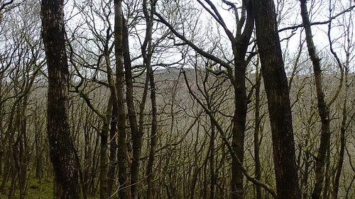
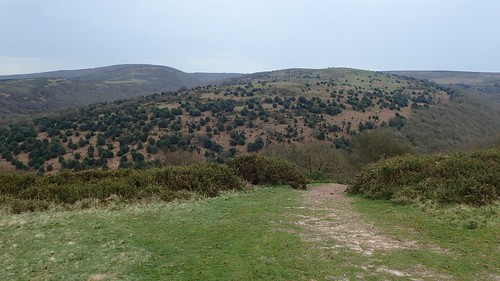
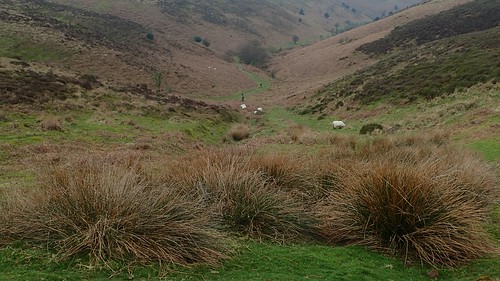
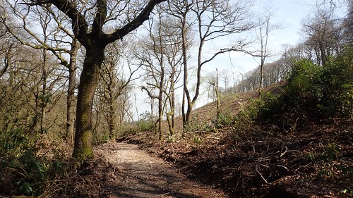
Looking south over Rams Combe, I was shocked by the volume of deforestation. I know this neck of the woods […] quite well and I’ve never seen it this sparse, in the four-years that I’ve been exploring this Area of Outstanding Natural Beauty.
Following the correct path to the car park isn’t too tricky from here, as you only have to turn left beside the suspended dog poo bag… Or note that there’s a cross-dyke bridging the short distance between the bridleway and the road.

Circumnavigating Robin Upright’s Hill, I would follow the next road to the north. There must be a story behind the vehicle license plate and the letters ‘WU’.
From here, I’d be descending towards Lady’s Combe. While much of the Quantocks area is classed as Open Access Land, with ‘paths’ and tracks running all over the place; I’ve generally found the bridleways on the map to be well marked and hard to miss.
Take note: portions of Wales!
I do remember following attempting to follow the path along Lady’s Combe sometime last year and from the opposite direction.
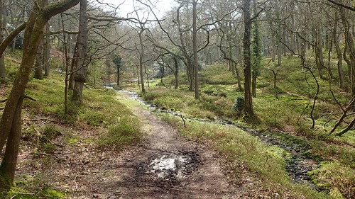
I found my way down to Holford Combe well enough on this occasion but, I wouldn’t be lurking so close to mean sea level for very long.
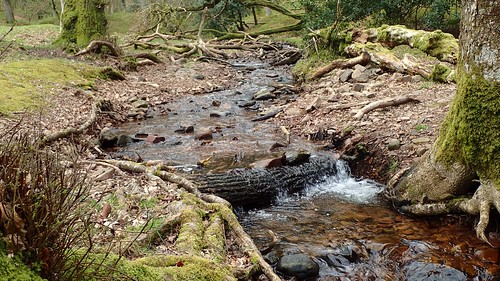
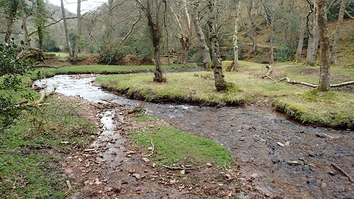
Here, I encountered what would be the first of several stream crossings. Born of the Lady’s Fountain spring (or something similar on Frog Hill), I’m never sure of when to refer to a stream as a brook, or vice-versa.
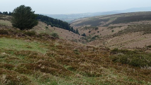
Now, I would begin a climb of around one-hundred metres and destined for my first summit of the day. Looking back through the trees, I could see the familiar forms of Woodlands Hill and Dowsborough hillfort; both of which feature in my regular walks here.

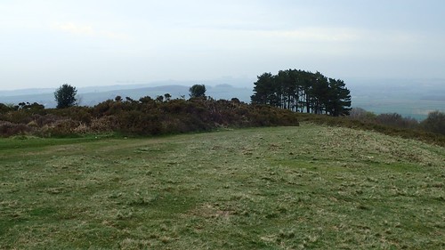
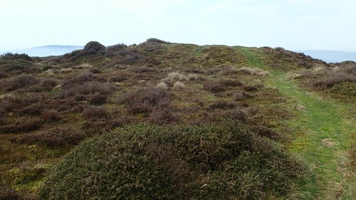
Soon enough, I reached the cairn-topped summit of Higher Hare Knap. I don’t come here often and I get the impression that others don’t either. Perhaps it’s lacking in the hilltop car parks to the west. Tranquil and with an almost-limited moorland-like view to the north.
I paused for some time with a cup of tea and something to eat, before moving on.
As I began descending west in to the next valley, a horse and rider came galloping past. I noticed somewhere recently (perhaps it was in South Wales) that signs have been put up to advise riders not to allow their horses to gallop, in the interests of preserving the landscape and its terrain.
Come to think of it, I might’ve seen the sign on Exmoor. While they don’t do as much damage as off-road vehicles (which have plagued the Quantocks over the recent winter), I can imagine it’s an issue we’ll be hearing more of.
Somerton Combe. Slightly wetter than the last and, surprisingly, a number of other people were about.
I would follow the course of water northwards, which appears to rise at a spring just north-west of Black Hill.
I crossed Short Combe to begin my next ascent; leaving other hills behind.
Working my way up Longstone Hill, this was more of a challenge than the former. That gathering of trees to the right in my photo is part of a memorial, dedicated to the lives served and lost from Holford and Kilve, during the War. I can never recall its precise location on the map.
A group of walkers (let’s refer to them as ‘late-middleaged’) were descending Longstone Hill as I walked on and up.
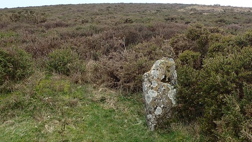
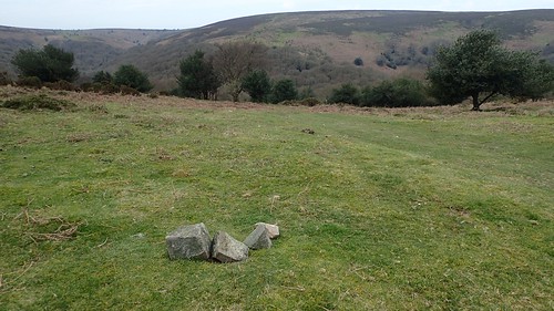
Although there’s no cairn or trig point to its 320m summit, there is said to be a boundary stone nearby. Not that I could find it. There’s a chance it lies within the heather and gorse, away from the path. This smaller stone (beneath the summit) was enough of a discovery for me.
Maybe it was the boundary stone after all?
I didn’t actually make it to the summit, as I could see there would be nothing of note to discover on top. Instead, I took a more direct router to greet the tops of the valleys just north of my location, from which I could walk westward and on to the next high point.
Of course, it also began to rain at this point and in contrast to the forecast I had read in the morning. I was wearing contact lenses anyway, as I often find my visibility is quickly impaired by the droplets and condensation of wet weather.

At 310m above sea level, I would discover the trig point of Beacon Hill and not for the first time.
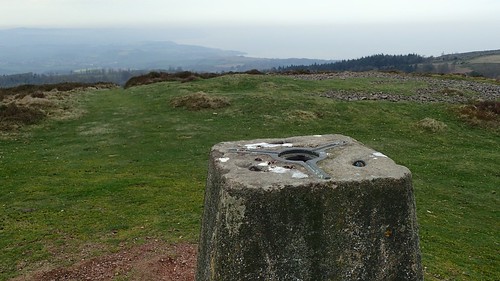
Although this is not the highest point of the Quantock Hills, it remains to be my favourite trig on this land. Fewer mountain bikers make it out this far north and views of the Bristol Channel (north) and west to Exmoor tend to be very good.
I perched carefully for my lunch stop; eager to avoid squashing the many pellets of sheep poo that adorn this summit.
With more than half of the walk complete by now, my best option was to take a fairly-direct route south on the return to my car.
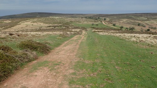
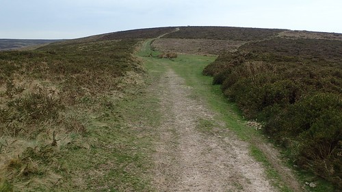
There’s a very clear-cut bridleway that leads all the way to Crowcombe Park Gate. But it is frequently used by mountain bikers, the occasional horse rider and the majority of walkers following this elevated line.
In short: I prefer to minimise following it too closely.
One slight detour west from this path leads to the site of Thorncombe Barrow. An ancient burial mound that also stands twenty-three metres taller than Beacon Hill.
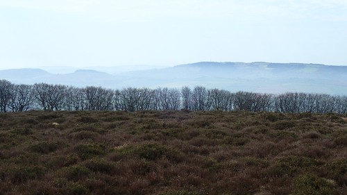
I paused here to finish off my tea and appreciate the solace, while admiring the eerie mist that had risen in the vale between ahead of Exmoor and the Brendon Hills. This was supposed to be April… I really don’t think we’ve seen much of spring in 2018?
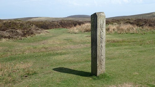
Boundary posts like this one (Halsway Post) and useful navigational aids. Another exists further north at Bicknoller Post.
Another optional detour from the main route heads on to Hurley Beacon. Another ancient burial mound (tumulus), also known as ‘Fire Beacon’.
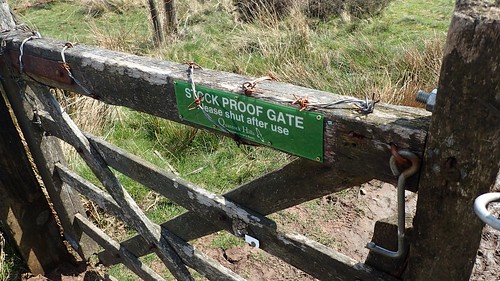
Although, I’d say the gate from here is more than just ‘stock proof’!

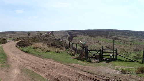
I arrived at Crowcombe Park Gate via the trig point on Black Hill. From here, I was looking to follow an eastward footpath along the edge of the field that would then led on to Rams Combe and my outward-going route.
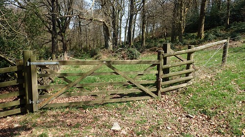
At the end of this field, I found the field gate to have been chained shut. I have since reported this to Somerset County Council and via the Ramblers’ Pathwatch app but, for the mean time, I climbed over – at the hinge end, which would cause the least amount of damage to the structure and its fittings.
Perhaps I should consider taking a different route, if I end up leading a group of twenty or more.
At first glance, I feared the way beyond here had been fenced off. Then, I noticed the ‘makeshift’ stile for climbing over. It doesn’t look very child-friendly.
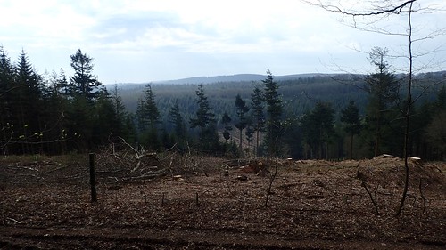
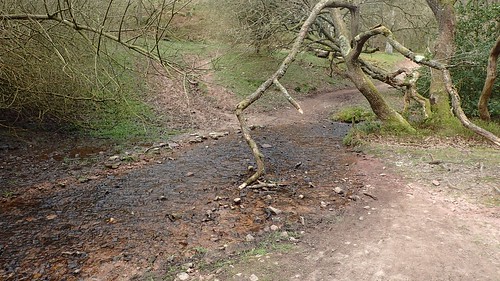
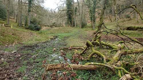
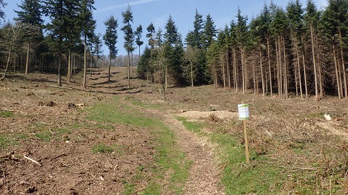
More trees had been removed along this route, before I’d cross a stream and rejoin Rams Combe.
There was another sign up to the left, prohibiting mountain bikes from using the path, in the interests of maintaining it. I wish I could remember the rest.
While it’s not entirely necessary to do a ‘recce’ of a walk for this event, I now feel very confident in leading my route, however many may end up following in tow.

What a beautiful walk! I’d love to be there right now. 🙂
LikeLiked by 1 person
Thanks, Elizabeth. I’m sure you can see why it’s one of my favourite areas. 🙂
LikeLike