Saturday 5th May 2018
My Bank Holiday weekend had begun! This was to be the first of two major outings over the course of three days. I’d not been across to the Welsh mountains since a very wet day in January. For this weekend, the forecast promised undisturbed sunshine.

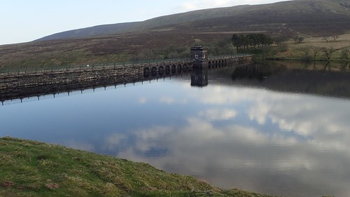
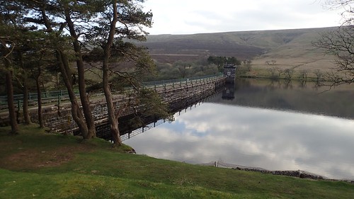
Leaving early from the Saturday morning, I made my way on to the A40 Hereford road, soon turning off at signs for Llanthony Priory. While the Priory (which I haven’t yet visited) offers a free car park of its own, I was able to navigate my way along narrow roads in to the Mynydd Du Forest, where I would eventually find the Blaen-Y-Cwm car park ahead of Grwyne Fawr Reservoir.
Following the run of the river, I’d passed at least two other parking opportunities before arriving at my intended destination. Each one appears to be free to use.
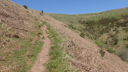
There were fewer than half-a-dozen other cars present, with space for many more. I was able to start my walk in good time, walking parallel to but climbing gradually away from the river below.
In many places, water could be found to trickle down the slopes of the hill and mountain sides. I ended up losing the path at one point; marching on ahead through the trees, before descending down a bank to rejoin the original track…
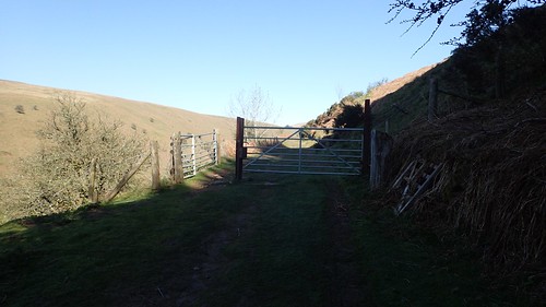
With the open space on offer beyond the gates, I realised it wasn’t the right way and had to make an about-turn in order to correct myself. I suppose it is better to get these mistakes out of the way early on!
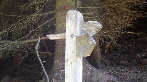
A broken fingerpost helped me on to the correct past, before I’d again lose my way in the woodland beyond. Looking anxiously for a point at which I could climb the fence and break out on to the hillside, there was typically another hiker sailing down the hill infront of me, who kindly directed me to the gate I’d been searching for.
My way forward would mean climbing the side of Y Fan at an angle; heading north towards the Blacksmith’s Anvil stone and the ridge beside it.
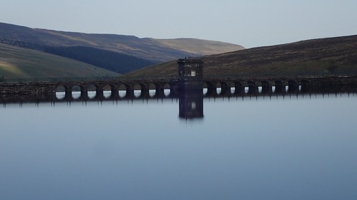
I could’ve paid more attention to my compass, instead of following the ‘obvious’ path on the ground, which appeared destined for Grwyne Fawr Reservoir (I could just see the dam, ahead).
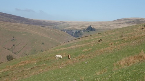
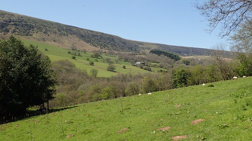
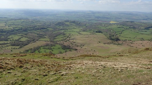
Away to my left, the flat plateau standing above the valley is Waun Fach. Perhaps not the most significant of mountains in South Wales but it is the highest point in the Black Mountains range.
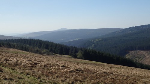
Some way behind me, Sugar Load (not officially a mountain) stood proud of the landscape.
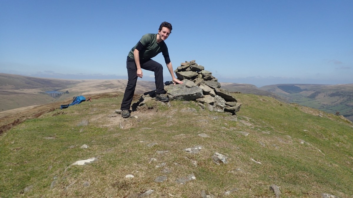
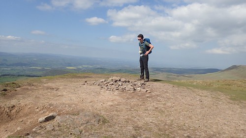
I reached the ridge of Y Fan with a sense of relief. On admiring the views across the next valley, I I felt a sense of achievement. Even if I’d not been able to locate the anvil stone.
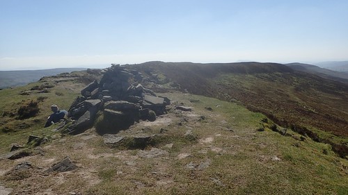
I was a few hundred metres north-west of where I’d hoped to be and backtracked along the ridge to reach the unmistakable cairns, where I also briefly met and talked with this guy from Pembrokeshire. He’d spent the night camping in his van in one of the other car parks – apparently, someone had tried to force an entry while he lay asleep!

We didn’t exchange names but he knew of the village I currently live in, all the way in North Somerset, thanks to his previous job that used to see him travelling across the Severn and all around the south-west. I was impressed, as I know many people living in Bristol, barely ten-miles away, who’ve still not heard of Wrington.

He soon moved on heading north towards Rhos Dirion, where I would arrive much later in the day. His own route had seen him join the route further south at Bal Mawr. Listening to him talk, I also picked up a few tips on how to correctly pronounce these names!

After resting up and refuelling for a few minutes, I would prepare for my descent in to the next valley, with the unmistakable line of Offa’s Dyke bordering the far side.

Another more interesting cairn could be found on the way down. This is more like the beehive-form of Carn Pica, which can be found to the eastern edge of the Central Brecon Beacons.
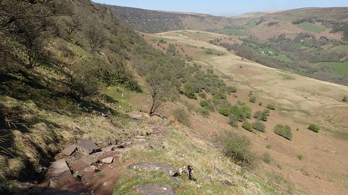
My descent lasted a good while, on a path lined with loose rocks. A couple of younger people passed me on the way up; their own faces outlining how challenging the ascent had been. I had to resort to using GPS on my phone to confidently navigate my way to the exit point that would lead to a road and then Capel-Y-Ffin.

If there is one chapel in the village that defines Capel-Y-Ffin, this is probably it. A few other people (less serious hikers) had parked at the roadside nearby, where parking opportunities are extremely limited.
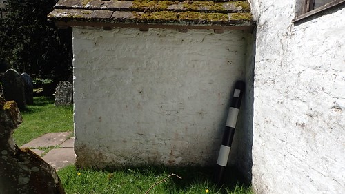
I found it odd that there was a traffic bollard lent against one corner of the wall.

Another chapel exists over the Afon Honddu river.

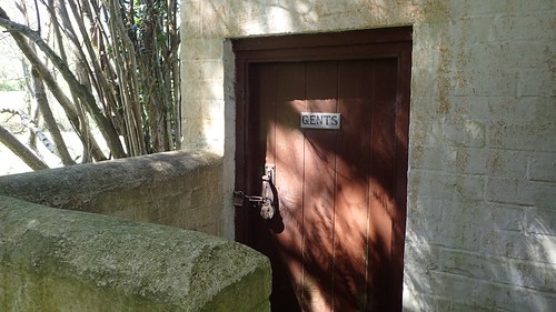
Unfortunately, the toilet door was locked.
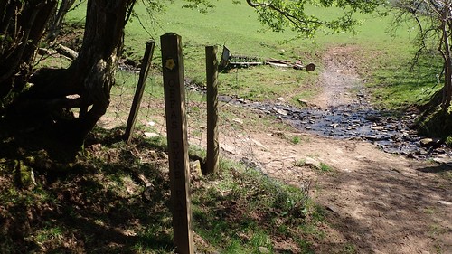
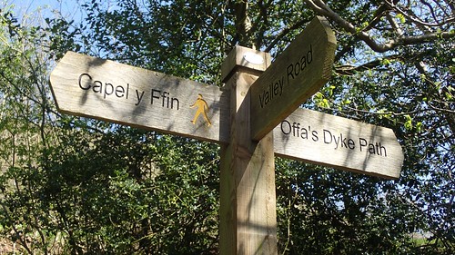
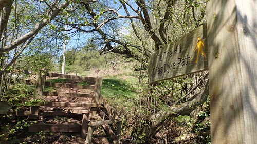
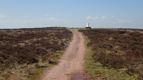
From here, the paths leading on and up to Offa’s Dyke are very well signposted and easy to follow.
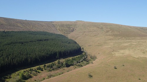
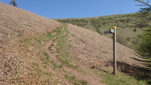
Above, you can just see the track I followed down from Y Fan before arriving in Capel-Y-Ffin.
I’d like to express that “The Hill” is an understatement in the carved lettering above… I would climb a good 300m in one hit before reaching the apex of the Offa’s Dyke ridge. I remember pausing to catch my breath about six times – no hill had ever hurt so much! I felt like I was going to throw up on three of those occasions.
It may not look too bad to begin with but, trust me; it soon kicks off as it means to go on!
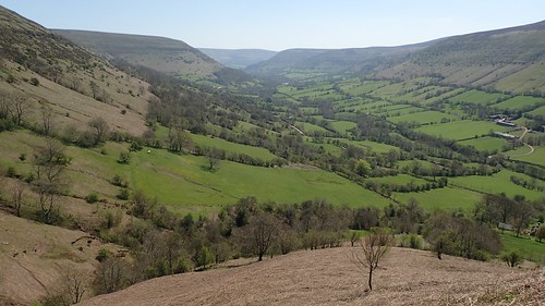
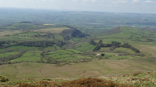
It was worth pausing to admire the views, looking south-east down the Vale of Ewys where Llanthony can be found.
I remember passing a couple of people who had decided to take a breather during their descent… There was clearly no easy way to do this one.

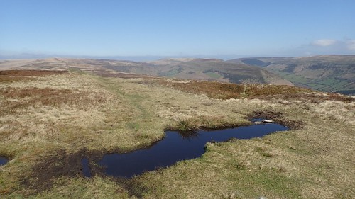
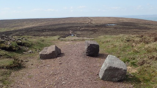
Another sense of relief and achievement reached me as I discovered the rather pitiful pile of stones that marks a cross-junction in the paths. Continuing over the ridge, you would soon descend in to the Olchon Valley.
From here, I was to turn left and follow the dyke north across the heathland towards Hay Bluff.

I would soon pass more and more people. Suddenly, I found myself in a less remote part of the Black Mountains! One group consisted of between twenty and thirty members… I remember now that at least one of my social media followers was there (she may be reading this now), although we didn’t recognise each other at the time.

Stone cairns adorn the line of Offa’s Dyke. Even in poor visibility (and I speak from experience), it’s very hard to go wrong, here.
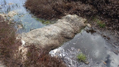
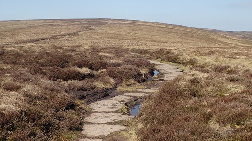
A number of “mummified sheep” had been laid to rest in the peaty water… These appeared to be nothing more than packages of wool. I wonder if the area had flooded over the winter? We did seen an excessive amount of snowfall and not to mention the absence of spring.
I stopped for lunch on the slope of Llech Y Lladron. Looking straight across the heather ahead of me, it looked as though I was actually going to arrive at Hay Bluff and receive a decent view…
I could see the trig from a good couple of hundred metres back. A surreal experience, in my fourth attempt; where, in each previous iteration, my field of vision had been filled with thick cloud.
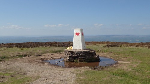
Actually, I was most surprised to find no-one else lurking nearby.

There are several car parking opportunities close by but beneath the Bluff.

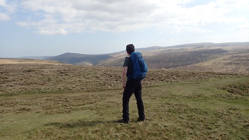
My next move would involve crossing the head of the valley I’d just escaped from and climbing towards the summit of Lord Hereford’s Knob.
This is known as the Gospel Pass and lies very close to the border with Herefordshire. Apparently it’s the highest road pass in Wales and, in spite of this fact, it is not referred to as a bwlch.


I’m actually looking at concocting and leading a group walk, inspired by this day’s adventure. Under my current plan, we’ll be parking somewhere along this pass, which should make lighter work of the initial climb at the very start of the day.

Lord Hereford’s Knob stands a mere 3m above sea level higher than Hay Bluff (680m Vs. 677m). I’ve been unable to find any explanation behind it’s name although, the Welsh may refer to it as Twmpa and avoid any sniggering at the back.
A placid cairn is to be found at its summit.
Another hiker – equipped with a tent, roll mat and larger backpack – had already stormed on ahead. My thoughts turn to the question: Why wasn’t I attempting to wild camp up here?
I pushed on, following my first ever visit to Twmpa and with one more summit in mind; the highest point in my seventeen-mile circuit.

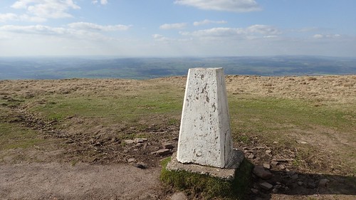
At 713m above sea level, this is the trig point at Rhos Dirion. I set my tripod up and attempted to take other photos with me in them but, somehow, ended up pressing the wrong buttons at the wrong time.

As I paused here brielfy, a male and female couple approached from the south-east; equipped with ‘his and hers’ Osprey rucksacks; about 65lt large and not unlike the Atmos AG model that I attempted to carry along The Ridgeway last weekend.
Everyone up here was wild camping… Even the guy I met from Pembrokeshire had asked if I was doing it. Although the laws do not encourage it, a wild camp in the mountains of South Wales is certainly on my mind!

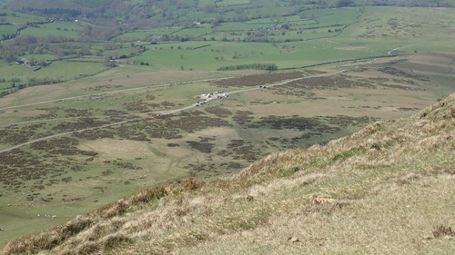
Heading south towards the junction with a byway, the path was in excellent condition and looked as though it was still in the process of being laid. Honestly, this was superior to much of the Central Brecon Beacons and yet, I never hear of many people summiting Rhos Dirion.
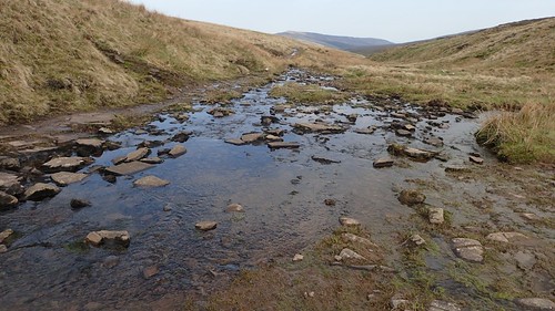
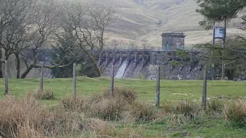
This byway would guide me down towards the reservoir, from the source of Grwyne Fawr. A small group of mountain bikers were also following this water’s story.
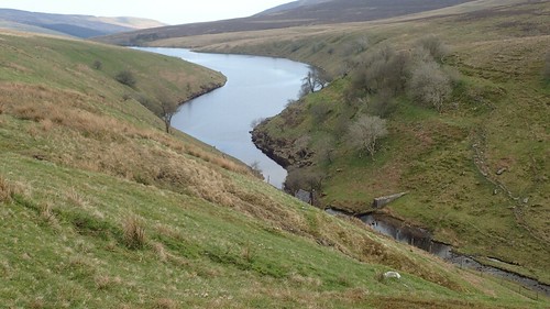
This was a much longer section of the walk than I’d anticipated. I was expecting to reach the dam in about thirty-minutes but it honestly felt very close to an hour.
Even then, I had some way to go before I’d be back at my car. But the descent was gradual, if slightly uneven or wet in places.

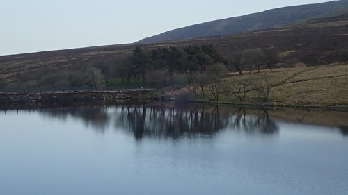
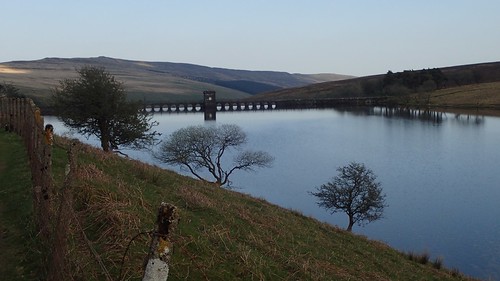
Before the reservoir was constructed, there was once a village in the valley, that was evacuated ahead of time before being ‘lost’ to the watery depths. This is actually quite a common theme for the history of Welsh valleys and man-made reservoirs.
I wonder whether many people have attempted to camp on the perfectly flat ground beside the dam? Maybe it’s too close to the byway for the comfort of solitude.
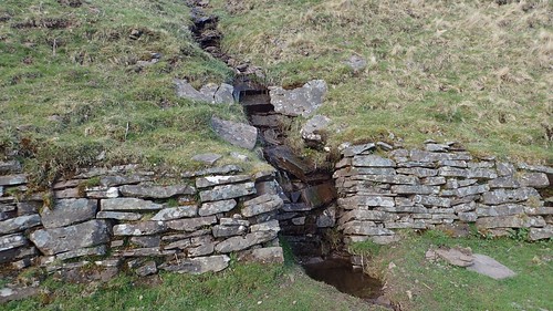
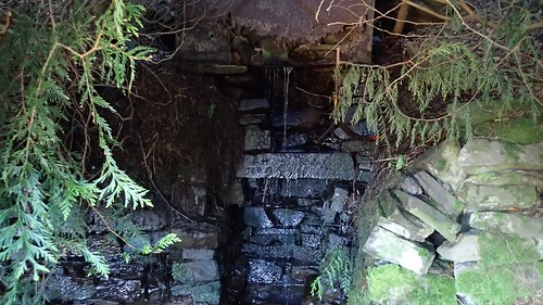
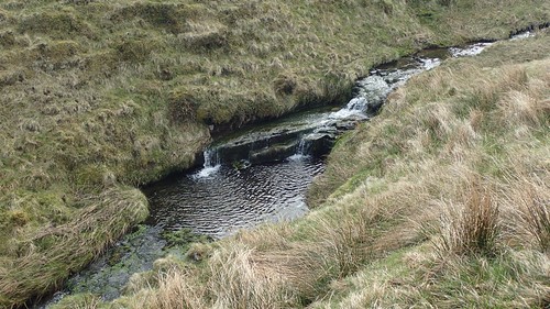
Drainage channels have been built in to some sections of the hillside.
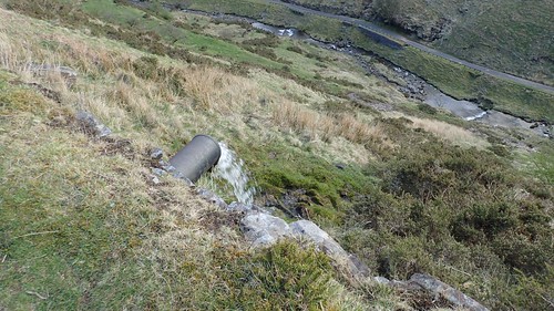
While in others, large pipes carry the water safely beneath the footpath.
This was the walk after which I’d decided to invest in a bottle with a built-in water filter. Throughout the day, I’d been drinking the increasingly warm water that I’d been carrying with me. It was so hot and still in places. I felt the temptation of this cool, free and fresh running water… But also, I was aware of the risks associated with drinking it raw.
Potentially, this means I can carry less water on certain walks and keep the pack weight down.
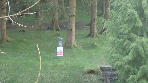
Signs are in place to remind people that camping is not allowed within the Mynydd Du Forest. Clearly, some don’t take any notice and it is possibly because of what these individuals leave behind that it is a prohibited act for the rest of us.

This area as a whole was about as litter-free as they come. Perhaps the signs do work, after all.

Loved reading this and also looking at the map as I was reading. Very inspiring. I must get out there for a hike and wild camp. Bit worrying about leaving the car in the car park overnight though..! Thank you for sharing 🙂
LikeLiked by 1 person
Hi Freyja,
I think that car park may be safer than some of the others nearby as they restrict entry to vehicles through the night. Campervans can often be found there in the summer.
I think the guy I met with the van had parked on Pont Cadwgan (open all hours). I hope to do a wild camp of my own nearer the summer.
Thanks for reading and for your comment.
LikeLike