Sunday 5th August 2018
As far as the Brecon Beacons are concerned, I’ve explored the main ‘Central’ peaks (Pen Y Fan and co.) several times. I’ve also hiked several times around the eastern end of the National Park, where its boundary laps on to the Black Mountains range.
This walk would be my first experience of hiking in the western Beacons. I was hardly going to turn down an opportunity to climb to the highest point of The Black Mountain (Y Mynydd Du).
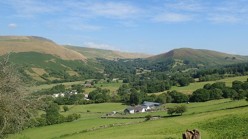
Following a good ninety-minutes of driving from Bristol, we had made our way towards the northern end of the Swansea Valley (Cwm Tawe), along the A4067. We’d planned to park in the layby just up from the Tafarn-Y-Garreg pub but, several others had already taken that opportunity. It is possible to use the pub car park across the road but, I believe that comes with a small charge (at least, according to Google Street View). We parked considerately along a quiet dead-end road further north still.
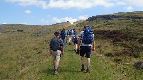
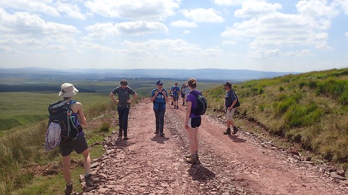
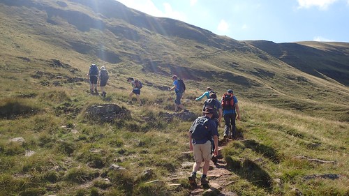
Our walk began with a gradual climb up the eastern side of the valley; from quiet roads, across farmland and toying with the Beacons Way long-distance path.
Back in the beginning of August, we were still subjected to the long-running heatwave that blighted many of the warm summers preceding it. While conditions between lowland and mountain areas can vary significantly, it seemed unlikely that this day would call for anything more than shorts and T-shirts.

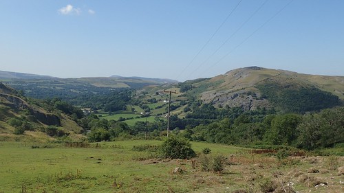
We crossed Twyn Y Ffald to skirt around the permeter of a disused quarry at Penwyllt.
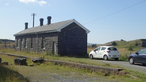
One of the vehicles parked outside of the building here was covered with Mountain Rescue labels. If this isn’t an operational base of some sort, it may be a training facility. If you could find your way up here, it may be another option for free car parking with a reduced amount of uphill hiking to follow.
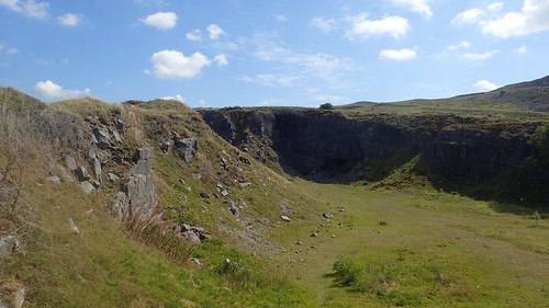
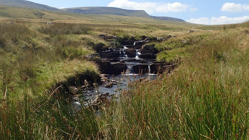
Some of this local land is also regarded as a nature reserve, where blind fish have been discovered within the daylight-deprived water underground.
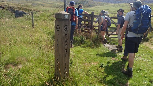
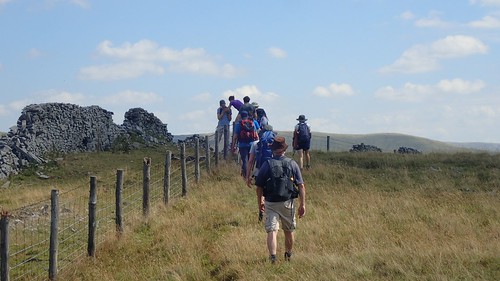
Returning to the Beacons Way, we passed this unexplained post marking a Taxi Point (Pwynt Tacsi). If anyone can explain this to me, please leave a comment below.
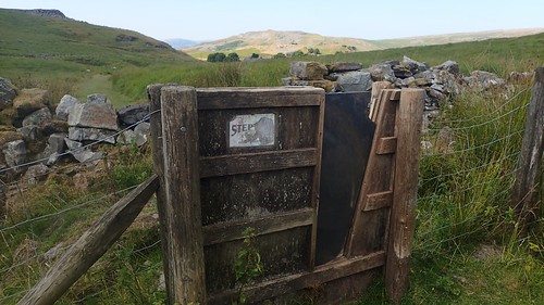
Some of the stiles we passed through closely resembled an executioner’s guillotine, but in a horizontal order. I’d not seen anything like it before.
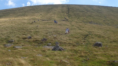
Still gaining elevation with every step, we plodded on along the former dramway.

Great views, turning back and looking south down the Swansea Valley. I say this was my first time here… But, in actual fact, I did my navigation course back in November, just down the road between the heights of Cribarth and the lowland surrounding Craig-Y-Nos park.

Looking at the map now, I can see that we officially left the Beacons Way again to closely follow and handrail the boundary wall to our left. This may’ve been easier than to follow the Way across uneven ground. In fairness to James, our walk leader; he was following a route that someone else had plotted and led a few years previously.
There was a point at which we were looking to cross through the boundary – possibly at Swallow Hole – and continue north to join the forestry track. But, the fence didn’t seem to allow for this, even though it looks practical on the OS map.
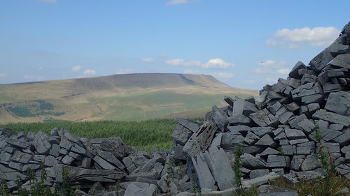
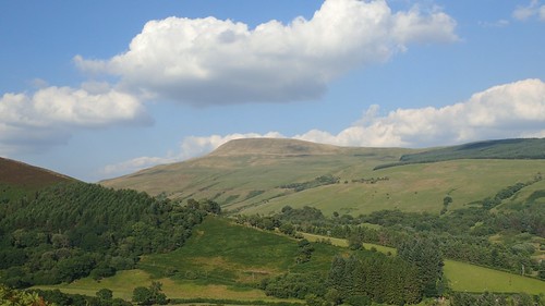
Beyond the dry-stone wall, we had a great view of Fan Brycheiniog, which would feature as our highest point along this route.
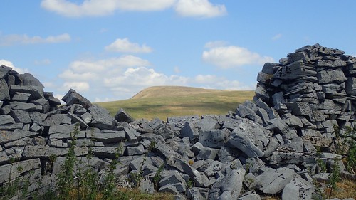
Through another void and we could see Fan Frynych; our more immediate summit and imminent destination.
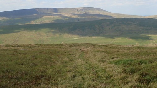
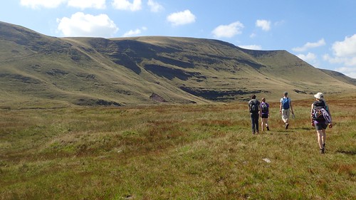
We’d been walking for a good couple of hours. This climb towards our first proper summit seemed to be never-ending. At least the track from Fforest Fawr was easy to follow, in a navigational sense.

At 660m above sea level, we left the comfort of the track to head on a course across rough ground and towards the fabled trig point… Gaining another 50m in elevation, the concrete pillar remained mostly out of sight until we were close. Some of the grass was long, there was no definitive path to follow and I imagine the area could have been boggy on a damp day.
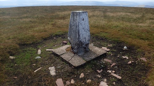
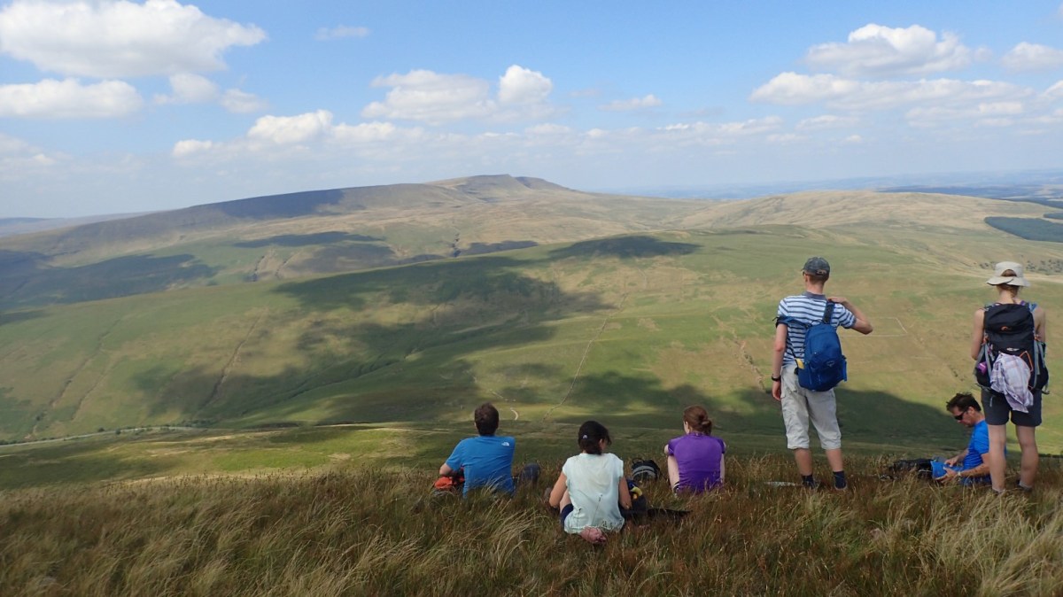
Standing proud at 725m above sea level, we made it to the summit of Fan Frynych and met with its critically wind-battered trig.
It really does look as though a beaver’s been gnawing away at its base, in a cartoon fashion. In reality, there is likely to be a substantial amount of concrete set underground and it looks as though subsidence within the landscape may’ve led to this fracture.
One day, it could well sink beneath the peat. Beyond this, you can just make out Pen Y Fan and Corn Du – the two highest peaks in the southern half of the UK and keystones of the Central Beacons.

Our view now, looking north-west across the Swansea Valley, was remarkable. I can imagine this still being a spectacular sight even on a day of cloud and rain. A great place to stop for our first lunch break.
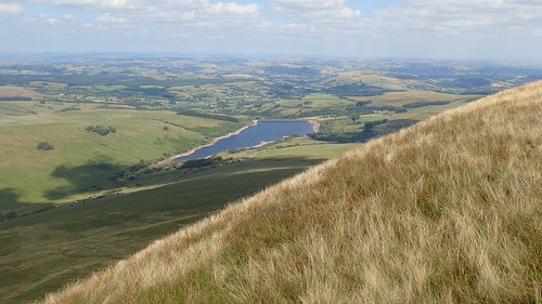
Cray Reservoir (perhaps not the most Welsh-sounding of lakes) lies a few miles north of here.
Just as there had been no clear path of which to follow to the trig pillar, our descent offered a greater physical challenge; losing a good 200m in elevation before our knees would had a chance to feel grateful.
I was pleased to be wearing zip-off trousers at this point, as the grass continue to grow. Some resorted to ‘bum-sliding’ down the slope, while led a more considered ‘zig-zag’ line (think of mountain biking up a steep hill), using a pair of walking poles to reduce the burden on my joints.
Even once we’d crossed the valley before us, there would be another hump to overcome before the challenge of Y Mynydd Du’s highest point.

Looking at the map now, I see it’s possible we could’ve gone south-west and almost back on ourselves for a few hundred metres from the summit, to then pick up a line of boundary stones and take less of a severe and shocking descent. But we soon found a decent path leading to the road via a stile.

Over the A4067 – a very popular route for motorbikes – and were climbing the next ridge; possibly named Cefn Cul. Behind us, Fan Frynych draws imposes a mighty presence.
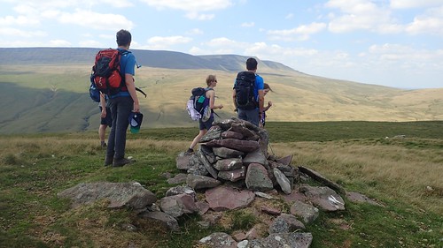
Using another boundary fence as a handrail, we gained nearly 200m in climbing to the 560m point beside this stone cairn. The true highest point of this ridgeline is a mere 2m higher still but we didn’t feel it was worthy of the detour.

There was one more valley to cross before we could begin our final push up on to the eastern flank of The Black Mountain.
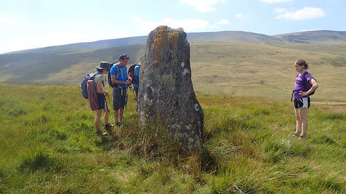
We met an impressive standing stone at SN 854 215.
Further car parking options could be found alongside the next minor road, close to the source of the River Tawe, among many other streams and fords. As beautiful as this space was, I imagine you’d have to tread across this moorland with extreme caution in the wetter months.
Drawing closer to our ultimate goal – while managing to avoid sinking in to the sponge mire beneath our feet – there was still no apparent sign of the lake that James had told us about; where we’d be stopping to tuck in to our second lunch…
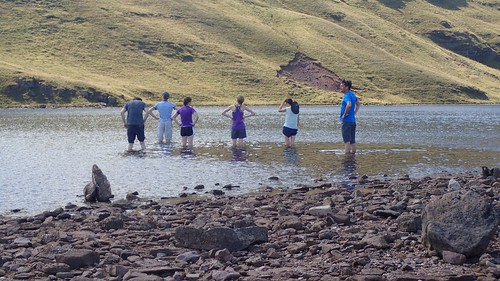
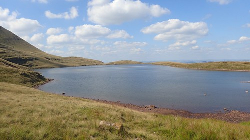
Suddenly, we were there. Llyn Y Fan Fawr – not to be confused with Llyn Y Fan Fach, which is 2.5km west of here.
Just one question remained…
Do we eat first or head in for a refreshing paddle?
I was in favour of refuelling before braving the act of removing my boots and socks. Treading further in towards the centre of the lake, the temperature would drop. Few were brave enough to dive completely beneath the surface.
Other visitors to the area (with European accents – possibly from Belgium) were properly wild swimming. Fish can be found dwelling here, if you’re patient and look closely.
There was time for our feet to dry out before we’d begin our final push to the summit. By this time, I’d decided to remove the lower legs of my zip-off trousers; confident that the miles of long grass tough terrain were now behind us. I don’t often wear shorts in less familiar areas but, this was the best summer we’d seen for several years.
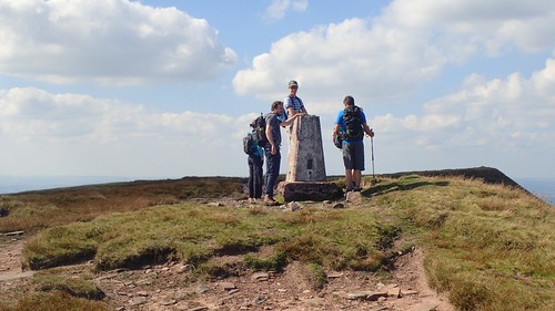
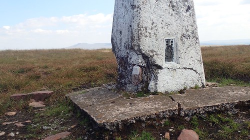
Standing at 802m above sea level, we had reached Fan Brycheiniog; the highest point on The Black Mountain. It is closely comparable to the elevation of Waun Fach, the highest point in the Black Mountains range, to the east of the national park.

Despite sitting 77m above Fan Frynych, this trig pillar was in a far better state. Perhaps the landscape here is less moorland and more akin to the red sandstone found in the Black Mountains.
Disclaimer: I am not a geologist!

This was a first visit to the summit for many of us. I’d personally been wanting to come here for some time. Although the car journey is similar to almost any other walk I’ve done across the Brecon Beacons, I often think of it as being slightly out of reach.
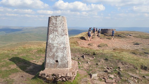
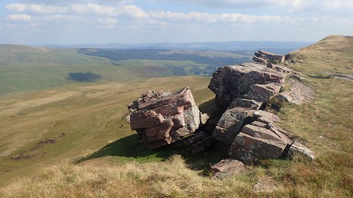
Not only is there a trig point to bag but this summit bears perhaps the best example of a roofless wind shelter I have seen (discounting the bothy-like structures of Penygadair on Cadair Idris, for example).
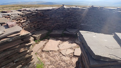
I’ve seen stacks and surrounds of stone set upon sites like Fan Y Big and Pen Allt-Mawr but this is almost as intentional as a dry-stone wall and it even has seating!
We were back on the Beacons Way and would follow the escarpment south along Fan Hir, heading in the approximate direction of our cars.

I’d be very tempted to return here on another day. To walk further miles of the Beacons Way; to continue north to Fan Foel, then heading west across Picws Du and on to discover the other lake.

There was nothing much remarkable about our descent and it was by far the least physically challenging drop that we would encounter. Best of all, we could see Tafarn-Y-Garreg. Although, we looked at our watches in sheet disbelief at the time; suddenly, it was close to 19:00 and on a Sunday evening!
Even without a post-walk drink, we’d be looking at a ninety-minute journey to back to Bristol and then another thirty-minutes for people like myself, who live away from the city. With most people returning to work the next morning…
This walk ended up being close to fourteen miles, which was a bit more than advertised but, in fairness to the walk leader, he was working from information had previously been given and with no reason to doubt or question it.

One thought on “Fan Brycheiniog on the Black Mountain”