Sunday 26th May 2019
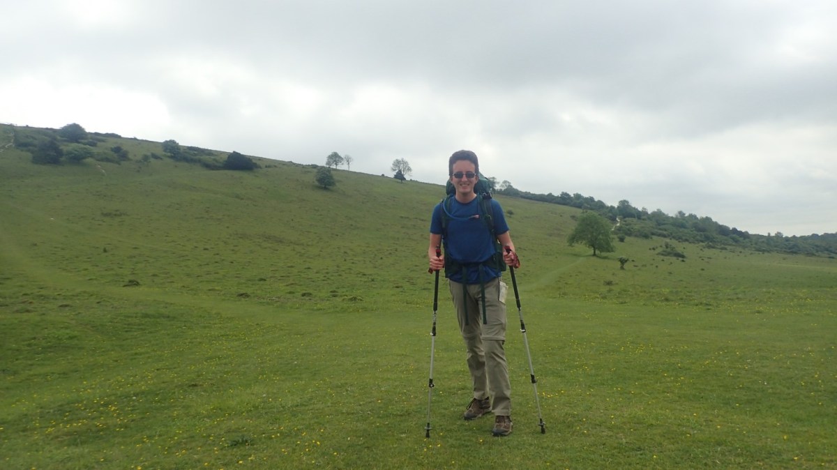
Having braved and survived the woodland scene of my first ever wild camp, I was up and packing early the next morning; ready for breakfast and the beginning of a new day on this promising National Trail.
This walk had originally been forecast to last a good nineteen miles. But, having walked on a bit further than intended the night before, I was looking forward to a reduced duration.

Most of my kit was packed away by 7am. It was only the outstanding tent outer that gave away my position to the sole runner who passed on his way through. Beyond that, I sat on a log, cooked my porridge, misplaced my orange lighter in amongst the leaves and was walking before 8am.

There was a memorial with a sheep on top. I seem to have deleted the photo with the engraved text and so, I cannot recall its purpose. This was somewhere between Hampshire and Sussex; definitely not any corner of Wales.

Following the road just south of Buriton, I found my second breakfast beside the driveway to someone’s home. Home-made flapjacks and drinking water, all for just £1! I’d have been a fool to have passed by. Such a kind, generous and unexpected offering.
I wonder whether they do this for many summer weekends? Or was it only for the busy Bank Holiday? I’d already seen a couple of runners and cyclists by this point. None of whom seem to pay any attention to this stand. I took a single glass of water, still carrying a plentiful supply in my rucksack from the night before.

Again, the signage was excellent. Are many other National Trail signs so informative? This area must receive its fair share of funding.

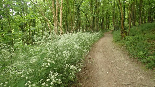
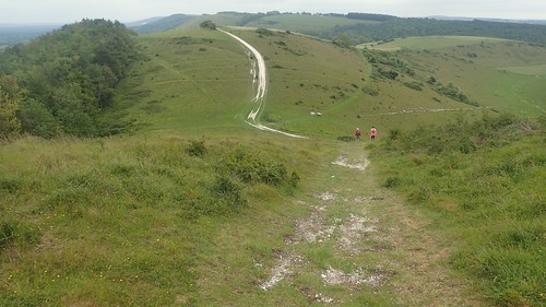
Throughout the morning, my route would be walled by greenery on either side.
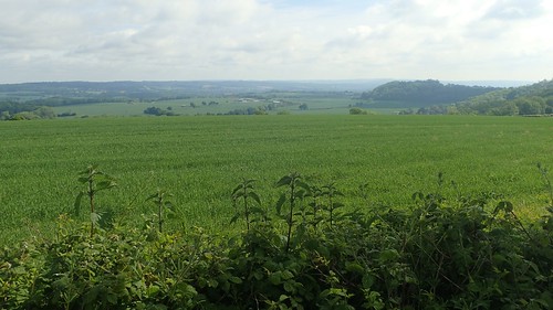
Beyond which, I could admire the open and passing views that I’d come to expect of the South Downs.
Somewhere along here, a group of cyclists had cycled on ahead of me. I’d soon catch up with two of them; one who was clearly on the ground and in pain (I think she’d hurt her ankle). I felt it would’ve been rude to have passed by just saying ‘Hello’ or nothing at all… I asked if they were okay, only to me told ‘NO!‘ by the injured party but kindly thanked by the attending friend. The rest of their group were also backtracking to add further assistance.
I’ve never had First Aid training and wouldn’t have been able to ‘do’ anything… But I think you can understand where I was coming from.

I’d spotted a toilet or ‘WC’ sign on my Harveys map and decided to make a mid-morning detour north to the village of South Harting; following a quiet wooded footpath running beside the B2141.
I beat a cyclist to the toilet block, which was minimal at best. One seated cubicle for the gents, barely enough toilet paper and your typical all-for-one urinal. Admission was free and, while I’d hoped to be able to grab some water from the tap, I had to settle for warm water from one of those push-button hole-in-the-wall affairs. It was enough to keep me going.
Halfway back up the hill, I paused on a convenient bench and took on board a couple of snacks to fuel me toward lunch.

Shortly after this, I followed the trail on to Harting Downs. Open land, no width restrictions and with views down the the village.

I took a number of photos along this stretch. A few scenes of video. Almost wishing for clearer skies on an otherwise dry and peaceful day.

At a junction of paths, there’s an option to immediately leave the South Downs Way and follow a strenuous eastern shortcut up and over Beacon Hill… I decided against this idea, having learnt from my mistake with Old Winchester Hill the previous day.

You see, the South Downs Way skirts around Beacon Hill in an anti-clockwise direction… Those who devised the route could easily have led it up, across and over! This did mean that I could backtrack to the summit from the eastern side.

It wouldn’t be an easy climb, following another chalk path. But the ascent was momentary, compared to the western route and I easily found my way to the trig point.
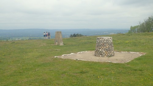

At 242m above sea level, this was my first trig of the day and second Beacon Hill in as many days!


Searching for a spot to sit for lunch, I found small piles and circles of stone, complete with angels, set beneath young trees.
I decided to park myself next to the bridleway I had just followed to the top. Naturally, people would come and go from the trig point while I tucked in to my minimalist lunch… A mini wrap filled with squeezy-cheese, a chcolate wafter, breakfast bar and a slice of banana-flavoured malt loaf.
Two cyclists paused, almost at the top but uncertain of whether or not they were actually on the South Downs Way… One reached to consult his handheld GPS device while the other turned to ask me. I had to break the unfortunate news that they were not officially on the trail, while another passer-by told them they could follow a steep-descent over the other side to rejoin it.
I was pleased to have not taken a shortcut in my own journey.

After lunch (which was the halfway point on my original day’s route), I could look ahead to the hills I’d soon be exploring.


Beyond Buriton Farm and a memorial, my walk continued in to the woods.


I made a brief detour to visit the Devil’s Jumps; a series of historic tumuli, which are said to align perfectly with the rising or setting sun on Midsummer’s Day.

…There was Satan himself.

Continuing east, I could see further hills. From my estimation, one final climb awaited me before I’d be heading downhill towards my campsite for the evening (I’d booked this one).

I had to pass the trig point at Linch Ball without treading anywhere near to it. A barbed wire fence with private land beyond. Had I not been carrying a 17-18kg rucksack, I might have been tempted to claim it.

Crossing the A286, I was surprised to find myself following the road up towards English Woodlands Timber… A company I know of from my time as a woodworker. I used to interact with Sarah a lot through social media. Had they not been closed on this Sunday, I might’ve taken a look inside.
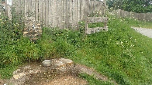
Across the road lies a farm, bearing a small shop with cold drinks and snacks. I bought a can of Fanta, having almost walked past the water tap without noticing. It was worthwhile. In my minutes of respite, I got talking to a couple of walkers who were also backpacking this trail but spending the night at the camp site here.
It was funny because, in all my days and evenings of planning, I hadn’t come across a campsite at this location… I showed them my intention to walk on to the village of Heyshott and a place called Manor Farm…

It was a significant climb to the top of Manorfarm Down. But at least it would be my last of the day and I could soon look forward to a restful night with running water and toilets.


Ahead of my final descent, I bagged this trig at Heyshott Down. A right of way runs through it, 233m above sea level.

Day Two’s end was nigh. My T-shirt? Disgusting. I was wanting to burn it, having not peeled it off for almost thirty-six hours, now.

A rough wooded path led me down to the edge of Heyshott. I passed a couple of people out with their dog. No other hikers to be seen or heard. This seemed to take longer than the ten-minutes I’d anticipated.

Following a bridleway to the south-east. I walked on through the entrance of Manor Farm. Signs here advertise for antiques and all sorts, amongst private accommodation. Not a cow or sheep to be heard and no suggestion of the ‘camping’ I had expected to find…
Returning to the road, I phoned the site owner, having made a note of her number…
It took a few moments for me to recognise her voice. We’d met probably forty-five minutes earlier and she knew exactly where I was… Beside the WRONG Manor Farm! What the other hiker had said to me earlier now made perfect sense. I would have to backtrack to that water tap and then, re-climb that same hill in the morning!
While I could take full responsibility for this error, it’s worth noting that a Google Maps searching for “Manor Farm Cocking” only leads you to the wrong farm in Heyshott. Also, the Heyshott farm is the only ‘Manor Farm’ printed on the 1:40,000 scale Harveys Maps. Had I studied my OS map more closely, I’d have seen the true Manor Farm in Cocking.

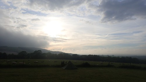
As I made my way back to the correct destination, we had a good laugh about it upon my return… Or arrival! I only paid as much as I was quoted in advance – it used to be £5 but they now offer a shower, bring the nightly tariff up to an acceptable £8.

My pitch was pretty decent. My tent went up okay and I had good views out over the vale, if being exposed on the side of a hill. There’s a water tap inside the camping field, in addition to the one 100m away beside the trail.
Toilet facilities are very basic – a single portaloo beside the trail that presumably also caters for customers of the shop. Then, there’s the shower…

Three sheets of steel, one draughty wooden door and no suggestions of a roof. Being 6ft1in, my head and shoulders stand proud of the sides. It was an experience, alright, as another camper had suggested to me! Once connected to the water tap and with the gas turned on, the water was very warm and I managed to complete the task before it started to rain.
If there was one downside to this experience, it was the early-evening arrival of a group of teenage/early-twenties cyclists who were anything but considerate towards other people sharing this field. Effing this, effing that, kicking a football around, throwing balls… They only hit my tent once but I was very pleased with they left for the pub with their parents. By the time they returned, I’d tucked myself in to bed.
I’d wrestle with my sleeping setup on each night of the South Downs Way. I was trying an untested down duvet that proved to be a little bit draughty at times and I awoke at 2:30am each morning, suddenly feeling the cold through my inflatable mattress.

After two days of walking and filming, I’d decided to recharge my phone for the first time. Admittedly, it would’ve last longer, had I not spent some time on social media that evening (my first allowance for this trip). I was gifted this Charge Anyway powerbank from GP Batteries as part of the Outdoor Bloggers weekend in April.

For company each evening, I could tuck in to The Journey Inbetween from Keith Foskett; a man very local to the South Downs National Park and who, I’d later learn, had begun his own ‘pilgrimage’ along the Way, forty-eight hours after I left Winchester.

Olly,
Well, imagine that, if I’d started 48-hours before we could have had a good chinwag.
Hope you enjoyed the book!
~ Fozzie
LikeLiked by 1 person