Friday 26th July 2019
It would be our final full day in the Peak District, six-days after we’d arrived. There was no group consensus over what to do; we each ventured off to our own accord.
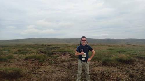
My only thought was to get another walk in. I didn’t fancy driving anywhere and decided to leave the car alone… From our holiday base in Sparrowpit near Dove Holes, I’d be heading up on to the Dark Peak.

Just up the road from our accommodation, I could pick up a footpath from the road junction and head north, leaving the familiar line of cottages behind.
This pathway was mostly blatant and easy to follow. Stick to the right-hand boundary as far as the final field… Stone stiles fixed in to each wall would allow for crossing.

But my plan was to follow this path for only a few hundred metres, before taking a downhill route to Rushup Farm and then following the Pennine Bridleway over the next road… A path that was anything but obvious. No waymarking arrows or signposts, as far as I had seen. There wasn’t even a ‘path’ walked through the field beyond the drystone wall.
I marched on, continuing north.

I crossed a stone stile in to the wrong field before learning of my error through the power of GPS. Soon, I was on the road as intended. I had to follow this for around 400m to the east to join the bridleway, which is also a National Trail.

Perhaps you can relate to this but I have never come across someone who’s talked of walking the Pennine Bridleway… Personally, I see it as the cyclist and horse rider’s alternative to the much-loved Pennine Way. This meant that I would probably encounter very few people for the next two miles on a Friday morning.


This section was not as dull as I’d feared it could’ve been. Indeed, I passed no more than two cyclists along the way. One who was pushing his bike uphill – clearly not a leisurely route.

Away through the wall was Chapel-en-le-Frith. We’d enjoyed a decent pub meal there one evening and had made regular use of their Morrisons store over any of the Buxton-based options.

Over the last year, I’ve developed a concerning habit of relying quite heavily on my phone’s GPS to determine where I am on a walk, with the aid of OS Maps. I’m paying less attention to my paper map (which I always carry) and the skills I’ve gained to read and understand them. I’ve allowed doubt to over-run the strings that move my body I suspect this could be a tricky habit to reverse.

At South Head, I would leave the Pennine Bridleway and continue to the east, with Mount Famine (not a mountain, geographically speaking) stood to my left.

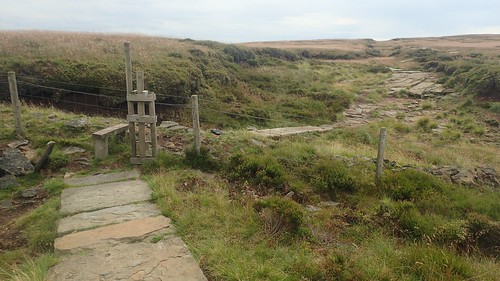
My route was not signposted, although clear to follow. Guidance was available for anyone looking to return to Edale. This was one of very few information boards that I would encounter on this day; mostly leaving the moors in their wild and to-be-explored existence.
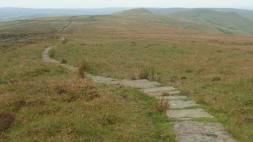
After crossing the fourth field boundary, I would follow a line of stone slabs (quite like those that border Kinder Scout) and head for the higher ground of Brown Knoll.
It was nice that there wasn’t a sign or information board telling you the way to Brown Knoll’s highest point and trig pillar. Map-reading was required.


At 569m above sea level, Brown Knoll would be the highest point of my walk. I felt alone. Miles of moorland surrounding me, with the occasional interruption of hills beyond the line of sight.

I sat on a bank of peat, away from the trig, for my first snack stop of the day. Minutes later and a Silver DofE group arrived from my onward direction…
They weren’t sure of where they were but kindly referred to me as a ‘gentleman’ who might know where they are. True to themselves, they fought an urge to cheat and use OS Maps. I refused to give the answer to a question they wouldn’t ask. It was then suggested that I might be a “Stooge”, set in position to ensure they did not cheat their way along…
Five minutes later and the leader of the group had cracked it. Brown Knoll, indeed. He asked for confirmation with a knowing smile, then jumping for joy as I returned a thumbs up. They seemed like a good group of young people and I hope they enjoyed the rest of their weekend expedition.
I was mostly impressed that this “kids” each seemed to bear an Osprey or Berghaus rucksack, where many youngsters are otherwise seen plastered in Vango.

Finishing my cup of tea, I marched on to the south-east with The Great Ridge visible ahead of me. I was now on the tail of two other walkers – how they were ahead of me, I couldn’t figure out… Had they hopped their way across the bog? Sat down for an early lunch right beside the path?

I met another information sign at a junction between a byway and bridleway. Turning left would lead me up and along Rushup Edge – they do likes their ‘Edges’ in the Peak District.

Initially, there isn’t an awful lot to see beyond a fence and wall to one side. Following an edge with no means to see clearly over it.

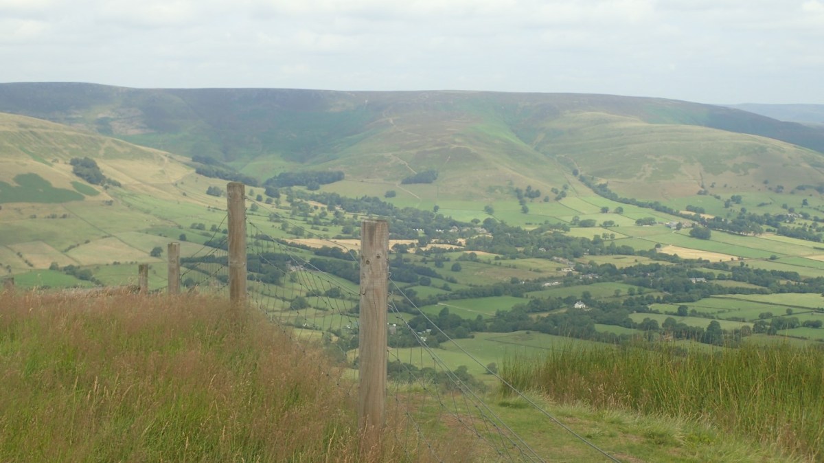
But as soon as you pass the tumulus at Lord’s Seat, Edale sprawls wide and down to the left.

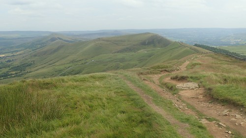
This was quite special. I’d looked on at Rushup Edge in 2017, as I arrived at Mam Tor and the end of my walk along The Great Ridge (above). I’d wondered what it might’ve been like to follow. I’m pleased I was able to return and discover it on this day.

Mam Tor looked as busy as you might expect. People climbing up and down; cars following the dividing road in both directions.

My next path would take me south and away from all of the honeypot popularity, crossing the aptly-named Windy Knoll.

Far away to the north-east, I could spot Win Hill and its pike standing tall above the ridge that overlooks Ladybower Reservoir from the south. Another memento from my Great Ridge walk of 2017.

South of the official National Trust car park for Mam Tor and along a parallel road, sits an unofficial parking layby with no charge. I’m certain it’s the kind of space that will be full by 8am on a Saturday.

A group of people approached, somewhat fearful of the cattle standing between us. As I strode through, another gentleman asked whether I’d just crossed a certain road – I think it was Old Dam Lane. Anyway, I hadn’t a clue, although he said he was certain it was in his northward direction.

I was heading towards an area of disused mines, knowing that my lunch stop would be imminent. Along the ridgeline some way ahead of me stood an unmistakable trig point. I didn’t intend to walk out that far but the temptation was certainly there.

Crossing a field south of a bridleway, I noticed that a farmer had painted white arrows on the ground to help keep us walkers on the right direction. Writing this now, the thought has occurred to me that I could take matters in to my own hands on land where the waymarking is poor…

I found a spot above Conies Dale and north of Conies Farm. It seemed as though rain was on the way but it would hold off for the duration of my long lunch break.


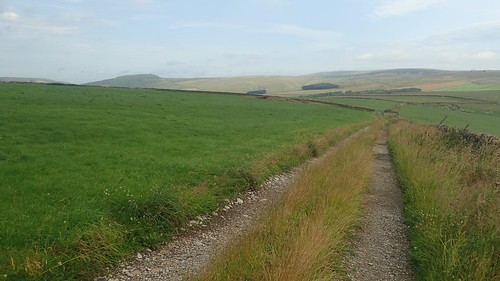
A succession of farm fields would follow before I would reach… Old Dam Lane.


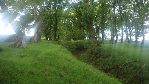
That man I met up near Mam Tor was probably mistaken. I hope he was able to correct his error or enjoy his time, regardless. I followed the road north-west for one mile towards Perry Dale. My return to Sparrowpit would follow the line of trees you can see arcing over the hill, above.
It would’ve been a mistake to rely upon waymarking alone for this final section.

I started with the woods to my right. Crossed through and walked with the trees to my left.

I crossed again to the southern edge but beneath the trees, braving nettles before eventually finding a small gate beside a waymark post that would indicate my exit from this museum of confusion. Between my map and GPS on the phone, it hadn’t made perfect sense. But it was over.

Before I would leave the next field, I spotted a group of (presumably lost) walkers (no backpacks or GoreTex clothing) who’d followed the opposite edge of the field, where there was definitely no right of way. They were attempting to leave via another gate before spotting my own exit point. Perhaps they’d become completely bamboozled by this wooded/unwooded path?
I was then back in Sparrowpit, close to the pub where we would dine on this final evening. A short walk up the hill and I’d be back at the cottage. Boots off in the Peak District for one last time in 2019.
