Saturday 3rd August 2019
She’s hate me for saying this but it had been four-years since Anna and I started our walk of the ‘Somerset Coast Path’ in the centre of Bristol. Officially, it is not a trail but does follow the coastline of Somerset as close as is legally practicable.
One walk remained. Picking up from where we left off in 2016, we’d be walking from Porlock Weir to Lynton along the South West Coast Path.

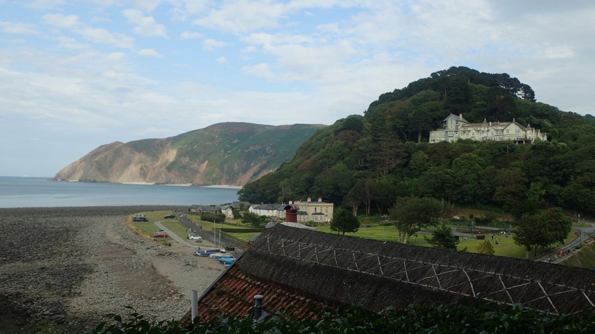
As we did in those days gone by; we began our day by meeting at the end-point car park in Lynton… Or was it Lynmouth? I’m still uncertain but we both arrived in the same place. I think it was only £5 to park there for an entire day. We left my car behind, now travelling back to Porlock Weir in Anna’s vehicle. There, I think it was £6 to park all day.
All fees paid, we were soon off and walking. Ten or eleven miles to go!
Already, we’d travelled up and down the infamous Porlock Hill road, with its 25% gradient and treacherous switchbacks near the base of the hill.

There is an optional Toll Road that crosses Worthy Combe much closer to sea level. I’m not sure if it’s open to walkers but I was put off from the idea of testing it as we’d already paid for parking. Maybe next time. I don’t believe it’s open to walkers.
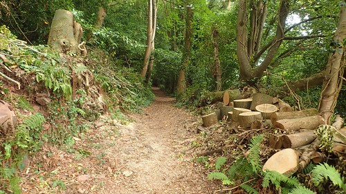
With views of Porlock fading behind us, we walked deep in to a wooded path beside the coast.

It had been straightforward thus far.


With the warnings of landslips becoming more frequent along with fenced-off sections of the coast (nothing to intrude upon the SWCP), our route began to climb… Left-right, left-right. It almost akin to driving up Porlock Hill.

This was pretty much how our morning would fair. Gaining height, losing height and then having to climb once more. All without anything more than a glimpse of the hazy Bristol Channel.
On a bakingly-hot day, this shade would’ve been welcome but it hardly matches the ‘idyllic’ image of walking a coastal footpath.

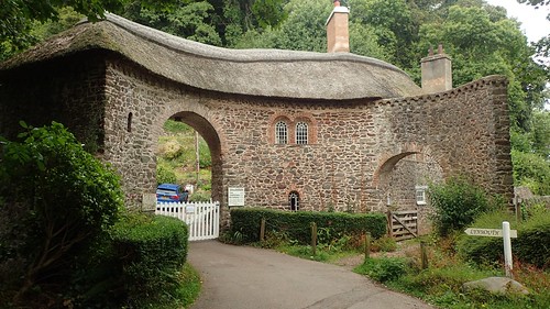
We decided to investigate the tiny church of Culbone. Anna had been here many years earlier. Inside, it was barely 12ft across its shortest distance, while the guestbook was filled with entries from people across the UK and Europe. It also had that typical ‘church smell’.

Just after Culbone is the optional to take the ‘Alternative’ coast route… Which appears to follow a more elevated route and, presumably, offering more in the way of views. But you still end up sacrificing all of that height-gained to rejoin the wooded route after two miles.

I might explore it on my own some time, along with the Toll Road.

I think it was in Yenworthy Wood that we had a slightly impromptu lunch stop on a conveniently situated log, staring on at the vehicles that had been put to work in this area. Further on, I’d find one with the keys dangling inside.

After lunch, we’d soon arrived at what I referred to as “The Jesus Pool”…

It is said that Jesus himself visited this Sister’s Fountain spring many, many years ago and possibly bathed in the water, which I haven’t photographed. I’m not a believer in such things but I find it interesting how people can respond to such suggestions – with the installation of a stone cross, for example.


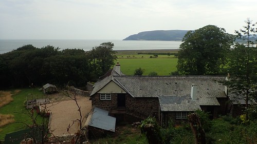
Turning back soon after this, we could kind of see what we had overcome.

It was early afternoon and the haze was beginning to clear. Wales’ south coast was almost visible.

Following the coast path towards Countisbury, we past a number of wooden posts with words carved in to them, like ‘Puddleep Gurt’ above. This was the only one I photographed but the mystery remains… Is it a Devonshire dialect or slang?

As we left Gurney’s Wood, we met an Honesty Cafe box sitting across the path.


I always enjoy discovering these, although they don’t crop up very often on my own walks. Although the prospect of tea was very tempting, it had been raining for several minutes and we were faced without shelter for the first time since Porlock Weir.


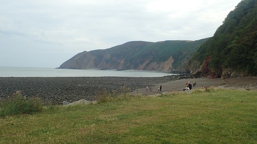
We followed the SWCP across the south of The Foreland. To the north, there looks to be a lighthouse at Foreland Point – another feature for a return visit.

With the raining falling more heavily, it was one of those situations where it was almost too warm for waterproofs. But my T-shirt was getting soaked and I learned a hard lesson on the South Downs Way earlier this year. We also had to climb uphill.

Down ahead of us was Lynton. Or Lynmouth. Hopefully both! An end to our journey that began in 2015 was now in sight.

I realise now that we potentially missed the chance to bag a trig point up on Butter Hill – my list of reasons to return continues to grow!

Gradually losing height now and passing a few others for the first time in a while, we would soon find ourselves meeting the A39 but only for a moment.
Then we arrived at Lynmouth, to the east of the river, with Lynton across to the west.


I’d not been here since the mid-to-late 1990s.

Crossing the River Lyn brought with it a sense of sadness and achievement. Our journey together was ending. This long walk would be complete within a few hundred metres.

Over in Lynton there’s the memorial hall, dedicated to the great flood that swept through her in 1952.

Before returning to my car, I was able to shake the hand of “The Walker”, as many others have probably done before me and will continue to do afterwards.

This point also marks the northern-end of the Two Moors Way (“Devon’s Coast to Coast”), the Coleridge way from the Quantocks and also the Tarka Trail.

I began this year with an intention of walking the Two Moors Way this year… It is almost September as I right this and I’ve had to put those plans to one side. Perhaps in 2020.

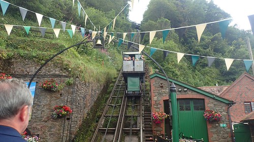
Before heading home, we decided to take a celebratory up the funicular cliffside railway. It was no great expense for a one-way ticket.


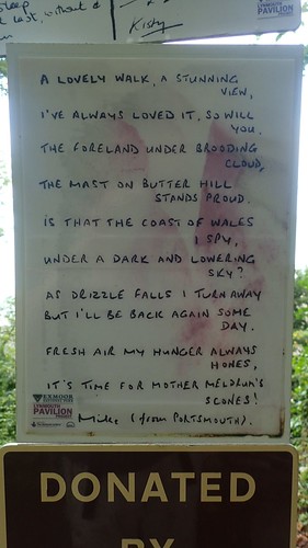
We’d walk the downhill route back to my car, haunted by the overwhelming presence of sometimes-headless gnomes.


Not a safe place to be on a dark winter’s evening! Fortunately, the poetry trail made up for these horrors.


I still haven’t made it further west to the Valley of the Rocks… A return visit is definitely on the cards, even if I’m less able to continue regular coastal walking across Devon.


It’s a grand bit of coast.
LikeLiked by 1 person
Thanks, John, It certainly is!
LikeLiked by 1 person
Ah, a lovely walk and a good write up. Love the poems at the end.
LikeLiked by 1 person
Thank you, Ruth. Me too. Completely unexpected. I hope more coastal towns will do this.
LikeLike
That is a beautiful part of the coast albeit it a lot in woodland, as you discovered. It can be frustrating to have to climb a lot and now be “rewarded” with a good view for your efforts.
This walk can be very dangerous because it is easy to get to the border with Devon and think “that was good, why don’t I carry on into Devon?”. Then you’ll do the same into Cornwall …. and well you know how it ends!
LikeLiked by 1 person
Hi Jon,
I am very well aware of that danger you speak of, especially knowing that the Valley of the Rocks is within reaching distance of anyone who happens to visit Lynmouth, whether they’re a walker or not… Going only that far in a day would not satisfy me either!
As we’ve probably said before, it’s a shame that public transport links aren’t always convenient enough to facillitate these linear routes.
I’m off to Dorset next weekend in a deliberate attempt to distance myself from North Devon!! 😉
LikeLike