
Monday 19th August 2019
Since changing my job in June/July, I’ve developed a working rota that grants me every other Monday as a rest day, with no further questions asked. One one of these ‘happy Mondays’, I decided to make my way across the Severn Estuary and in to South Wales.
My goal was to climb ‘The Skirrid’ for the very first time and also try out a ten-to-eleven mile circular route that I’d sketched out in advance.

One advantage of setting off on a Monday morning was that the car parks would largely be clear. On this day, I arrived at the National Trust-owned parking area to find just one other vehicle in occupancy… I also realised that I hadn’t received my newest membership card after the renewal (it probably went to my old address) but this issue has since been rectified. Just to be safe, I left the old card on the dashboard under the windscreen (it wasn’t until the next day that I would realise it was beyond its expiry date and hence why the machine wouldn’t recognise it).

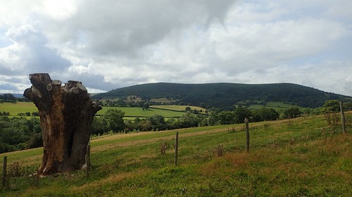
This car park sits near the southern tip of Ysgyryd Fawr and offers space for dozens of vehicles. I’m not sure whether they allow overnight parking. Abergavenny was scarcely visible far away to my left.

My route immediately joins the Beacons Way as it heads up through Caer Wood. One of those long-distance paths or trails that I’ve had thoughts about walking.

Skirrid Fawr (which I translate in to large fractured/shattered) is a hill that many people will climb as part of a day out. If you’ve ever heard it’s a steep climb to the summit, take it from someone who climbs hills regularly…
It does hurt!

Heart-racing up through the woods, where I’d passed two other walkers who’d decided to rest and pace themselves, the Way soon emerges on to a more open ridge-like feature of the hill.

From here, you can look east to see Sugar Loaf and another portion of the Black Mountains range. Technically, ‘The Skirrid’ is included as the easternmost feature of this range, although is stands alone.
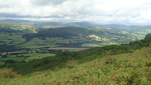
I could also cast my eye towards a rather long and very green-looking Bryn Arw; another hill I’d not bagged and that would mark the halfway point along my intended walk.

Walking this section of the ridge, I couldn’t help but to think of Black Hill.

Almost at the summit and I couldn’t help but to be aware of the showers brewing around me.

This trig point, standing at 486m above sea level, is not unlike one that can be found at the top of Bal Mawr, with it’s brickwork construction of stone. A welcome reward for such a blood-pumping uphill excursion.

With the wind blowing towards, I knew that rainfall was imminent. It was only a question of how long and when… But with these realisations, I persisted to pause while I refuelled admire the awesome views.

To descend from the northern tip here, following the most obvious path would’ve involved a drop of near-vertical extremes… But to get back on to and follow the Beacons Way was slightly tricky. On higher ground, I’ve generally found that waymarking specific to this trail is scarce at very best.

Had I not made an initial wrong turn, I might’ve missed this rare photo opportunity, where I found myself standing above a rainbow for the first time in my life.

With the aid of GPS, I was able to return to the Way and it wasn’t actually that hard to find… It just didn’t marry up perfectly with the map data, although the track I wanted was quite close.
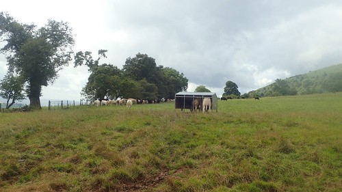
People will often comment on how cows favour lying on the ground when a shower is due to arrive… But here, I offer proof that they prefer to seek shelter and hide from the elements, just like us humans. Had I not accidentally wandered away from the Beacons Way here, I’d have missed this photo opportunity.

On lower ground and when crossing farmland, the Beacons Way markers return. At this point, I was only a few miles from the route’s south-eastern start/end point in Abergavenny.

I followed the Way to a road near Pant-y-Tyle and then alongside a series of yellow-topped posts signed for Crucorney.

Another excellent view of the Black Mountains, with Pen y Gadair Fawr visible in the centre.
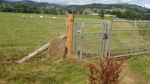
Heading towards the A465, I passed a couple of stone markers with numbers carved in to them.

I’m assuming they denote the distance (in miles) from the next town or village. As I stopped to take a photo of one, I turned back to find a farmer’s dog barking millimetres away from my backside! While the owner continued to circle the field, cutting the grass without any apparent concern.

One last look at Ysgyryd Fawr before crossing the A465.
One of several reasons I’d not walked here previously – despite frequently driving past it for other nearby trips – was that it does stand alone from the rest of the crowd and I’ve often found it difficult to contemplate a circular walk (of a length that justifies the seventy-five minute drive) that almost certainly involves two crossing of a busy A-road.
I did pass the grounds of Llanvihangel Court and, while it looks very private, they do have parking available for visitors. I’ve yet to do any research in to it but I assume it’s another one of these spaces used almost exclusively for events and celebrations.

Safely across the A465, I arrived in Llanvihangel Crucorney… Home of The Skirrid Mountain Inn; allegedly the oldest inn of the nation.

My original plan had been to avoid the Beacons Way where it now follows the road for a few hundred metres. But the footpath running past the churchyard wasn’t obvious enough for me, as I reached an unlocked gate leading on to someone’s driveway with no visual indication that the right of way continues…

It’s probably the type of path that local dog walkers are familiar with or that more confident walkers would be brave enough to stride along. I retreated to the road, convincing myself that it made more sense to follow the official Beacons Way route…!

Crossing the Afon Honddu [pronounced ‘Hon-thee’], I would then take a right turn immediately after the road bridge.

Then, I would leave the Beacons Way for the rest of my day. I wouldn’t be walking as far as Hatterall Hill (another icon of this area that I’d yet to explore) but this path would lead me up to the farm at Great Llwygy.
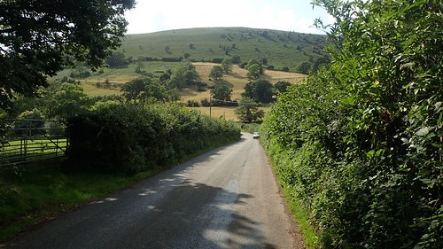
Bryn Arw was moving closer in to my view. It was looking very green and dense on top… But my thoughts remained with the ambition of getting there in time for lunch.

I should’ve followed an apparently unsigned path heading south-west from (and possibly between) the farm buildings but, due to a lack of clarity, I decided to continue up the bridleway track, gaining more elevation than I’d intended to.
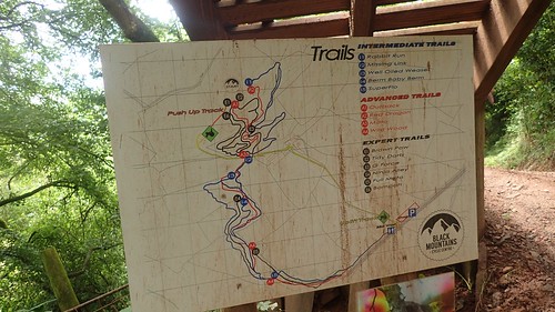
A series of mountain biking trails run through the woods of Strawberry Cottage, with no mention of them on the OS Explorer maps.

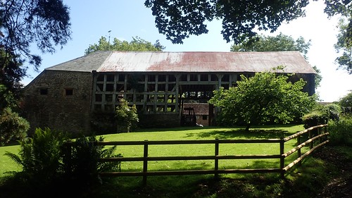
At least the pathways here were reasonably well signed, as I made my way towards Strawberry Cottage Barn.

I had some difficulty following the way around the cottage as it appeared on the map. It’s a bridleway so, I can’t imagine the difficulty cyclists and horse riders might encounter, here! It was close enough to see me down the hill and finally to rejoin the point I’d been aiming for.

I would cross the Afon Honddu for a second time, followed by another road and then I’d make my way along past Stanton Manor Farm.

Initially, I made the mistake of leaving the main track far too soon and heading south along a footpath beside Little Stanton Farm, with Bryn Arw above and to the right… I’d pass a good few hundred metres before realising this, at the driveway to Bryn-arw Farm!

After correcting my error, I was on to the common land of Bryn Arw. It was looking very green indeed… But paths appeared to have been cleared by walkers before me, marking the way. I’d need to pay attention to the map and my pacing to take each of the intended turns… (Or just rely on GPS).

I was about 100m beneath the summit of Bryn Arw when I arrived at a ‘wall’ of bracken and ferns. That “path” had vanished. Ended. Ahead of me stood vegetation that would rival my 6ft1in height.

I tried following the edge of the common but soon met with a familiar fate. Hopping over one gate, I tried to follow my intended route on the other side of the wall… Technically, this was still Open Access Land at this point and not trespassing…
But I would have to somehow cross back over. There was no guarantee that this overgrowth would recede and there was no way I’d have been comfortable taking a group along this way.

Retreating then, with a fear of ticks having found their way under my clothing, I found my way to a familiar crossroads of fern-free footpaths and sat down on a log for my long overdue lunch stop.
Honestly, it was around 14:30 by this point. I was quite tired physically and psychologically, I felt uncomfortable. All this strife and misdirection had only led to the failure of claiming Bryn Arw; the demise of my attempt to proof another group walk for our programme calendar and its many vacancies.

After lunch, I made my way back towards Bryn-arw Farm with another view of Ysgyryd Fawr. My car seemed so very far away and, in this moment, I just wanted to climb in and drive home.
But there were positives from this day so far. I’d climbed Skirrid Fawr for the very first time and it had been worthwhile. I captured a rainbow in a photo that I’d be very pleased with and I covered a few previously unlogged miles of the Beacons Way.

As I couldn’t head up and over Bryn Arw, I would now attempt to follow it near its feet and rejoin my intended route at the southern end…

Close to the site of a disused quarry, I met with the ridiculous once again. This time, brambles were tangled in to the mix. My only option was to turn back once more and head for the road. Chances were, that would not be flooded with ferns!

People who know the area very well might be aware of a fact that Bryn Arw is ‘highly avoidable’ through the summer months… At least, this is how I imagine it! Perhaps I’ll return around the winter or early spring. By which time, much of it might have died off.

I wouldn’t face much of a challenge in following my way back to my car. I crossed the railway just east of Great Llwyn-gwyn, follow by the A465 for a second time.

A series of field paths and farm tracks would guide me most of the way. Stiles weren’t where the maps had suggested they might be in the final few fields but I found my way to the car.
