
Sunday 25th August 2019
Six-days after the partial disappointment that came with my walk of Ysgyryd Fawr and Bryn Arw, I made my way back to the Black Mountains for a second crack at finalising a medium-level route for my walking group.
Same setting; different hills.
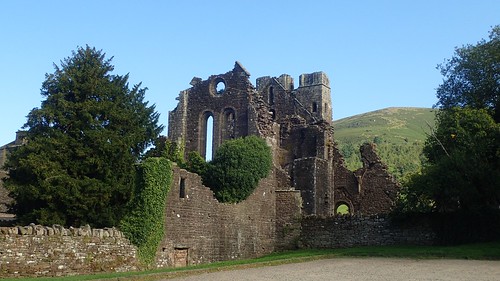
I made my way to the well-known car park beside Llanthony Priory (I still haven’t learned how to correctly pronounce ‘Llanthony’, beyond the initial ‘Ll’). I’m often grateful that this space is free to use (and it has toilets), even though I don’t use it often myself. I’d happily pay £1 per day and see that money reinvested back in to the local landscape and I imagine many others would feel the same way.

To my surprise and delight, I was ready to start this walk before 9:30am. I’d broken the ’10am Curse’, if only for one day! Cars were parked all over the local roads and yet the unmarked bays were largely vacant inside the car park. A neighbouring campsite was genuinely jam-packed with tents. I knew I’d have to gain altitude to escape this Bank Holiday madness.
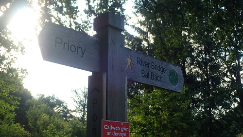
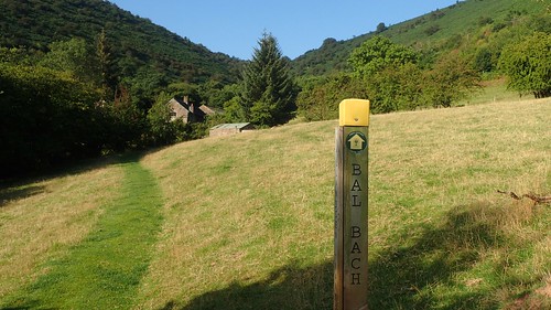
Most of this route would be brand-new to me. But this initial climb up to Bal Bach (‘bach’ meaning little or small) was one I’d done before and in both directions.
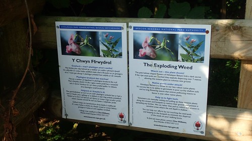
I couldn’t recall having seen warning signs of an exploding weed back in December… But there’s no threat to human life, here.
I was, however, following the Beacons Way; a ninety-eight mile long-distance path that crosses the Brecon Beacons National Park. Statistically, it is two-miles shorter than the South Downs Way that I walked back in May… But the constant height gain and exposure at higher levels would make it far more of a challenge for a multi-day hike… Perhaps one day.
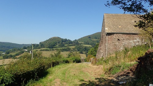
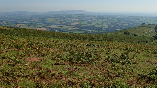
Having climbed up Cwm Bwchel before then, I had a very good idea of what to expect and of the intensity of the ascent that would leave the vast majority of other people splashing in the Afon Honddu river at the bottom.
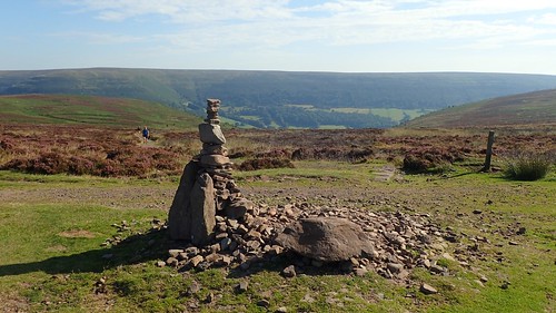
Moments before reaching the summit cairn (almost 520m above sea level), I did catch up with a pair of other walkers who had travelled the same way.
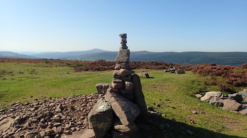
This trend for the stacking of stones appears to be growing. Each time I walk somewhere new or even to a place where I’d expect to meet few others… I encounter something like this. I passed through here on another walk in July and no structure of such height was to be seen or found.

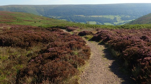
My route from here would continue along the Beacons Way, heading south along the ridge. New territory for me and less of the familiar. Another couple of people emerged, sporting rucksacks in the range of fifty to sixty-five litres large… First, they walked past me. Then paused, consulting the first two walkers I met and, next thing you know, all four of them are following in my footsteps!
Along here, the going was easy. My way ahead, undeniable. I wanted to do some vlogging along the way but felt too self-conscious with people close behind (by the way, that’s actually a scarecrow in the photo above).
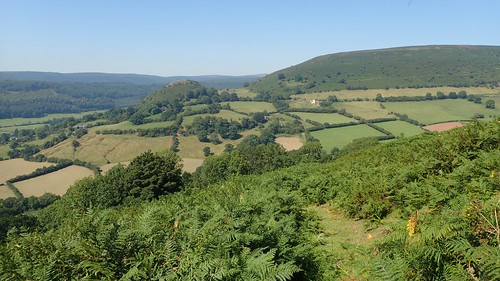
Looking north-west beyond the unseen valley beneath me, I could make out Pen y Gadair Fawr and Waun Fach, marking the highest point(s) in this mountain range.
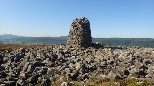
Garn Wen [not to be confused with Garn Wen in Pembrokeshire] is a nearby summit marked by an almost tower-like cairn. Not unlike that of Carn Pica, much further west of here and another that sits further north along this right, close to a path junction above Capel-y-Ffin.
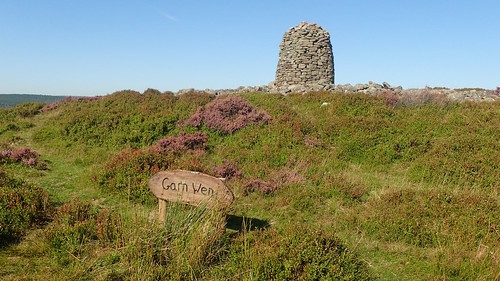
…There’s even a sign, for anyone not adept at basic map-reading skills.

My original plan had included stopping here (if not at a busy Bal Bach junction) for a mid-morning break. But I felt unnerving by the constant swarm of flies commanding the pile of stones. Every now and again, one would buzz past me, although not causing any physical harm.
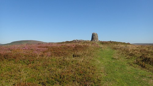
All I could do was march on in the hope that when I return here, there will be somewhat of a breeze to keep the pests away.
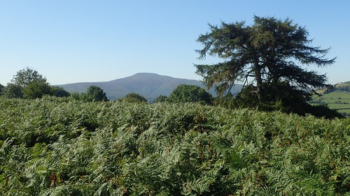
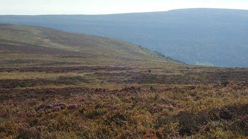
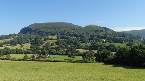
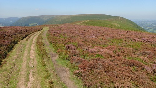
Easy walking along a clear path followed, as my elevation slowly sank beneath the rise of a distant Sugar Loaf.
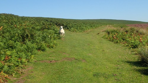
A pair of flies had decided to escort me along the Beacons Way. Constantly circling their way around me but without making contact. Then, I had a sheep on my tail… Every so often, I’d heard a ‘baaaaa’, turn around and find this guy standing, staring at me and waiting.
Back at Garn Wen, I had caught the unfortunate but unmistakable odour of ‘dead sheep’. Perhaps there’s a sad story behind this encounter that the native sheep was unable to communicate.
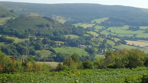
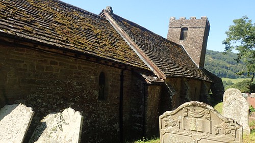
Far beneath me and across the Vale of Ewyas to my left (east), I could see the crooked church of Cwmyoy, which was set to be a highlight of my walk closer to the halfway point. From here, it was a great distance beneath me.
Before reaching Llanthony Road, I’d stop in a field for my overdue snack stop. Exposed to the sun and still without a breeze… But the flies were not to be seen, felt or heard.
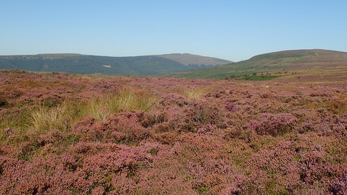
Ahead of me stood two significant hills… To the left was a portion of Hatterall Hill and its ridge – a fraction that I would not be heading for, as my own route lay beyond and just out of sight. To the right of that is a smaller but unnamed clump, just north of Cwmyoy.

I gave myself a significant thirty-minutes of time and space on the edge of this field. Listening to the breeze, noticing the space and distance from the sounds of human activity. I’ve had a lot on my mind very recently and have been through a number of significant life changes in recent months.
So often, my walks – as in other areas of my life – are set on the idea of achieving objectives. From A, to B, then C and eventually Z. With little time to appreciate the inbetween. I don’t always have to do this.
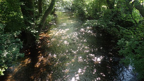
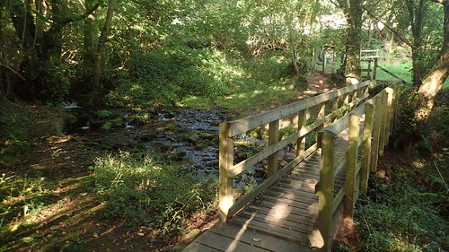
Beyond Neuadd farm, I crossed the Honddu once more, following the road in to Cwmyoy.
I wanted to get to that church and began by following a right of way over a stile near the road bend… Which only led me to a tiny wooden gate that appeared to lead in to someone’s garden!
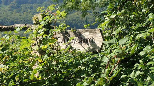
Further east along the road, I was grateful to (just about) spy this sign for Cwmyoy Church. There was no apparent right of way on the OS map and my fears of ‘not being able to reach the church’ quickly eased.

It was perhaps two years ago – possibly in 2016 – when I first saw a photo of St. Martin’s Church. I’d been wanting to see it with my own eyes ever since and this is why:
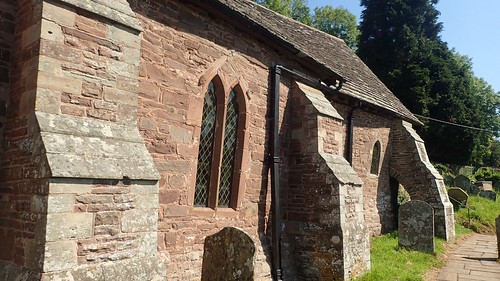
This church dates back as far as the 12th Century and the crooked nature of its appearance is apparently due to the effects of a landslide that could’ve happen soon after it was constructed. Landslides were not uncommon in this area of red sandstone. Skirrid Fawr, a feature of my previous walk, takes its shape due to a significant collapse on its western face.
A couple of visitors were loitering and seeking shade beside the main entrance. Next time I’m here, I’ll try to take a look inside (and pray that we don’t get trapped).
From the church I continued east, crossing fields and roads with the aim of rejoining the Beacons Way. I had to deviate from my plans to head uphill from Perthi-crwn as I wasn’t able to locate the intend path junction – even with GPS running as a reassurance. Again, it looked like I’d be passing through the gate of someone’s private garden!

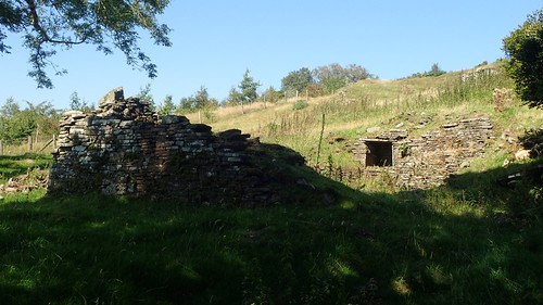
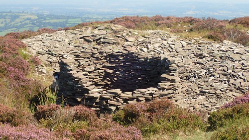
So, I made my way further north towards Ty Canol and this four-walled ruin.
One b***ardly-steep climb (albeit a brief one) later and I’d reach a stile that would grant me fabled access on to the common land of Hatterall Hill.
This would’ve been a reasonably tame circumnavigation of this south-western tip of the ridge… But for the presence of ferns! That same feature from which I fled Bryn Arw, only six days earlier. I was mostly able to follow a visible path on my way, although the occasional tangle of brambles slowed me down. I don’t think I’d have been successful in getting this far, had I found and followed that other path.
I then passed the leftovers of Boxtree Cottage, before beginning an enduring climb up towards the greater portion of the Hatterall Ridge.
To my right, awesome views of Herefordshire, although I cannot name or claim to have visited any one of those hills. I don’t see this sight very often. Someone may even tell me that it’s not near Hereford!
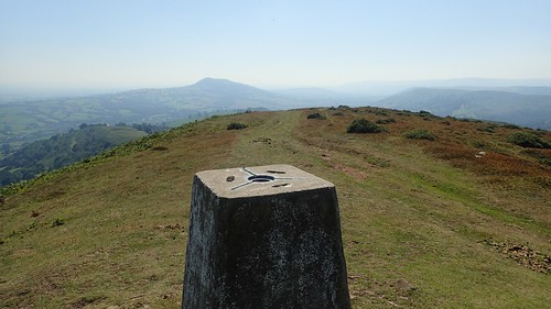
I was relieved to have made my way to this first trig point along the ridge. A true marker of the way. Not only was I back on the Beacons Way but I was also now following Offa’s Dyke – a National Trail I’d love to walk but one that also demands a full fortnight of commitment.
I was wanting to stop, rest and have my lunch. But there was still no suggestion of a breeze. It was unbearably hot. I forget the precise temperature of this day but it must’ve been in the upper twenties, even at more than 400m above sea level.
You can possibly see one or two flies hovering near the top of my photo, above. I had small clouds of them following me along this ridge. Like an army.
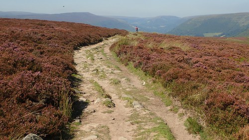
I passed a group of people talking about the Camino Ingles, maybe another couple and then there was just one man ahead of me.
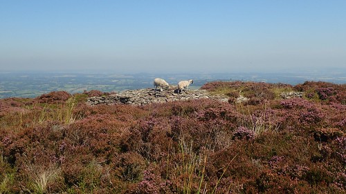
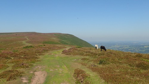
Sheep attempted to settle close to a stone wind shelter. Even without their full winter jackets, they must have been suffering.
Feeling unable to sit comfortably and have my lunch, I felt as though I was reaching for my car and the end to this walk. But there was still a good distance of ridgeline to follow. I might’ve enjoyed this more on a cold and cloudy winter afternoon!

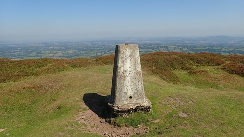
A rather stunning view of the Vale of Ewyas. Llanthony was in there somewhere and I’d soon pass the junction for it… But I still had one more trig point I was determined to reach.

Standing at 552m above sea level, this was the highest point along my route.

I didn’t want to queue or pause awkwardly before taking my photos of this trig pillar so, I found a grassy spot just east of here and, at long last…
THERE WAS A BREEZE!
All of my efforts and my miles of strife… It was worth it for this heavenly respite!
To get back down to my car, I could’ve backtracked a few hundred metres and followed that well-worn track while staying true to the Beacons Way…
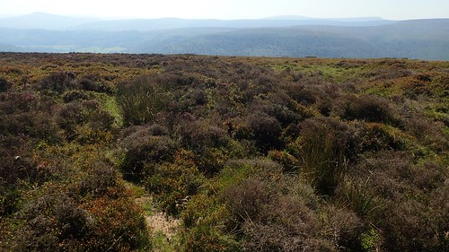
But I wanted to try another route that was marked on the map and, at first, looked something like what you see above.

This still me on to the intended descent; it just evaded the need to re-walk a path already worn. I crossed a few streams along the way down and, on two occasions, drank from them with the aid of my Pure Traveller bottle and its built-in water filter. I don’t use this as often as I certainly could. To drink filtered water from a fresh and running stream… It tastes unlike anything else I could’ve packed for the day.

By the time of my return to Llanthony, it was closer to 15:00 and the priory itself was quite bustling with people slow-cooking in the late-summer sun.
There’s no such thing as a bad walk in the Black Mountains. I’ve had moments of disappointment and I’ve survived the higher ground in almost-dangerous conditions. I’ll always come back here, for as long as I live only ninety-minutes away.

One thought on “Llanthony Loop (Black Mountains)”