Saturday 14th September 2019
I recently spent some time in Dorset, with three nights of camping and four days for walking around that. It was my first visit to the coastal part of the county since Easter 2016. When in Dorset, what else is one to do but walk another stretch of the South West Coast Path?
With my car boot fully loaded, I drove down from home in a journey that took a little over two-hours… Google Maps had suggested it should last a little more than ninety minutes but no form of technology seems to account for my own misdirection and reluctance to use GPS too often.
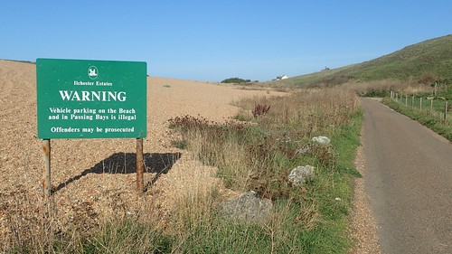
What matters most is that I go there in the end and without having to ask my phone for directions! I could’ve started from the pay-and-display car park in the centre of Abbotsbury (as per my original plan) but when I found out that the Chesil Beach car park, just south-west of here, was available for only £3 a day… I decided that my walk would start and finish beside the coast.

As it would happen, there was no car parking attendant on-hand to take my money and the shop which signs direct you to was closed all day. Dozens of people parked for free… I’d happily left some change in a donation box, if something had been available. With the sun shining, it was a busy day. Fishermen flocked to their place(s) and, whoever might’ve benefited from the revenue, well, they missed out!

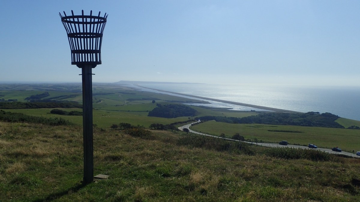
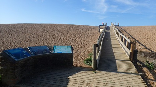
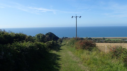
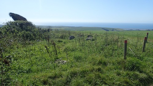
Heading in a clockwise direction then, my walk began with a climb up on to Chesil Beach – which, in itself, is an eighteen-mile long bank of stone and shingle that also forms a natural flood defence. As impressive as it may appear in two-dimensions, it bears a staggering height when viewed from up close.

To climb up on to the bank was a mistake on my part… As the official coast path route follows a dead-end road that soon deteriorates in to a track.
I would follow the SWCP only as far as West Bexington. As part of a circular return, I could the the ridgeline that I would follow from then on, up to my right.

Several pill boxes adorn this section of Chesil Beach. On one of them, someone had decided to add the informative graffiti reminding people not to use the stone structure as a toilet…

I probably set off for my walk at around 9:30am (still in good time to beat my ’10am Curse’). But by this time, it was already incredibly busy with fishermen. In mid-September, might I add… What would it have been like in July and August?
Without too much to report (apart from twice passing a group of friendly joggers), I made it to West Bexington and the next parking opportunity for Chesil Beach. I believe the charge was around £6 to spend the day, here.

Heading north and inland, I would follow the South Dorset Ridgeway steeply up the road ahead.

I only learned of the ‘SDR’ a few days before making this trip. I’d spotted the words ‘National Trail’ alongside a distinctly inland footpath on the OS map that didn’t follow the line of the SWCP to the south.

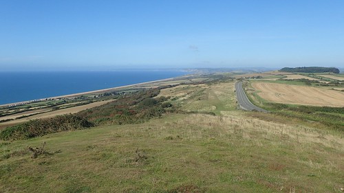
It was formerly known simply as the ‘Inland Coast Path’. These are not uncommon – I’ve seen alternative routes near Minehead in Somerset and then further west towards Lynton. But what makes this Dorset Ridgeway unique is that it runs for a full seventeen miles; bypassing Weymouth and Portland, all the way to Osmington.
At the end of this climb, I followed the Ridgeway across Limekiln Hill and with the B3157 a short distance to my left.

Unfortunately, the SDR doesn’t join up with any of the other ‘Ridgeway’ routes that cross the south of England. Although the Wessex Ridgeway kicks-off further west at Lyme Regis and, many miles later, can tie in with The Ridgeway deep in Wiltshire.
I stopped for my first break of the day on Tulk’s Hill, seated beside a pair of tumuli and with no other walkers around. I was under the impression that this ‘inland route’ remains comparatively quiet, even during the height of summer.

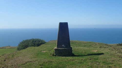
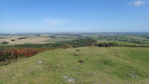
Crossing the B-road after a good thirty-minutes of time-out, I could see the raised plateau of Abbotsbury Castle ahead.

Initially, I mis-read my map and made the mistake of following the northern side of the fort and missing the trig point… Surprisingly, this raised mass is not Open Access Land. But that didn’t deter me from laying my hands on the pillar.

How had I not been to the Jurassic Coast in more than three years? I felt good to be back here and with the intention to stay for three more days.
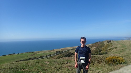

I’d been spending money on an osteopath to fix various aches around my frame. I felt incredibly able while following this sixteen-to-seventeen mile route. Aches and pains remained but there was a freedom of movement I’d not experienced for a long time.

Although hazy, facing east in the middle of the morning; you get a great view of the Isle of Portland from up here, where the eastern end of Chesil Beach terminates. Two days from this walk, I aimed to be walking the Portland Coast Path.

Abbotsbury was soon beneath me, to the south and on my right-hand side. Had I wanted to, I could’ve significantly shortened this circular walk.

Up on the hill, standing alone just west of Abbotsbury was St. Catherine’s Chapel. I decided not to visit on this occasion but I do intend to revisit over the coming months.

Not only was I following the South Dorest Ridgeway National Trail but I was also walking alone the Hardy Way, destined to visit the National Trust-owned Hardy Monument in time for lunch.
I passed a rather easy-to-miss stone Hampton Stone Circle, apparently dating back to around four-thousands years ago. Its stones were reinstated after an excavation in the early 20th Century. A sign on a nearby fence post was all that alerted me to its existence.

A path heading downhill between fences led me safely between the cattle fields on either side of Hampton Barn, although some of the ‘stiles’ were questionable.

Through a patch of woodland and then uphill on to heathland, I would soon see the tower I’d been heading for.

National Trust members are welcome to climb the tower during open hours, with a fee payable from visitors who do not hold a membership card.
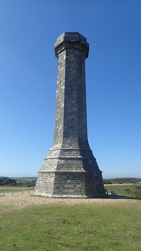
I decided not to bother, as the views from here for already panoramic and I didn’t like the idea of bumbling up a dark staircase with walking poles and all, while a good number of others were trying to enjoy their own afternoon here.


This Hardy Monument was erected in memory of Vice Admiral Sir Thomas Hardy (not the actor).

After another half-hour of respite for lunch, I plodded along my final few hundred metres of the SDR before leaving one trail to follow another…

If only for a single mile, I’d follow the Jubilee Trail south on the beginning of my return to the better-known coast path.

I left the trail at the next road and then spent several miles following tarmac in my most-direct way to the point at which I intended to rejoin the SWCP.
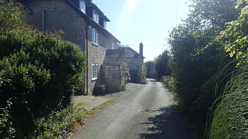
Some of these roads were ones I’d earlier driven along, in the hope of finding Abbotsbury without dropping down to the obvious-route of following the B-road.

If (or when) I return to this one, I would look to reduce the volume of road walking, even if it means shortening the overall length of the walk.

It was to the north of Wyke Wood, between Langton Herring and Abbotsbury, that I did finally rejoin the South West Coast Path. Albeit, a good kilometre or so inland of the actual coastline.

A steep climb up steps soon led me to the top of Merry Hill. Although this was otherwise private land beyond the right of way, I ventured east a short distance to bag my second trig point of the day!


I would then have to brave a path of not-overly-concerned cattle after returning to the route.

Nearing a return to Abbotsbury, I noticed that Portland was much clearer, now that the sun had sailed over to the west.

I stopped for one final time, somewhere above Clayhanger Farm and finished off my daily rationing of snacks. Although I was in no great pain, I was tired. Following the drive down and the miles now behind me, this was my first proper ‘day off’ in almost a fortnight.

Interestingly, the coast path passes right by the entrance to Abbotsbury Swannery (a prime opportunity for a day’s free parking, in my opinion…). If you so wanted, one could probably saunter down to the on-site café or make use of the toilets.

I followed typically clear and frequent signs for the coast path, soon to pass beneath the aforementioned Chapel Hill.

…Except, I somehow ended up in the wrong field, having followed a signed ‘permissive route’ that didn’t feature on my map. I was too close to the must-pay-to-enter Swannery, while I could see other walkers on the official route up and away to my route. With the aid of GPS on my phone, I was able to realise how far off-course I was… But the farmer had thankfully left the next gate open (and was nowhere to be seen or heard).

Linking up with the MacMillan Way, the SWCP swings around towards the car park along an unavoidable walk along shingle and stone that sits beneath the higher ground of Chesil Beach. I cannot personally imagine following this for even a single mile. It is hard work! At the very least, I’d demand planks of wood strapped to my boots.

It was a bonus to find the car park’s toilets were open and free to use, even where other facilities remained closed. An interesting incentive would otherwise have been available to encourage people to pick up after the disregard of others. This would not be the only example of this kind that I would spy across the weekend.

A few more miles of the South West Coast Path in Dorset, now ticked off. My first experience of the South Dorset Ridgeway and, one day, I’d like to see a bit more of the Jubilee Trail that Nick (if he’s reading this) has told me about.

A good walk and a good distance. Was interested in the invitation to pick up litter. Not all of the rubbish is left behind by local visitors of course, as quite a lot is washed ashore by the waves. There is a round-the-coast walker -Wayne – who walks with his dog, Koda, and is picking up litter as he goes. Not sure if he’s been through here yet. He’s making slow progress!
LikeLike
Thanks, Ruth. It was a good walk, perhaps bordering on ‘a bit too long’ for a day in which I’ve driven down that morning – pitching my tent afterwards was a bit of a chore. Very true, so much of the rubbish is washed ashore from goodness-knows-where. I will try and look out for Wayne – sounds interesting!
LikeLike
I always thought the “Inland Coast Path” was a ridiculous name, so I welcomed the change. I mean if it’s a coast path it’s near the sea and if it’s inland well then it’s not a coast path! Naming issues aside it’s a great path I’ve done it a few times.
Lovely photos on this walk and I’m glad that you enjoyed it. Looks like you have great weather for it too. I’ve walked some of the Wessex Ridgeway and intend to finish it eventually (and then probably all of the Great Ridgeway up to the Norfolk coast).
For my sins I’ve also walked the entire way from the road out to Portland to Abbotsbury on top of the shingle bank of Chesil Beach. So yes I can confirm that it is hard work!
Looking forward to hearing about your other walks whilst in Dorset, it’s an area I frequently visit.
LikeLike
Hi Jon,
Haha, that’s an excellent point! I suppose I shouldn’t be too surprised to learn that you’ve walked the “inland path” few times now. It was a great weekend for weather. Even when it tried to rain on my last evening, it would not last. Sunshine every day and warm but never too hot. I would like to see a bit more of the Wessex Ridgeway. I’ve only done a few odd bits around Wiltshire with the White Horse Trail.
Jesus, that must have been quite the challenge!! How long did it take you? I saw someone walk (and wild camp) the distance of Chesil Beach on YouTube last year. He said it was hard in the video but it’s tricky to grasp a sense of that without seeing it in person.
LikeLike
Regarding the Wessex Ridgway I’ve got from Lyme Regis as far as Wardour (near Tisbury). I did the Ridgeway National Trail a long time ago (but in sections, not in one go) and would like to (someday) do the whole route from Lyme Regis up to the Norfolk coast (Hunstanton I think?) that comprises the whole “Greater Ridgeway”, but as usual I have far more things I’d like to do than I have time available to do them!
As to Chesil Beach I think about 6 or 7 hours. You can read about it here, if of interest : https://britishcoast.wordpress.com/2015/10/06/78c-wyke-regis-to-abbotsbury-via-chesil-beach/
LikeLiked by 1 person
Thanks, Jon, I’ve just read your Chesil Beach post. I forgot about the firing range (which I recently spotted on the map) but I do like the idea of meeting few other people.
Perhaps one day!
LikeLike