Sunday 15th September 2019
I’d awoken from my first night of camping to the scent of ‘sewage’ that seemed to be localised around my tent. I had absently pitched very-close-to a drain cover on the previous afternoon… With other campers likely to depart (fingers crossed) on this Sunday, I decided that I would attempt to move my tent after completing this walk.

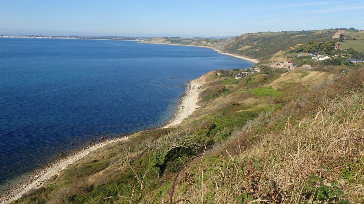
Being pitched only a short walk uphill from the Jurassic Coast, it made sense for me to have at least one day where I wouldn’t climb inside my car.

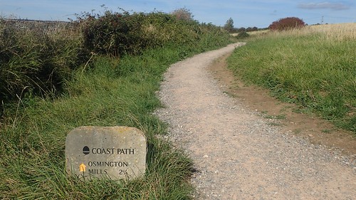
In aid of my cause for this day, I’d also spotted that a public right of way runs down along the outside of Rosewall Camping. This is officially part of the South Dorset Ridgeway and would lead me to its eastern terminus at Osmington Mills.

I wasn’t sure if I’d be able to find a point at which I could have joined this path towards the bottom of the camp site. So, I made my way back up the driveway to follow clear signs of the footpath. But before reaching a road, I did pass a signed entrance in to Rosewall from the bottom. Very handy for coastal walkers, I’m sure.

On the previous day, I’d followed the South Dorset Ridgeway from its western end point at West Bexington. Now, I was heading for the other end, leaving only a few miles of unwalked territory to be explored another time.

Ignoring the public toilets to one side, I found that the South West Coast Path passes down to and across the property of The Smuggler’s Inn… I had to pass the benches you see outside and then snake around the left-hand side of the building!
They must receive a lot of passing trade here, in the summer and, although I’d set off at around 9am, they appeared to be preparing to open up, if they weren’t already. Had I made this trip to journey with company, I’d have probably stopped here for an evening meal.

What can I say; the Isle of Portland was clearly visible again. Another twenty-four hours and I’d be experiencing it for myself.

Walking to the east, I would meet with a point at which I left this section of the coast all the way back in July 2014, just west of Ringstead Bay… I saw nothing to gain from retracing any further steps. I remember the pain of scaling White Nothe! I’m fitter these days but I’d seen it all before and, with Durdle Door and Lulworth Cove just beyond, it was almost certain to have been a busy day.
If you’re interested in reading my blogs from my first ever walk in Dorset, please see the following links:
Part 1
Part 2

I turned north at Bran Point to pass through Spring Bottom – as I did in 2014, as part of my circular return to Lulworth. I’d slapped on the sun cream, only to now find myself walking through shade.

I think I passed a couple of (probably local) dog walkers through here, with no signs of any ‘serious’ coastal walkers like myself… Emerging from the woodland, I had views of the ridgeline to the north and several miles west of the Purbeck Ridge.

As I had done five years ago, I climbed the steep narrow road through Upton to the A353. It was busier than I’d anticipated or could remember. Even stepping aside to allow cars to pass was tricky in places. For anyone else attempting a similar route, I’d encourage you to attempt the footpath passing through Poxwell Big Wood and running parallel to this road.
As pictured above, I would then have to cross the A-road to continue my walk.

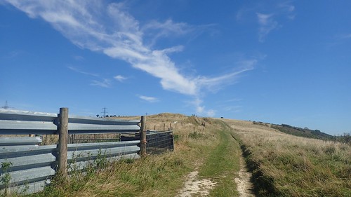
I followed a bridleway up beyond an old quarry. On my paper map, I’m sure it was marked as a restricted byway… Or perhaps the sign and waymarkings said as much.

From Pixon Barn, I continued north towards the heights of these hills. An optional permissive route can be followed from here for a more direct route to the White Horse sculpture. As it’s not marked on any map that I’ve seen, I decided against trying to follow it.

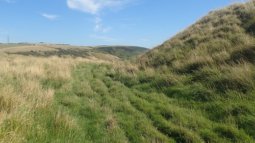
Now, I was following the Hardy Way. While it’s not the ‘SDR’, it does trace back to the monument I’d met on the previous day. A stretch of ridge walking lay ahead.

I passed only one other walker for these first 1.5km. Then I arrived at a junction, where I’d follow a downhill path towards the chalk horse. By returning to this point after, I’d be able to rejoin the South Dorset Ridgeway.

Quickly losing height, I followed a clear path in the direction of the feature. I was able to track my progress along the hillside by observing and counting the field boundaries down and away to my left.

This is… Part of it! As with all of the White Horses I’ve previously met around Wiltshire and Oxfordshire, the Osmington White Horse is best viewed from a distance – as you’ll see later on. Even with a man riding this one, I found it hard to determine who’s hoofs I was staring at, as I removed my backpack to sit and rest for half an hour.

I did then retrace my steps to the Ridgeway path, where I met a pair of walkers heading for the White Horse, while I attempted to catch my breath.
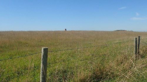
A trig point sits on the private land of East Hill. Out of reach for now.
From a point above the second Spring Bottom of the day, I would follow the downhill path towards Green Hill.

Crossing one road, the SDR leads me around the hundred-metre-high lump and on to the next road, where I would again leave this ‘inland’ trail.
Heading south now, I was determined to make it to the top of Chalbury, a former hillfort.

I don’t seem to have many photos from the summit – perhaps the glare of sunlight was not in favour of my camera’s vision. There’s no right of way to or across the hill but, being Open Access Land, it wasn’t hard to find hinged access points (gates).

Looking to the left, I could see the Osmington White Horse, where I’d stopped for a break less than an hour ago. I’d be wanting to stop for lunch in another hour but currently without a clear idea on where that might be.

I followed a path beside the covered reservoir and on towards the south of Sutton Poyntz. This led me to a residential area from which I’d walk the roads heading south towards the A353.

Crossing that A-road for a second time, I found that both of the fish and chips shops in Preston (separated by a pub, no less) were closed on this Sunday lunchtime and not due to open in the evening, either.
This is a problem I’ve noticed in recent years; very few English chip shops are open on a Sunday evening. Sometimes, that’s when I most crave a takeaway after a good day’s walking. I mean no disrespect to any Chinese outlets but your chips, in my experience, are not as nice.

Heading south still, I’d rejoined the Hardy Way and would follow it past the local church, apparently heading for a dead-end lane.

This led me to a caravan/holiday park, with a choice of two routes. Right, goes the Hardy Way, while I decided to turn left towards the south-east.

Initially the ‘public footpath’ signs were excellent. But I found my way up to this vantage point overlooking the sea of fibreglass. My GPS led me to a dead-end. Or, it was advising me to walk through, over or under a row of caravans! My own attempts to get back on track saw me scrambling through fences of the ‘dog exercise field’ in true YouTube-style [in reference to the guy who attempted a straight-line walk across Wales, earlier this year]…
I retraced my steps back to that aforementioned junction and returned to the Hardy Way. This meant follow the roads of the holiday park, signed for ‘the beach’ and constantly in the shadow of people who decided to step outside in order to pollute the environment while poisoning their own lungs (smoking).

I was heading for Bowleaze, where I’d intended to rejoin the coast path. From what I could see on the map, it meant braving this fairground-style tourist attraction. Potentially, I could’ve bought fish and chips for lunch but I was also saving that ploy for my final evening meal of the three-night getaway.

Once I discovered the coast path with great relief, I’m pleased to say that the National Trail acorns were frequent enough to guide me along.

Bowleaze Cove was as busy as I imagine every other beach to have been along this stretch of coast. Just beyond that is Weymouth. Technically, I haven’t walked the coast through there but, as a hub for tourists, I’m less inclined to do it for anything more than being a completionist [ie. it can wait; there are other miles I’d rather discover].

I found a ledge beneath the cliff path with nothing more than a pair of empty cider cans for company. Ahead of me was Portland once again. Not long now! I sat, I ate and I wrote, while one man in a speedboat proceeded to zip backwards and forwards at high speed… I was waiting for him to get bored (or to run out of fuel).

It must be a bother for other seafarers travelling at a more leisurely pace.
Barely two miles left to walk and I’d soon be back at my campsite, ready to shift my tent in to a more pleasant location.


While I do believe that I’ve experienced some of the worst that the Dorset coast path has to offer, this short walk back had its own share of gentle undulations.


Just west of Osmington, I remember crossing one stretch of land where fires had apparently been set and lit every few-dozen metres. Wild camping? Thoughtless barbecues? Who knows. I do wish people would at least tidy them up afterwards.

Some of the route here has been diverted in from Black Head, due to the constant through of cliff erosion.

A view to my campsite (if not my pitch) gives you an idea of how convenient my stay was. One to avoid during the peak season. But a few more miles of the Dorset SWCP ticked off and I have seen both ends of the SDR. Wherever I walk in this county, it seems to be beautiful.

Looks you picked a good time to go. Some of those fields (quite possibly those with the burnt area of grass) are a massive campsite in the summer, probably stretches for about 5 fields in total. I think they are only licensed for a few weeks of the year (and have “portaloos” not proper facilities) but if you walk through there when it’s open, it’s like a festival! Glad you avoided that. Bowleaze Cove is not the best. I usually hurry through there, especially in summer. Usually packed with people on jet-skis, having barbecues on the beach etc. Noisy and smelly, basically!
LikeLike
Ah, I had no idea there was a genuine campsite there. When researching for places like Rosewall, I did find a number of sites that were only licensed to open for a couple of months each summer.
Portaloos on their own are bad enough. I can’t quite imagine pitching beside the SWCP. I’m also pleased to have evaded that – and the heart of Bowleaze! 😉
LikeLike