Monday 16th September 2019
For each of the two previous days spent walking around South Dorset, I’d looked on across the sea to the Isle of Portland. Curious. Anticipating this overdue opportunity to explore its coastline for myself.
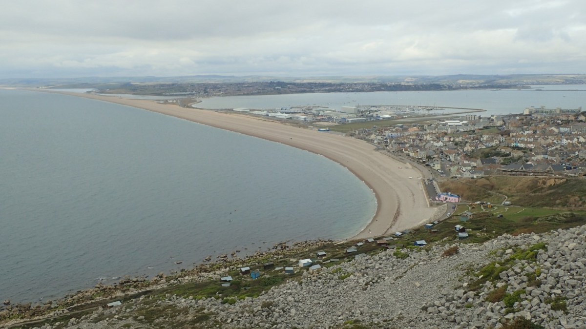
I had everything planned for this walk a couple of years ago and I was able to drive to the Chesil Beach car park – alongside the causeway linking Portland with Weymouth and the mainland – without the need for GPS.

It did cost £6 to leave my car here for the day… I knew of this in advance and I was able to pay by card. I’ve heard that certain car parks up in the Lake District are more extortionate than this but expect you to pay in coins only!
I would like to think that they could reduce that fee to £5. It is a very popular location, with a visitor centre and café on site. A number of caravans were parked up (this was around 9:30am), as if to say they had already spent the night there. How much had they paid for such a privilege?!
Portland was my destination. A distinct island, clearly visible from the south and with a constant stream of traffic heading to and fro.

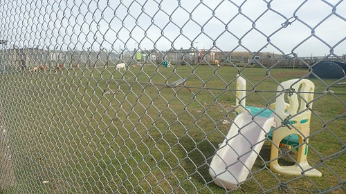
Safely crossing the A354 to the eastern side, I would follow a boardwalk on to a path that follows the line of a dismantled railway track.

Leaving the hustle and bustle of Weymouth behind (which was busy enough to drive through), I wasn’t quite sure of what to expect from Portland. I knew of its boat-themed heritage and all that surrounds the Olympics of 2012. But it was an island, largely detached from the rest of the UK…
As I lost connection with the main road, I found myself in a very industrialised area. Boats. Everywhere! As to be expected, really.

I failed to take a decent photo of the Olympic Rings. They’re on the wrong side of the fence and very close to the water’s edge (not visible in any of my photos). A bit of a shame, really. Like the White Horse of Osmington; they’re probably best viewed from across the sea!
[I’ve just read that a stone sculpture of these rings sit on a hill higher up and you can visit them.]

I passed a jetty offering ferry rides, cafés, signs advertising stand-up paddleboarding… A very clean and active space. Not at all like your typical British seaside town.


I’d soon begin to head away from the sailing academy and port, with the Norman-esque Portland Castle ahead of me.

Portland Castle is owned by English Heritage and you can gain access for a fee (unless you’re a member). I decided not to bother on this occasion as I still had a good ten miles or so to walk and I wanted to see what lay ahead.
Also, I’d just overtaken a man I’d been casually following from the car park… I allowed him to leave a good five-to-ten minutes ahead of me. He was wearing a backpack similar to my own (same brand and colour)… It was almost like following my future self; still walking solo in to my sixties (possibly seventies). It was possibly the weight of his SLR camera that slowed him (me?) down. As I made my effort to overtake him, I almost wandered in to a private area beside the port… Had I not checked back to see him crossing the road, I might’ve lost the official coast path.

From a more urbanised area on the edge of Castletown, the blue signs were very clear and easy to follow. If not strictly coastal in scenery, at this point.

I followed a path bordered on either side and progressively heading uphill. On my right, fairly new and clean-looking buildings with dozens of large cars parked outside. Portland was looking prosperous.

However, above the hedge to my left, I saw clear signs of neglect and deterioration, as I climbed towards Fortuneswell.

Nearing the top of my ascent, I could look back down towards the harbour and then with Chesil Beach running away to the left.

Following the National Trail acorns led me to a nature reserve known as The Verne. Another man – looking more like a proper photographer – could be seen taking photos from various heights and angles.

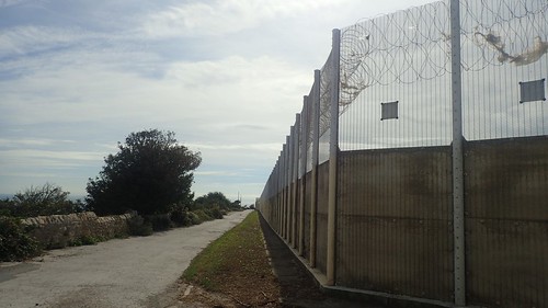
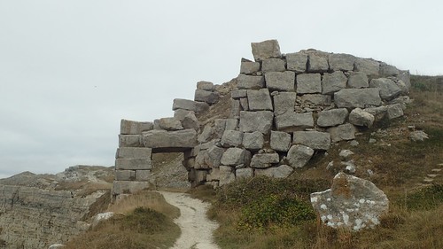
Beyond the deep ditch and high banks was The Citadel – now home to Her Majesty’s Category C Men’s Prison. To me, there was something a bit ‘Hollywood’ about this… Like one of those films where a prison is set upon some island, far from the mainland. If anyone was to escape, they wouldn’t be able to travel far.


Just around the corner we have Fancys Farm. A free-to-enter attraction with the added opportunity for free parking outside. They appear to have a café inside as well.


This looks to be the only farm on the island. I wonder how much custom they receive, sitting next door to a prison?

Continuing clockwise from there and the landscape transformed. It was coastal. Quite rugged and here still the familiar setting of another disused quarry for the renown Portland Stone.


My map also suggests this was once used as a firing range. Apparently I’m supposed to watch out for fellow pedestrians.

Then the SWCP passes the old engine shed that would’ve served the now-defunct railway line. Plans are finances are available to transform this in to a visitor centre. Perhaps we’ll see it materialise within a couple of years.

Having passed one prison, it was now time to circumnavigate the young offender’s institute!
Again, with that theme of law-breakers being left to rot on some unreachable rock out at sea. At least I was also walking beside the coast.

Here, the coast path descends sharply to follow a lower route beneath the cliffs. I’m sure you could alternatively maintain height and follow the road.


I’ve often thought that coastal locations provide idyllic situations for wild camping opportunities. Along the way, I’d thought of how I’d seen no such chances thus far… Until I spied what looked to be a pill box beneath me, with a small but potentially stone-free patch of grass beside it.
As far as the eastern side of Portland goes, this was about as good as it might get!

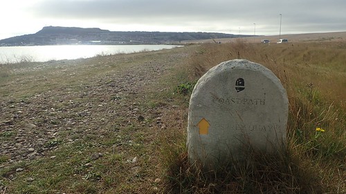
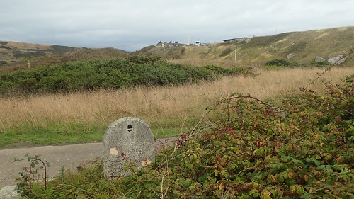
Ahead of Church Ope Cove, I met this marker for the England Coast Path.

I’d long forgotten that a stretch of the ‘ECP’ had already been opened in Dorset… With the South West Coast Path having been prevalent for so many years. I couldn’t recall having seen any signs or markers specifically for it. Neither can I imagine they would’ve had to do much, other than to update the occasional sign or make minor redirection.
Thinking about it now and 2012… It was probably an encouraged effort with the Olympics in mind.
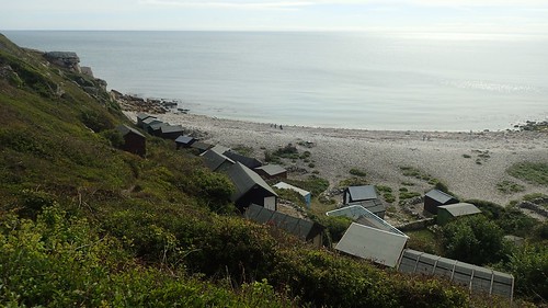
Huts adorn the shores of Church Ope Cove. It doesn’t quite compare to Lulworth of Chapman’s Pool. It was surprisingly busy on this day but somewhat bearable.

I then made the mistake of following “footpath signs” up beside the ruins of the local church. Many small lizards (newts?) scurried away beneath my feet but only in this vicinity.

To have remained true to the coast path, it looks as though I should’ve dropped down to the cove and followed a lower level path from there. Perhaps one day, I’ll return to correct my mistake, where instead I would follow a road beside new-build houses made of Portland Stone.

This short stretch of road walking would bypass an area labelled as Southwell Landslip – possibly for the best?!? I’d soon rejoin the official trail beside the next car park and remain honest from there.

Now I would join quite a rugged section of the coast path. Following the line of the road but with no sight or sound of any passing traffic.

Looking back over my left shoulder, I could see those infamous white cliffs of the Jurassic Coast. I felt confident enough to be able to say that I had walked all of it.
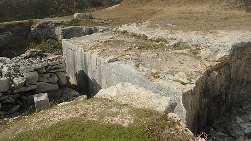
In front of me, further evidence of a redundant quarrying. I’ve read that some of the stone from Portland was used in the construction of buildings in London and other areas.

Following a less rugged path along the coast now, I passed what might have been a boundary stone. Or perhaps a guide for the Portland Coast Path (not that sticking to the coastline, here, should present a challenge).

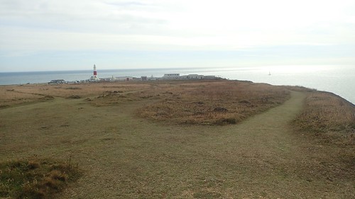
Not for the first time in recent minutes, I could spy the infamous lighthouse of Portland Bill. So good, they made a kids TV show about it…

I could see two other lighthouse-esque structures further inland. One is used as a bird observatory while the other, I believe, is a private residence (much like those found in Burnham-on-Sea and… along the cliffs just west of Eastbourne).

Even though this was a Monday and the kids (and teachers) would’ve already returned to school, it was around lunchtime and I wasn’t the only person with the good idea of a post-school-holidays getaway in September.

If you’re prepared to part with £7, you can can walk up the stairs to the top of this lighthouse. For a lesser fee, you can explore the visitor centre. While some of my spare change went on a couple of cards with birthdays coming up.

A mighty obelisk stands at the southernmost point in Dorset. I would’ve thought I’d be able to see Cornwall from here, if not Lizard Point… But it wasn’t visible to my eye [realistically, I might’ve been able to see Salcombe in Devon at best].

I would’ve stopped here for lunch but for the presence of other people. Travelling south from here, you’d probably reach the Channel Islands (Guernsey and Jersey) before the north-west coast of France.
It’s better-known as the Trinity House Obelisk.

I followed the coast past fishermen and around to a more rocky area… Unaware that a few others had (slowly) decided to follow in my own lead. With a distant view west along the stretch of Dorset’s coastline that I haven’t walked, this was a pretty good place to rest.

Some clambered over and down the rocks, as if they could continue walking beyond… Minutes later, they would return to rediscover the coast path.
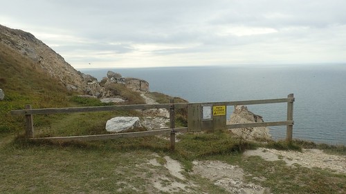
Officially, the SWCP bypasses an MOD (Ministry of Defence) base that occupies a small section of the coast. While the main trail leads you in and away from the cliff edges, this is Open Access Land, so I decided to follow a path closer to the shore.


Suddenly, it all looked a bit grim as I walked north along Portland’s western edge.

One private residence had been partially walled off from prying eyes. But if you’re going to build or commission a design that stands out from the rest of its locality… People are going to look on with curiosity!

Around the round house and I had my first sighting of Chesil Beach for several hours. This end to my walk was nigh.


I’d pass yet another area that had been quarried at some point.

I’d read warnings of a closure to the path ahead but didn’t see any such notice on a particular fence that could easily be walked around and so I carried on… To a point where the path came to an end, I had to turn back and take a higher route.
As I began to descend along steps in to Chiswell, I spotted a group of tourists unloading from a coach, beside what looked to be an obelisk or memorial. Possibly near the ‘Battery’ that’s marked on my map.
[This is also possibly close to where the Olympic Rings are, which I couldn’t see.]

It seemed obvious from here on; just follow the beach without walking on it.


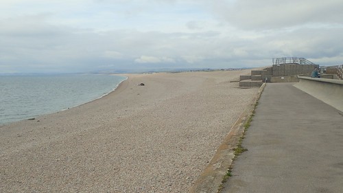
I made my way down to the brief sea wall, where National Trail acorns direct you away from the shingle.

Wandering backstreets of Chiswell with the sounds of a nearby A-road, I would resort to using GPS on my phone as a guide, as local signage appeared to have given up.

…This led me briefly on to a lower bank of Chesil Beach before I’d return to the roads. It was as uncomfortable as I’d anticipated. With a good ten miles already behind me, I wouldn’t have lasted much longer.

It’s possibly there is an actual coast path, just west of the A354. From where I was, it looked a bit loose like the bank higher up. So, I stuck to the noisy and busy road; sharing this pavements with the occasional cyclist and a power-walking lady who overtook me twice. I could only think of nicer pollution-free places to go for a power-walk!

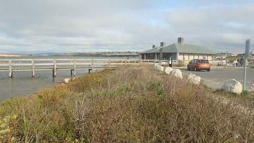
Two miles later and I was back at the car park. Another incentive to clear litter from the beach. I had wander around the visitor centre inside and did buy a cup of tea (which came with a free biscuit).

My walking in Dorset, for this trip, was done. On the way back to Osmington, I picked up fish and chips for dinner ahead of my final night of camping. I had tentative plans for a shorter walk (inland) the next day, ahead of the drive home… But it turned out to be pretty windy in the morning, I was tired and I ended up back home by lunchtime.
While I haven’t counted up the mileage, I can say that I’ve now walked most of the Dorset SWCP between West Bexington and Old Harry Rocks (there’s probably a void totalling ten miles in between and on to Studland).
When I next venture down this way (and if not to repeat a walk), I like to think I’ll be heading west towards Lyme Regis and the western end of the Dorset route (I estimate that as a sixteen-mile linear walk from West Bexington).

I do quite enjoy Portland, so different. It’s probably the part of the South West Coast Path most scarred by Human activity what with so much of it having been quarried away (and the remains just left when the quarries closed), and the prisons (there are 2 now – and there was also a prison ship moored in the harbour for a time).
Nevertheless I do enjoy that circuit perhaps because of the variety. There are areas that feel rugged and remote and others packed with activity and there is a lot of history. You quite often see cars displaying the local sticker on their bumpers “Keep Portland Weird”. I like that!
LikeLiked by 1 person
I should add by the standards of the south of England it is considered to be a fairly deprived area. It is quite isolated what with only the one road in and out. There is no railway any more and all the road traffic than has to negotiate driving through the centre of Weymouth to get anywhere else too, so it takes a long time to get anywhere from Portland.
LikeLiked by 1 person
I wondered about these things. It’s your classic ‘Where do these people work?’ situation. I didn’t spot any supermarkets (although Lidl were sponsoring a construction job), which could mean repeat journeys to and from Weymouth, if not through it.
LikeLike
That’s exactly what I liked about it. Every ‘corner’ of Portland was different
One would normally have to walk dozens of miles to encounter such variety.
I’d happily do the circuit again and make an effort to see the sculpture park.
LikeLike