Monday 17th February 2020
It was the Monday morning after a weekend of Storm Dennis. One week earlier, the UK was recovering from Storm Ciara. Two storms ruining consecutive weekends… I decided to take advantage of my day off and go for a walk.

I’ve walked the coastline between Clevedon and Portishead a few times since 2015. I didn’t fancy covering the full six-to-seven miles (plus the return) on this post-storm occasion of 30mph wind gusts. But I would cover a good portion of it.
Faithful to my old habits, I parked my car along the road beneath St. Andrew’s Church (frequently used by dog walkers) and dodged the main pay-and-display locations.

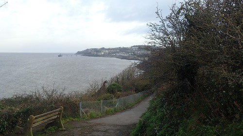
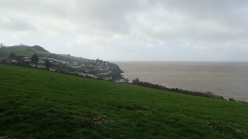
I followed the Poet’s Walk around Wain’s Hill; pausing to look south along the coastline of private land… After forty years of campaigning, there is finally going to be a route across here for walkers and cyclists, joining the edge of Weston-super-Mare.
It was forecast to be a cloudy day with persistent gusts of wind. As Clevedon came in to view, I felt as though there was something else in the air. Had I made the right decision in leaving my waterproof trousers and gaiters behind?

Casting an eye back from The Lookout, there was nothing much to see. Grey, all-consuming and probably heading my way.

By the time I reached the edge of the marina, it was bucketing down. Large drops of light rain. Not torrential but the kind you sees you soaked through in seconds. But I wasn’t about to turn back.

While a group of kids on half-term were being geared up for a swim and old folk took shelter where they could find it, I splashed on along the seafront.

Just on from the bandstand there’s a stretch of benches. Steel frames and wooden slats, only… One set doesn’t fit in with the rest.

This is known as Clevedon’s Talking Point. A pair of hardwood benches that form a semi-colon… Made and installed by yours truly! It’s all about increasing suicide awareness and giving vulnerable people a place to sit and talk.

While the legs are made from recycled oak railway sleepers, the tops (seats) are made from hardwood (ekki) decking that was salvaged from Weston’s Grand Pier when it burnt down in 2008.
There’s a quiet hope that we’ll get to make more of these around the region as time goes on. What’s really sad is that they were designated such a bizarre and uncomfortable location. Disturbing two lines of traditional benches and not appearing to fit in. But we had no say on where it could go… It was the call of the council (presumably in a late-night game of Pin the Tail on the Seafront).
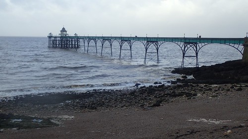
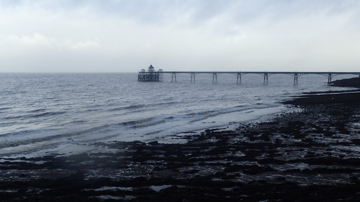
To visit and explore Clevedon’s Victorian Pier, it costs only £3.20, which I feel is still really good value given the attention it’s received in recent years. Back in 2015, I paid only £3 so, not a lot has changed there.
Be wary of carrying a tripod or large camera though… Staff will probably refuse entry on the grounds that you’re a “professional” photographer.

Moving on from the town, I followed the path above cliffs. Beneath one hotel, a wall had been damaged. I wasn’t sure whether or not this was an act of the recent storms.

Ladye Bay is another popular spot with dogs, walkers and rock climbers.

Beneath its small car park, someone had decided to discard a sofa chair. It was so clean and dry, I could imagine it had only been dumped that very morning… WHY? How could anyone think this is acceptable?!

Even on the edge of the town, the going was muddy under foot. Gaiters might’ve been a wise choice, even if I’d stand out from the less-adventurous crowds.

Within that first hour, the wall of rain had vanished almost as soon as it had arrived. Occasional drops fell while the sun made various efforts to break through.
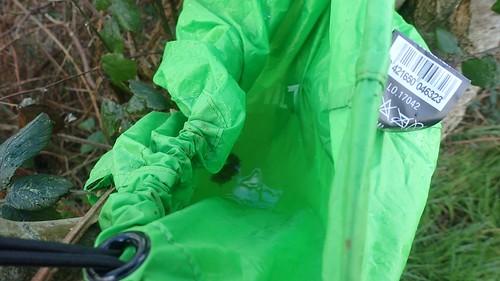
I found a rucksack cover caught in one tree and thought of the individual who possibly lost in during the weekend’s storms in some mandatory DofE expedition. It held a good kettle’s-worth of water after all of the rain.

Caravan’s above Walton Bay meant I was nearing the end of my coastal stint. Public footpaths leaving the coast were clearly marked and signed. Black Nore lighthouse is only another mile further on.

Water appeared to be gushing from one of the private gates, forming a large puddle on the footpath.
Leaving the cliff edge, I would begin heading inland towards Weston-in-Gordano. There was a reasonable ascent to get away from the coast.

I followed this path up to the edge of Common Hill Wood. Had I wanted to, I could’ve continued down across the Gordano Valley, on towards the M5 and then up to Cadbury Camp, where I would be walking six-days after this…
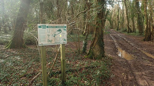
At first unsure of which unsigned path to take through the woods, I followed the one bearing the most footprints(!) and then realised I was on open access land… So it didn’t matter as much!

Through the trees and the mud, I emerged on to Walton Common. My first time ever stepping on to this land. No-one that I’ve known has ever spoken or walking visiting here.
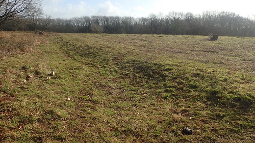
A near-circular formation can be seen from above, with a raised edge defining a large barrow. I saw the opportunity to sit down for lunch, with only one dog walker for fading company and blue sky breaking through the clouds above.

I don’t know where these cows came from! I’d surveyed the area well enough before pulling out my sit-mat. First, there was one, approaching with caution. Another couple trailed behind, with others slowly coming in to view.
They posed no serious threat or danger to me. I imagine they were only wondering why someone was sitting on their land on a Monday afternoon… Up until this point, I’d earmarked this land as a potential illegal wild camping spot!

As I was packing my things away, stuffing sandwiches in to my pockets and getting ready to move, a family with one dog emerged from the opposite direction and engaged themselves in a not-violent stand-off against the cows. I left before either party made the next move; soon finding another quiet spot beneath trees and to the south-west of the former hillfort.

After lunch, I dropped down to cross the road on the edge of Walton in Gordano and then began to head up from beside a house and stream, through Rock Wood.

This was the most antagonising portion of my walk… Negotiating a golf course! I’ve had so many unfavourable experiences over the years, with a complete lack of waymarking across so many sites; I often strive to avoid public rights of way that cross any green (unless I’m following a National Trail).

On entry, the gate bore the typical instruction to ‘keep to the footpath’… In truth, this example wasn’t too hard to follow and there were no active golfers to tell me off if I had made a mistake. In fact, the dog walker heading towards me was allowing his pet to roam all over, while the owner himself was several metres off the right of way and would otherwise have been liable to receive a golf ball in the back of the head.

I did make a mistake in the next section, where waymarking may not have been sufficient. I took a “grassy path” from what appeared to be a public bench and probably led along a golfer’s shortcut between holes… I whacked my head on a fallen branch (even after ducking) and then spotted the sign above, telling me that I should’ve stuck to the caddy-friendly gravel path after all.
Walton Castle and its remains sit within the confines of this venue. I didn’t see any signs encouraging walkers to visit – it may well be a ‘golfers only’ affair. Perhaps I’ll get there another day. North Somerset hasn’t held on to many of its former castles (although this one looks like it’s also reserved for corporate events).

Down the hill and at the next road I arrived in Walton St. Mary. I passed another walker, wearing gaiters and on his way up as I’d descended. A short distance along the road and I’d pass the local church. From here, I could rejoin my outgoing coastal walk close to Ladye Bay and retrace those early steps back to my car beneath St. Andrew’s Church.

While the wind of Storm Dennis remained (and, to be fair, have barely eased, almost a fortnight later), there was colour in the sky above and reflected in the crashing waves beneath me.

For some reason, I decided to push myself up and over Wain’s Hill, where I had arced around it in the morning. I consumed the rest of my lunch from the bench (having otherwise contemplated eating in the car) and pondered why there was a cross on this spot…
Was it a Holy reference? Or yet another claim to some legacy of King Arthur, Camelot and Excalibur, like so many other sites around England and Wales!

If anyone can clarify the above and perhaps also explain to purpose of these two wooden posts… It would be greatly appreciated!
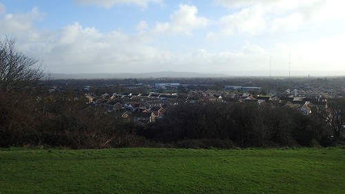
One last look across Clevedon. After I was born, I lived there for most of my first year on this planet. I’ve only been back since for work and other passing purposes. I sometimes wonder whether it could be preferable to where I live now.

One last look at St. Andrew’s Church. A decent day’s walking and with an early finish just after lunch – by which time, my non-waterproof trousers had sufficiently dried out.
