
Tuesday 15th September 2020
This would be my second walk in the Yorkshire Dales. Although it would first involve a twenty-minute car journey away from Ingleton and in to… Lancashire! However, I was still within the boundary of the Yorkshire Dales National Park.

I would be following a 13 mile route from The Walking Englishman. An incredible free resource that I’ve often used on my trips away to new places. One thing lacking from his walk was a car park…
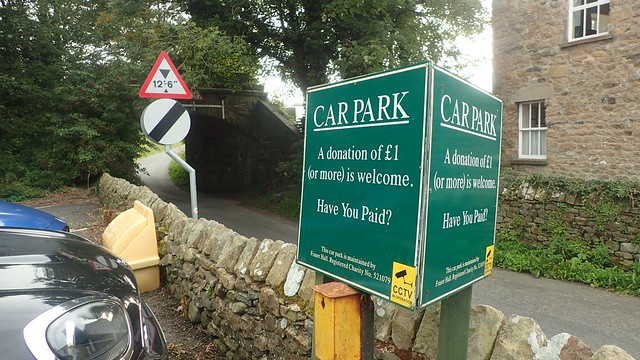
But with the aid of Google Maps, I had quickly found one in the village of Leck and was confident enough in making the drive without any form of a SatNav. As hoped, the car park here runs on a donation basis. I would happily donate a £1 coin before the end of my day. There are several such boxes beneath signs around the bays and, I can confirm as a witness, that they are indeed emptied by the end of the day.

On with the walk and I joined the road, heading north away from the A65 and deeper through the village of Leck. A couple of left turns and I’d soon find myself walking beside or parallel to Leck Beck (a river).

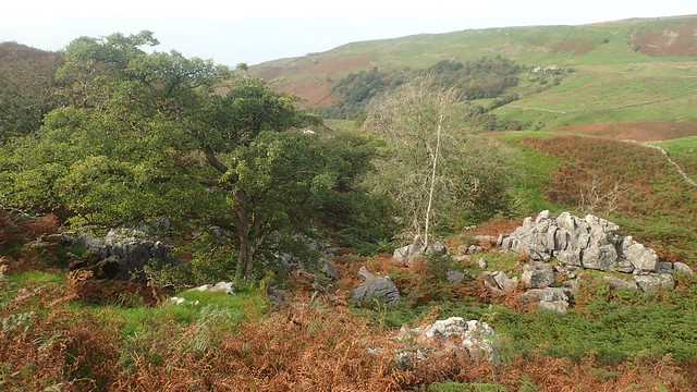
Through a conservation, continuing away from civillisation and I was heading closer to the fells and dales before me.


So far, I’d passed only two dog walkers in the village – both of whom gave a friendly ‘hello’. Looking ahead across the moorland, I felt as if I could go another couple of hours without human interaction… And would!

Still loosely following Leck Beck, I found myself crossing wet and marshy ground under foot. Not to be unexpected in Yorkshire (or Lancashire), as I was fast discovering.

My path climb up around the crag (rock) and away from the river, when convenience allowed. Before plummeting down to the point at which I’d return to the water’s edge…

Except, the bed of the leck was dry. I couldn’t have been too far from the source. Officially, I’d leave all public rights of way from this point and would confidently step over a fence, with the aid of large stones that others had set in place before me.

This dry river bed would remain as my guide along Ease Gill Kirk (which I think translates to… ‘Ease Valley Church’). From one side to the other; taking whichever grass bank offered the least resistance. I dare not think about what this must be like in the midst of a wet winter.

I passed what might’ve been an entrance to the Lower Kirk Caves. Yet still, I felt as though this was not a route that many would travel. Quite a world apart from the Three Peaks circuit!

On the map I could see the word ‘waterfall’ and knew that this would be the point from which I would take my next bearing away from the present route. I wasn’t expecting much. I certainly wasn’t expecting this:

If there had been a car park close by, you can bet I’d have met half-a-dozen or so others enjoying the water, here. This is a bit of a haven, in that sense. A lesser-known beauty spot and I’m assuming that most of the water here goes down in to the caves, with the river having been so dry.

With the sound of crashing water and not another soul to be found, I stopped here for a tea break, while contemplating my next move.
It looked as though some had scrambled through the fence and up around the western side of the gill. But my preference was to keep to the east – again, bearing in mind that there is no public right of way (it is Open Access Land).

Well, I made the right choice in keeping to the east and would soon spot a ladder-stile to cross over the dry-stone wall.


Above the gill, some of the rock formations were stunning. Limestone? Sandstone? I couldn’t quite understand how the water had left these ‘pools’ or ‘bowls’ within.

Over the stile (Yorkshire does love these) and I could begin to see my next move. To cross and climb up out of the gill. Leaving the still-dry river bed behind.
A brief but very steep ascent led me up on to the open moor. I’d taken a compass bearing that would guide me toward a pile of stones named ‘Richard Man’.
In poor visibility, I’d have been heavy reliant upon GPS from this point. I was attempting to cross a good mile of moorland using only a compass bearing… It’s not something I was trained to do. There are tricks and techniques that I could’ve employed (anything more than a couple of hundred metres, in my opinion, is too great a distance for a mere compass bearing).
But with good visibility ahead, I was somewhat confident that I wouldn’t go far wrong. I’d deliberately set my bearing to the west of Richard Man; knowing that, when I did reach that boundary line, I could continue uphill to reach the stones and not miss it.

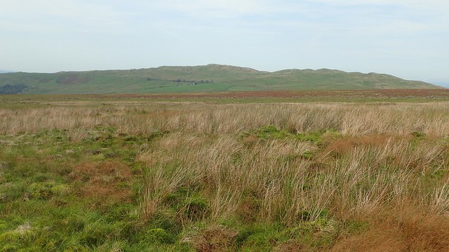
Far to the south and south-west, I could see nothing but distant hills and open land. No obvious signs of any cities, towns or motorways. I did have to cross a wire fence (which is not something I’d recommend) but, with care, as I could not see a gate or any other right of passage.

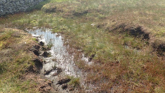
I’d underestimate just how tough this stretch would be. I’ll say again, that I was crossing open MOORLAND. Standing water, peat, tussocks and the constant threat that you’d find yourself somewhat deep and damp. Thankfully, I crossed without going in any further than my ankles. I was beginning to see why walkers in Yorkshire can often be seen wearing gaiters.
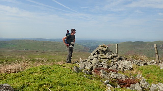
One more field to cross and, with a bit of an ascent, I reached Richard Man. No plaque and even Google can’t offer an explanation for its title… Just another pile of stones, if you ask me!

From here on until the end of this walk, I would be ‘handrailing’ – a genuine term for navigation using a line as your guide. Whether that’s a river or boundary line, as it my case.

I was tired and seeking lunch. But with still another half-a-mile or so (with ascent) until I would reach the next waypoint.
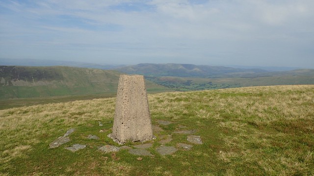
Through a gap in the wall, I made my way to the trig point of Crag Hill – not to be mistaken for a different hill in the Lake District.

(If anyone can explain to me the significance and meaning of these three red stars, I’d be grateful to hear from you.)

This was my lunch stop. Very well deserved and with great views of the Howgill Fells and Lake District. Whenever I do make it to that part of the UK, I’ve earmarked the idea of exploring those fells on either my first or final day.

But at 682m above sea level, this was not to be the highest point of my day.

Keeping to the south side of the boundary wall, I would soon reach Great Coum, crossing the valley of Ease Gill beneath me. At 687m, this was the highest point of the route. Across the next valley to the east stood Whernside.

Even from here, it doesn’t look like much and yet, it is the true highest point in the Yorkshire Dales.
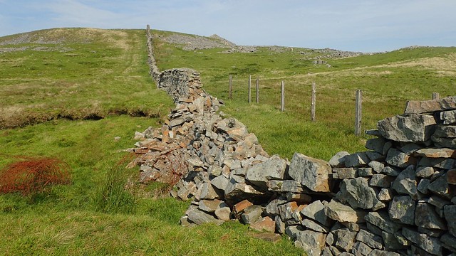
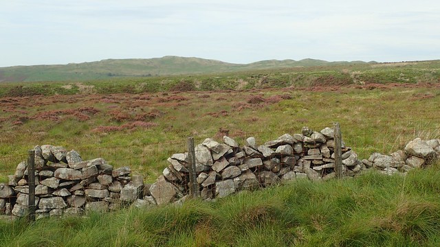
Miles upon miles of dry-stone walling. I’ve walked across most of Exmoor. I’ve seen portions or Dartmoor and a good chunk of Snowdonia and North Wales… But never before this trip to Yorkshire, had I seen man-made boundary lines quite like it. They run on. And on!

Marching south towards Green Hill, I came to this boulder looking quite out of place. Neither could I make much sense of the names or the dates.


Were these people who’d built or worked on maintaining these walls?

It’s actually the County Stone and I should’ve spotted it on the OS Map. Today, this marks a moment where Lancashire and Cumbria may kiss. Historically, this defines the meeting point of Lancashire, Westmorland and West Riding of Yorkshire.
There was still some distance to cover before I would reach my final summit. On the way up to Green Hill, I passed a couple of walkers – the first I’d seen since the morning – who’d taken a wide berth away from the line of the wall…
It was continually wet and boggy under foot. Make no mistake: the Yorkshire Dales is a stunning place, offering so much for those who love the outdoors. But do pack your gaiters and prepare to get your boots dirty!

To the south-east, I could see Ingleborough. Almost as ‘Kilimanjaro’ of a hill! Thoughts of climbing it the next day would keep me plodding on across the bog.

Having trekked this far, I wasn’t about to turn away from a broken gate that’s been tied shut at each end. Beyond here, lay the summit of Gragareth.

I haven’t searched for a definite answer but I believe we can extract the work ‘grag’ (like ‘crag’ = rock) from its title. As for the rest… It was possibly named after some bloke called Gareth?!

But don’t take it from me. I spent the entire day pronouncing it wrong… “Gra’gareth” should sound more like ‘Nazareth’… As I was corrected by the campsite owners, later that evening. Hearing it suddenly, I felt it made much more sense. I was complicating it as if attempting to speak and understand Welsh.

My day of fell-walking was nearing its end. Following a worn path downhill to the east, I would soon pass a trio of cairns marked on the map as the Three Men of Gragareth – I’ve since read online that ‘man’ could be an old alternative to ‘rock’ or stone.
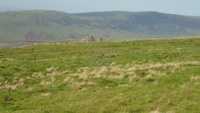
To the north of them sits another crowd of rock piles, marked only as ‘cairns’ on the map, without a name to distinguish them from the next.

Of course, I spent time exploring both before carefully zig-zagging my way down the escarpment and to the south of Leck Fell House, where I’d join a road for the first time in many hours.

There was in fact a small parking area with space for many a couple of cars and not much more. Approximate location was SD 674 790. I’m sure you could spot it on Google Maps. Had I know ahead of time… I might’ve parked here instead and lopped a mile or two from the length of my walk!

For the final two miles of this walk, I would follow the road, while giving way to the occasional driver heading to or from the farm, it seemed.

This had been a day full of challenge and reward. I haven’t yet spoken of the weather. Warmer than the day before and with no more of a breeze. Sun cream had probably saved my skin and I had Ingleborough to look forward to the next day.
But would this good weather continue?
Length of this walk = 13 miles
Route taken from The Walking Englishman
Thanks for reading.
