Monday 14th September 2020
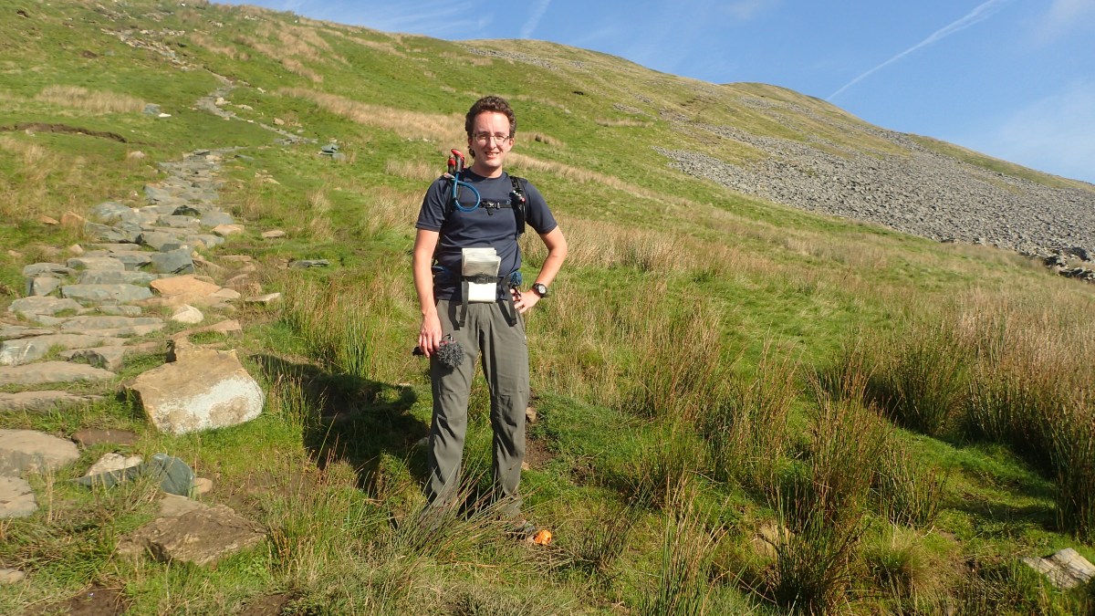
On my first morning in Yorkshire, I would head up to Whernside – the highest of Yorkshire’s Three Peaks – and setting off on foot from the campsite – only a short walk as the crow flies but with a good measure of ascent.
In not having to drive somewhere, there’s an advantage to be taken in being able to start a walk sooner. I’m sure I was off and walking from Philpin Farm at no later than 9am. On average, my usual walks seem to start at around 10am or shortly before.

I’d slept relatively well; the night after an extended drive up from home (thanks to a closure along the M5 motorway) and then the task of having to pitch your tent in the wind, adapt to a new environment, layer up(!) and sort yourself out with the essentials like an evening meal.

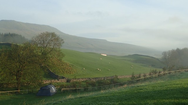
Philpin Farm’s campsite sits right beside the popular Yorkshire Three Peaks walking route – a trail that is not recorded on Ordnance Survey maps. Some will stay here overnight while attempting the twenty-five mile circuit of all three summits over a weekend. I’ve had thoughts about taking on that challenge myself… But I’ve never committed to it and didn’t want to over-exert myself on the first day of a five-night trip!
Ahead of my inevitable climb, I could see Ribblehead Viaduct; an iconic vision that would become a feature of this walk before the end.
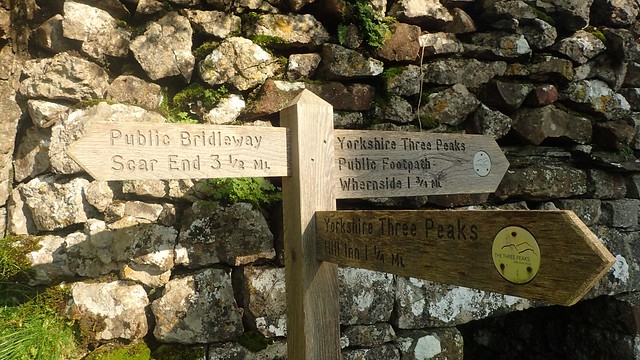
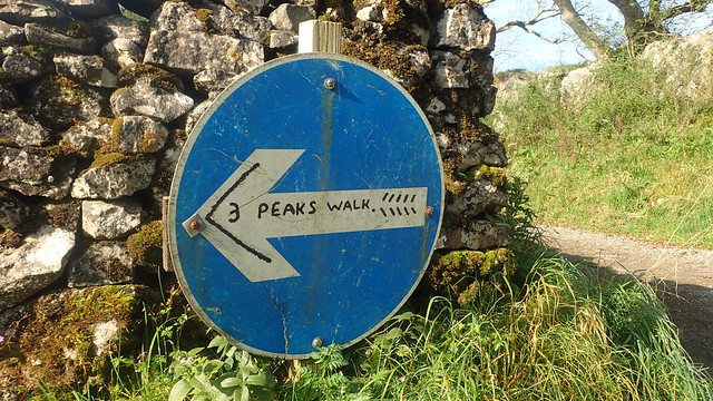
With such a draw for people to take on the Three Peaks challenge (not to be confused with the National Three Peaks of Scafell Pike, Snowdon and Ben Nevis…), it was good to see that the route is so well catered for with waymarking. I guess it’s almost to be expected, as the route must be popular with many runners, along with those who walk it.

I’m pleased and proud to say that I recently donated £20 towards the upkeep of these very paths – many of which are paved with limestone, as you’ll soon see further down. I felt it’s the very least I could do, having visited the area for the first time and not contributed too much financially elsewhere.


All that these many signs lacked was a warning of the ascent that was to follow, as I soon found myself winding up the limestone staircase! A couple of runners passed me, heading in the opposite direction. Otherwise, I was alone on this walk. In the Yorkshire Dales!

It was a warm morning. Nothing above the late teens (if even that high) but what was absent was the breeze from the previous evening and even as I reached the ridge line.

Looking east across the valley, I could see Park Fell, to the left of Ingleborough. Cloud was lifting from around those summits – both of which I’d be tackling in a couple of days.

I’d not encountered a pair of kissing gates quite like this before. Timbers looked quite new… Had they been installed in time for the Covid invasion of our lives?! A one-way socially-distanced system of access on the hills?… Or fells.
Probably not! But I can imagine this route gets very busy on a weekend in decent weather.
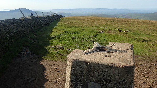
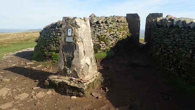
A few others were already gathered around what would be the summit of Whernside – the highest peak in all of Yorkshire. In spite of its long, down-like form, it remains classified as a mountain.
Truth is that I almost missed this trig point! But for the other people around, I didn’t spot the gap in the wall (nor the concrete pillar beyond). I hovered away from the group, pretending to check my phone for other things… Which discreetly activating GPS in OS Maps to confirm my location.
I sat down, had a cup of tea, something to eat and waited patiently for others to disperse.

I almost forfeited my internal game of forfeit to a group of young ladies who, by the sound of it, were looking to conquer Ingleborough in the same day. In good spirits, their break was anything but brief! When I later returned to the campsite, I realised they were also staying at Philpin Farm, pitched downhill from my own tent – what were the chances?! Yet, they were up on Whernside with reasonably sized rucksacks.
Another guy who passed (haven’t packed conservatively) was looking to complete the Yorkshire Three Peaks in only six hours… Having started at 7am, he would’ve needed to be about halfway by now but felt as though he wasn’t quite going to make it… To my mind, he would need to be walking more than four hours per hour and he wasn’t the running type!

With a boundary wall to my left, I continued walking north toward the next path junction. Away to my left, I could see the Howgill Fells. Beyond them… The Lake District!

It is true that I deeply driving the extra hour to reach the Lake District for my very first time. I know that journey will have to happen another day (although not too soon, with the North West slipping in to lockdown). I felt a bit odd though, having travelled so far, being so close and yet not crossing that border in to Cumbria.
I’d considered breaking off from the well-trodden path and continuing north Knoutberry Hill. But I missed the left turn through the boundary and, even though I was now thinking about trying to fit Ingleborough in… My main intention would stand to keep this walk as straightforward as possible. Otherwise, I could’ve walked along a trail known as A Pennine Journey – one of Alfred Wainwright’s less-talked-about routes and one for which there is a campaign to celebrate it as a National Trail.

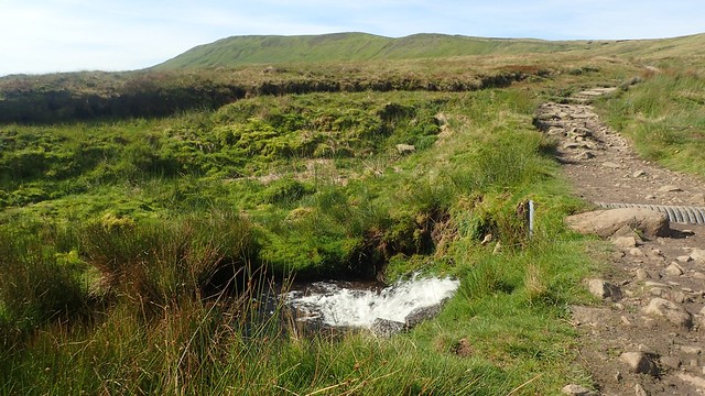
I would follow Force Gill (‘Gill’ meaning a ravine or steep-sided valley) and soon pass the waterfall I’d been able to hear on the way down.

Looking to the north-east, you can see what I believe are air shafts, with the railway line running through Bleamoor Tunnel below.

Around here – sometime in the late morning – it was suddenly much busier than I had known so far. Many people were heading up to Whernside in the opposite direction to my own walk… I must’ve passed twenty of them before passing the waterfall and then, an even greater number heading up from the viaduct ahead.

This was a Monday morning – and I’ve done well to crop them all out of my photos! Why weren’t they at work?! It’s also possible they pondered the same about it! However busy it could get over the next five days, I imagine it would’ve been even busier over in Cumbria. That was a major reason for why I went for the Dales and not the Lakes.

I passed what I thought might’ve been a former station at Blea Moor, where I also found a plaque commemorating the drystone walling in the local area.


Walking beneath the railway line now, there was an opportunity to turn right, passing through and following the Dales High Way back toward the start of my walk… But there was still one significant item on my Must See list…

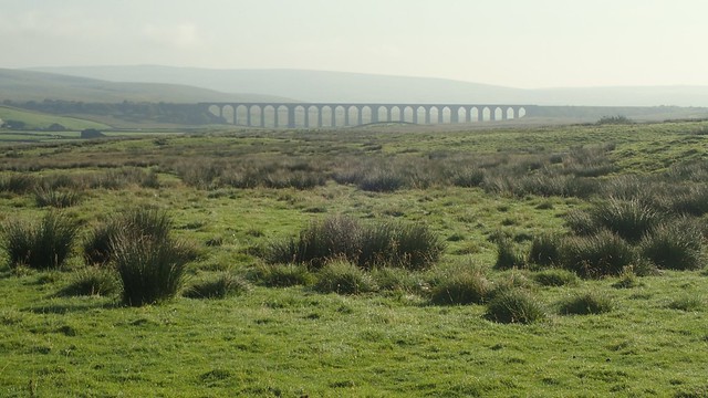
Ribblehead Viaduct. An image from many magazine covers, postcards and it probably features in a lot of modern drone footage. I’d quietly admire this one for a number of years and now, I’d finally get to see it up close. Time was on my side.


Work to build this structure was completed in 1875 – just take that in for a moment… We’re talking one-hundred-and-forty-five years ago… And it’s still standing. Still in use today!


I did take the time to read through all of the available information. Being a short distance from the B6225 road, it was fairly busy with people. Free parking options are available close by and it was around about lunchtime.

Through the arches and I would soon be returning to the campsite.

Sat upon a grass mound away from the main path, I would stop for lunch. Sure enough, a train would soon pass by – I didn’t take a photo but you can see it briefly in my YouTube video from this day. A couple of people asked me to take their photo and I happily obliged.
Before this trip, I’d heard all sorts of things about “Northerners” and how unwelcoming they can be… But I was impressed by the assertiveness of these two visitors (I don’t believe they were local) and the strong majority of other walkers I had passed had each greeted me with a ‘Hello’, ‘Hiya, pal’ or ‘How do!’

Ingleborough could wait for another day. I’d planned a couple of ‘spare’ walks for this week, just in case. There was the pressure of not being able to do them but, equally, I could save those for a future Yorkshire Dales getaway. It was barely 13:00 and I had a very good chance of returning to my tent in time for a rare afternoon off.
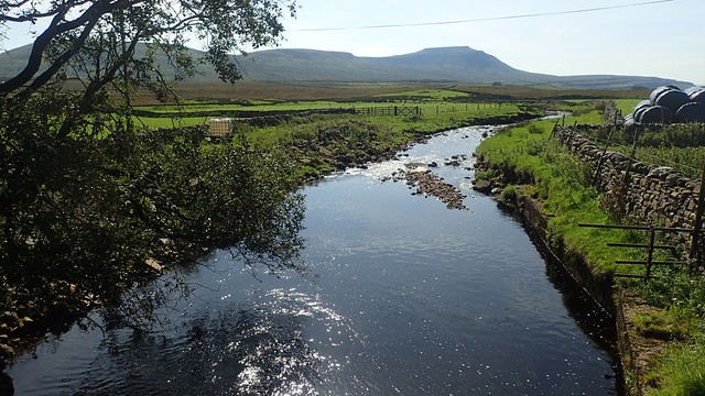
Following the bridleway through Gunnerfleet Farm, I would soon cross Winterscales Beck (‘Beck’ meaning river) – twice. Further bridleways – some with clearer waymarking than others – would soon lead me back to Philpin Lane.

A very welcome and rewarding introduction to the Yorkshire Dales and without too much exertion. I’d ticked off one of those must-see locations from my unwritten bucket list and I knew there would be more to come through the rest of the week!

If you’d like to see my route, you can find it on OS Maps, where you can also download a GPX file (although you may need to be a paying subscriber).
You can also watch my YouTube video from this day.
Length of this walk = 8.25 miles
Thanks for reading.

Great reading again Olly. I’ve never walked those areas, the closest I’ve been was when I worked nearby and was driving around to get to my next job. Beautiful scenery though and Yorkshire people are very friendly too.
LikeLike
Grand pics of a walk I’ve still to do.
LikeLiked by 1 person
Thanks, John. I hope you do get around to it.
LikeLiked by 1 person