Wedndesday 16th September 2020
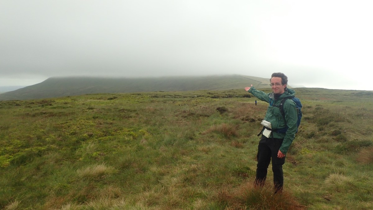
This was the one walk and mountain I’d most been looking forward to during my Yorkshire Dales trip. Another that I could approach directly from the campsite. No need to step in to my car (although it was a useful space in which to store muddy boots and keep the tent relatively clean).

In the evening before this, we’d received a shower of rain – the only one I’d encounter during my five-night stay. That probably set the scene for a rather bleak and atmospheric morning.

I could still see Whernside, to the north beyond the tents. But walking south, the summit of Ingleborough looked to be under cover.

With due care, I walked east up the B6255 road from Philpin Lane. There’s no pavement and yet, every year, hundreds (if not thousands) of Three Peaks challengers follow this same route.
Just past The Old Hill Inn (a pub that was sadly closed at the time), I turned right beside an information board, detailing a footpath closure and the diversion to be followed. I knew of this in advance of my trip but it was good to see such clarity available – quite often, councils position vague notices referring to footpath numbers – the kind of detail that an OS Map won’t provide.

It was at Southerscales Scar (an escarpment) where the diversion begins. Instead of contouring around and along what appears to be a more gradual ascent; the signs, fencing and yellow arrows guide you straight up the hillside, steeply following the drystone wall.
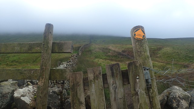
It’s entirely possible that some have walked this way before. I don’t believe there was a right of way here beforehand (and there are no markings on the OS Map) but this is Open Access Land, meaning the public have a right to roam anywhere within its boundaries.

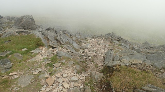
Ascending in to the cloud, this was quite the challenge. Not unlike the Whernside ascent but distinctly lacking in the security of limestone slabs under foot.
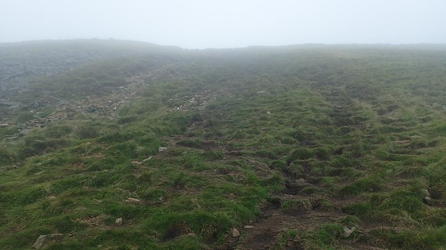
It was wet and boggy in places, as you might expect on the moors. But this only made the going harder. I wouldn’t like to follow it downhill!
At the top, I walked in to 30mph winds that would mute conversation but couldn’t do enough to clear the cloud (or ‘clag’). One guy was leading two others on a walk of some sort and asked for confirmation that I had indeed followed the diverted route up (they were looking to descend).

As I followed the boundary wall towards Simon Fell (and left the diverted route), I saw two kids in trainers (no backpacks and probably teenagers) looking to follow that slippery route to the bottom… I’d be surprised if either of them made it home without a brown backside that afternoon!

There wasn’t much at all to see of or from Simon Fell so, I followed the next boundary wall west, past Green Hill (different to the one from my Gragareth walk) on towards the summit – where I almost caught up with a dog walker, barely visible through the cloud.

There’s some debate between archaeologists and historians, as to whether or not Ingleborough was in fact a hillfort and settlement in the prehistoric times. Certainly, parts of its form appear to have been fortified by the hand and graft of man. But beyond that, there may not be enough evidence to say for certain.
At more than 7oom high, that’s a fair elevation. Yet parts of Dartmoor rise to more than 600m and people once lived all over that moor.

On to the plateau of a summit (not unlike Pen y Fan and Corn Du in the Brecon Beacons) and visibility was still a challenge. This wind carried droplets of water in its passing. I followed cairns in the hope of finding the wind shelter – cairns were historically used to mark ways and guide walkers across open land, long before limestone and anti-erosion methods were introduced.

I passed a group of young people (again, probably teens), led by an adult (possibly on some Duke of Edinburgh Award training – they’ve probably had few opportunities for that in 2020).
But this was the wind shelter I’d expected to find on Whernside(!), two days earlier. I was able to sit down and have something to eat and drink before moving on.
I was there for a good ten to fifteen minutes. No other souls emerged through the cloud. But I’d noticed the unfortunate signs of human visitation: cigarette butts on the floor; empty crisp packets stuffed in between the rocks.
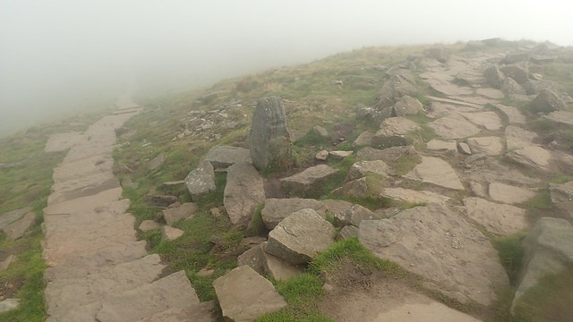
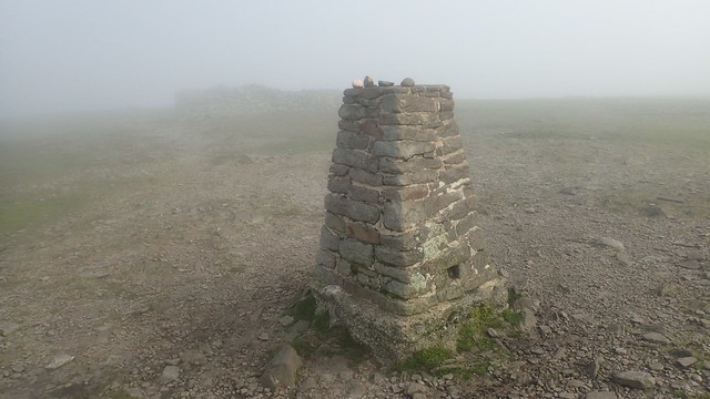
From the trig point, I took a compass bearing and found my way back to the steps I’d followed to the top. A bit further down and I arrived at this path junction, marked by a standing stone (which almost looked like a trig point, on the way up).
Now, I would follow the path running east along the Dales High Way and in the vague direction of Horton-in-Ribblesdale (I think this also follows the Three Peaks Walk). The Dales High Way is a ninety-mile linear route that runs in to Cumrbia.

Gradually losing height along another limestone way, I could soon discover the landscape surrounding me. Off in the distance but still very much in the cloud, I could see Pen y Ghent – my final of the Three Peaks to conquer and one that I would have to wait another forty-eight hours for.

Other people were heading up in the opposite direction. Some worse shorts and T-shirts. Some, or so I thought, made silent, internal remarks about the fact that I was wearing gloves. Most just gave a pleasant ‘How do!’ in passing.
In the rocky area above (not to be mistaken for Malham Cove), a runner overtook me, saying that he had already smashed his knees five times! I’ve still yet to go on my first proper trail run and I don’t think I’ll be doing it before the new year!

With Pen y Ghent still in view, I met the Pennine Bridleway and would follow this south and around towards Clapham [in Yorkshire, not London!].

At this point, I also left the Three Peaks walk and made a note of the call for donations towards the upkeep of path maintenance (I made a £20 donation online, after my trip). If or when I visit the Dales again, I’ll probably make another donation. It isn’t much but it may help.
Follow this link to make your own donation.

More walkers were present around here – one couple told me that I was the first person they’d seen all morning. Before that, I’d passed a small group of older men carrying shotguns. Their vehicles were parked on the other side of the wall… I don’t truly know all of the laws on shooting and hunting but I believe they were after grouse, as there are plenty of ‘grouse butts’ on the map.

Peeking my head over the wall from the bridleway, there was the incredible sight of Moughton Scars.

Rock for miles! Somewhere up there was a trig point. Over the other side lies Horton Quarry.

I would soon leave the Pennine Bridleway and head down in to the next valley, with a view to discovering Trow Gill. I was going to head up to Ingleborough for a second time! But none of this would happen before stopping for lunch.

In the other direction towards Clapham, I could’ve discovered Ingleborough Cave. Perhaps I’ll see it another day – along with the waterfalls trail in Ingleton.
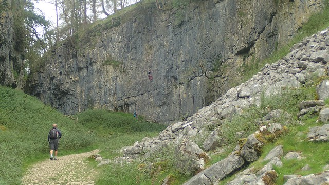
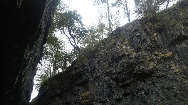
Trow Gill. ‘Gill’, I know, is another term for a narrow or steep-sided valley. I’m guessing that ‘trow’ is an old word for “through”. Unlike the climbers you can see above, I was only heading up through the gill.
Again, it was busier here than at the beginning of my walk. Some, I imagine, walk only as far as the gill before heading back down.


Now following A Pennine Journey, I could see Little Ingleborough ahead – my next target. Around me the landscape began to expand, while Ingleborough itself remain hidden behind the veil of cloud.
A Pennine Journey is almost as long as the Pennine Way and there are calls to turn it in to a recognised National Trail.

I took a very brief detour out to Gaping Gill before returning to the main path. Some were understandably having their lunch here.

If a ravine or valley is “gaping”…
Can it truly be classified as a ‘gill’?

My main reasons for climbing Ingleborough twice in one day were so that I could make more of my day, and not have to settle for another nine-to-ten mile saunter… And also, so that I could see and tick off a bit more from this area.

It was, of course, steep on the way up. Cairns would guide way, closer to the summit. Unlike it’s bigger brother, Little Ingleborough was largely free of cloud cover.

There’s no trig point here but a pair of cairns (or just piles of stone) mark the summit. A few minutes of respite walking await, before the inevitable final climb.

Although it looked clear from a distance, I would soon find that the visibility had not improved from the summit of Ingleborough! I’d love to return here on a clear day and see it all again.
From the plateau, I decided to take this ‘less certain’ descent towards the path I had followed in the morning… I blame the lack of visibility, as the going was anything but easy. Sometimes minor scrambling and downclimbing was required – and somehow, a group of three people had tagged along with me!

I almost began following the Dales High Way east towards Horton… But soon corrected myself and met with the diverted footpath from the morning.

Even with the cloud, this was quite a stunning and treacherous walk heading north.

One slip and it couldn’t been a very long way to the bottom! Somewhere, way down there, was my campsite.

Again, I passed the top of my morning’s climb up from the road. With the cloud having cleared below, I felt even less enticed by the thought of descending along that way! No bodies were visible.

Instead, I followed the boundary wall all the way to Park Fell and I’d make my descent from there. ‘Fell’ is another name for a “hill” up here and bears no relevance to anyone tumbling down a boggy footpath diversion…
I could also see Ribblehead Viaduct from up here.

I felt it was a long old walk alongside this wall. I knew I was in to double figures with the mileage and a part of me wanted this walk to be over so I could rest… As much as I had enjoyed the challenge, the atmosphere and the experience as a whole.

There was no other access to the field with the trig point but from a gate at the northern end. I would have to double-back on myself but it would’ve been foolish not to, after having walked so far.
I’m also curious to know how this signed “ridge walk” might compare to what I’ve just done. It’s another situation where the route doesn’t exist on an OS Map.

At 563m above sea level, this was a good point from which to pause for the final time. Great views looking north and east over a less familiar section of the Yorkshire Dales that I hope to explore in the future.

A fairly sharp descent led me down towards the farm at Colt Park, where I’d turn west and following a fairly-easy-to-follow footpath around the hillside (fellside?).
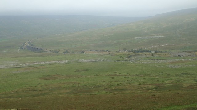
It looked to have been another busy day over by the viaduct.

I passed another Malham Cove-like formation at Fell Close Rocks. I’d thought above trying to leave the rights of way and forge an off-piste route would hopefully follow the road… But I was feeling quite tired by now and didn’t want to risk too many rocky sections, potentially climbing over walls and upsetting farmers.

In the final field before the road, I spotted a sheep lying on its side (not pictured). Fearing the worst, I took a deep breath before passing… Only, its legs began to move and, as I edged closer, I could see it was definitely alive and just stuck.
I asked a friend once, why sheep haven’t “evolved” to the point where they can recover themselves… She suggested that it’s probably got more to do with how we breed sheep. In any case, I helped this one up on to all fours and my good deed for the day was done.
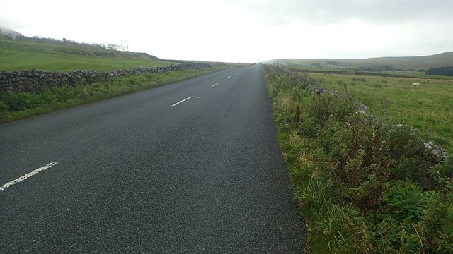
I was going to cross the road and follow the same bridleway as from the end of my Whernside walk… But instead, I took a chance along the B-road; stepping aside to let cars pass when required.

I did pass The Old Hill Inn for a second time. Only a short walk form the campsite but it was closed throughout my stay. I’ve just read that they’ve closed again as of early November, thanks to the pandemic… This is a very tough time for small pubs.

With fifteen miles under my belt, I soon returned to the campsite. As I said, I’d love to return and do Ingleborough again on a better day and it is definitely my favourite of the Three Peaks. So good… I did it twice in one day!!
Length of this walk = 15 miles
Thanks for reading.

Some amazing geology there. I’ve been up Ingleborough but not to the caves or “gills”, which look well worth exploring.
LikeLiked by 1 person
Trow Gill is almost like a mini and brief Cheddar Gorge. I saw some photos of the cave inside Gaping Gill – I don’t believe the public are allowed in often but it is stunning. Like something from one of the Batman films!
LikeLike