
Sunday 7th February 2021
After a month in which I was honest and stayed very close to home and walking only from my own doorstep; I decided to give myself a day off. But, instead of sitting at home, watching Netflix and taking it easy; what I had in mind was to drive for precisely five miles (across Weston-super-Mare; the town I live in) and follow a fresh route for a local walk…

At the time, I was willing to believe that we were ‘allowed’ to travel for up to five miles for the purpose of exercise and leisure. But, while doing some research after this day, I found that this isn’t the case. We are only being encouraged to stay very local. What I did was not against the law as such – and I don’t wish to start any debate about what we should or should not be doing. But I did feel as though I was bending my own lockdown rules.

My walk started in Uphill, which sits in the south-west corner of Weston-super-Mare; directly across from where I call home. It’s only another mile (or less) further than my daily drive in to work. I found a parking space on the road near the two pubs and began a somewhat familiar climb up to St. Nicholas’ Church.

This partially-ruined church (its nave is missing the roof) was built nearly one thousand years ago in 1080AD. Although not open for regular services (in or outside of a pandemic), I find that to be an impressive fact.

Through another gate and over the hill, stands a tower in the spot where there was once a windmill. This is sometimes known as Uphill Beacon. I’ve only been in and climbed the steps once… At the time, it was like a litter bin around the stairwell. I didn’t go near it on this occasion as a dog walker was lurking, seeking shelter from the Baltic breeze.

Next, I would drop down from this higher ground to join the West Mendip Way – which begins (or ends) beside the entrance to the marina. I’ve walked the West Mendip Way a number of times over the years but rarely in this direction.

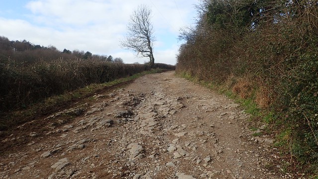
I would follow the Way up to Bleadon Hill. A matter of miles, compared to the full thirty that would lead you all the way to Wells Cathedral. Mud was a theme among these early paths, when not crossing the A370.

From Purn Hill – perhaps the most insignificant hill along the full Mendip Way – I continued on towards Bleadon village.

I would follow the Way up on to the Roman Road that follows the spine of Bleadon Hill… Only to leave it, as I turned off to follow a path through Bleadon Hill Golf Course.
I’ve walked along here several times since last summer. Before that, a number of years had passed since my first visit. Even when golfing is allowed, this right of way is very clearly marked, define and easy to follow. Many other golf courses do not compare in their approach to walkers. Meanwhile, the owners here are taking the time and opportunity to look after and improve the site.

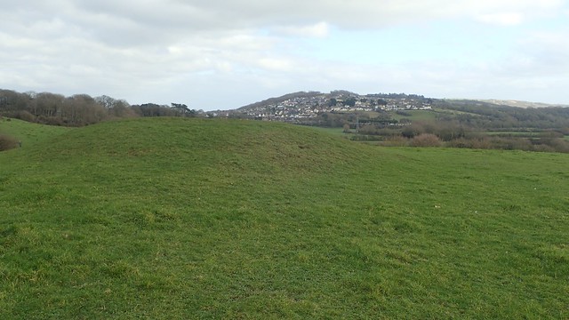
From Bleadon Hill, I could look across Weston-super-Mare to Worlebury Hill, where I was walking seven-days earlier.

This path heading east beside the greens continues in to a path of woodland above Hutton. Shelter from the bitter wind – only this morning, the “feels like” temperature was around -4°C!

I paused for a cup of tea before leaving the woods (while also filming snippets off this day for my YouTube channel – which is now available to watch on Walks With Olly).

I followed the road up through Canada Combe to rejoin the West Mendip Way at the eastern end of that Roman Road.

Through the mud, water and I would continue east to pass Christon Plantation. This area was quite familiar to me, as I walked around here back in July, one summer evening.


Some of these tracks were highly avoidable – over the years, walkers have forged a higher path that skirts alongside the sunken bridleway.

My walk continue towards the M5 motorway, which also forms a boundary between North Somerset (where I was standing) and Somerset, where I wasn’t prepared to tread during lockdown. Banwell Hill is in view, above. I’ve not been there but I believe there are shallow caves that you can explore.

Just before the motorway, I was looking for a footpath that I could follow down in to the village of Christon – and I’d believed I’d found it with the stile above… Except, any ‘way’ beyond was ridiculously overgrown…

Just west of here, there’s an accessible stile that grants access in to the same field. But it doesn’t feature as a public right of way on the OS map. Yes, one of those! At least I didn’t have to trudge back through all that mud.

This path soon led me down from Flagstaff Hill and towards the “shrunken Medieval” village of Christon. If you dig a little online, you can find that there was once a hillfort close to this site. Some of the land has been shaped by man over the centuries.

I spotted the stones on my walk last summer. I only thought of them as standing stones – perhaps forming a straight line or boundary. Some sources suggest there was once a great stone circle, here. While it’s not a ‘World Heritage Site’, I do appreciate that the current landowner hasn’t shifted or removed the stones.

For a few minutes, I walked along the road through Christon, which connects Bleadon with Loxton. But I then began followed a dead-end road up towards Keeper’s Cottage.
Heading up a dryer track now and I was returning to the top of Bleadon Hill. A lot of exertion and I could’ve cut this loop out and saved myself some strife. But I was now beyond the halfway mark in this walk.


There was a really good view of Crook Peak from here and I could see a few people on the top.

Then, as soon as I’d rejoined it, I would leave the Mendip Way, once again. Another bridleway would lead me all the way down to the eastern edge of Bleadon, via Shiplate Slait. Good views of Brent Knoll (above) on the Somerset Levels.

Another footpath, now walking between the fishery and South Farm. This was, by far, the wettest section of my day! It had not improved since I took a group of five others through this wetness over Christmas.


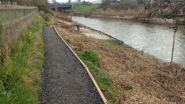
Veering away from Bleadon and back towards the A370, I would follow a substantial footbridge over the River Axe. Just as I did last July.

There’s an old-looking sluice gate before the road. Apparently still in use today. Although it looks about as well-maintained as Birnbeck Pier!

Straight over the road and I was still walking beside the River Axe. But this next section was completely new to me.
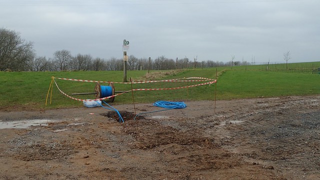
On a work outing the week before, I’ve spotted workers clad in hi-vis clothing while driving past, here. It looks as though they were making improvements to the right of way. A new surface beneath our feet, with gates and yellow arrows that looked brand new.

Beyond here, the official right of way appears to meander around this pond and through the corner of the caravan park, before heading out to rejoin the river… I didn’t want to bother with that and saw no signs saying ‘private’ or ‘keep out’. So, I snuck between the river, the pond and walked on in the same direction.

Also of note, here, is a local example of an Oxbow Lake – yes, that thing you probably remember from geography lessons in school!

To continue west and head for Bleadon Levels Nature Reserve, I would now have to brave the road. Not a major one but the traffic was frequent enough. Worst of all though, was the litter. I could probably have filled three bin bags’ worth! People say that the “litter problem” has increased since the first lockdown. I’m not sure – perhaps we’re just more aware of people’s thoughtless behaviour?

Then, I would join the Brean Down Way – a cycle route that links the seafront of Weston-super-Mare with the beach of Brean and Berrow.

If you observe signs around the nature reserve, you can see that there are footpaths around the place that you won’t find on an OS map. I took this opportunity to step away from the busy and surfaced ground. But to continue in the same direction.

I was almost back at the car. Uphill Marina and St. Nicholas’ Church were in view; the latter sitting above a former quarry where the remnants of limekilns can still be discovered.
Shortly before the end, I climbed to the top of a hill named as Walborough.

It was around 13:30 by the time I returned to the marina… Usually, I’d have been looking to finish my lockdown walk at least one hour earlier, so that I could arrive home in time for lunch… I’d packed food with me, just in case. But the cold wind and constant exposure meant I didn’t feel comfortable stopping anywhere. I ate while I walked, for as much as I could. But back by the marina, it was HEAVING with people. All over the cycle path and Mendip Way! Cars were still rolling in. Yikes! My decision to walk here seemed so foolish, despite having encountered so few others until now.

Some were even queuing up for ice cream, on a day of sub-zero temperatures! But honestly, I had enjoyed the walk. My longest distance for some time and quite a hilly outing.
Length of this walk = 13 miles
Thanks for reading.

I walked the whole West Mendip Way a few years ago, I really enjoyed it. It’s nice to live close to some good hills!
LikeLiked by 1 person
Somehow I missed reading this before! I know a lot of the walk you describe, but only in disconnected bits. As ever, really interesting with all the extra information about what you saw and passed by.
LikeLike