Monday 23rd August 2021
This walk was the main reason for which I chose my particular campsite just off of Winsford Hill on Exmoor. It was to be a repeat of a walk I did with two friends back in January 2019.

Leaving the car alone (well, having used it as an overnight store for my footwear), I left Halse Farm campsite on foot, heading straight for Winsford Hill.
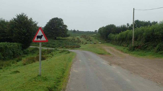

A blatant bridleway led me from this road and up towards the top, where I’d soon cross the B3223 road. Visibility could’ve been better but it was hard to go off track, or so I felt.


Over the road and I was now descending. This was now the tail-end of the route we walked back in 2019… Meaning I’d had to climb back UP that hill towards the end of this walk.
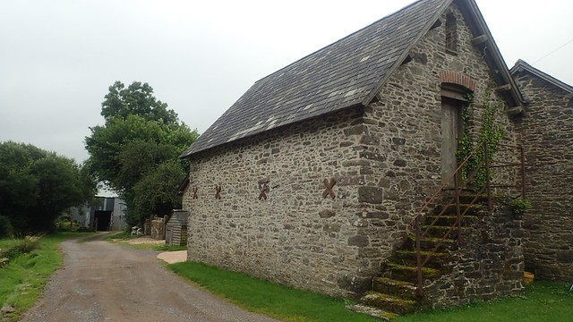
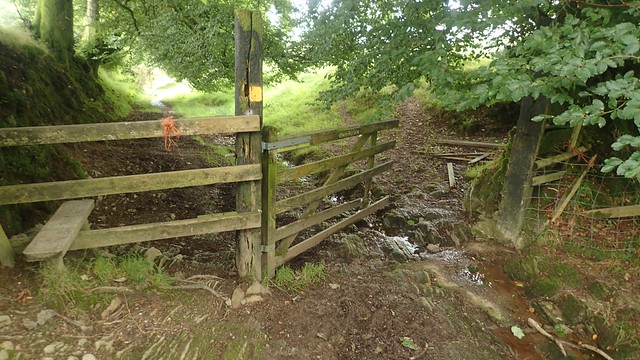
I followed bridleways between the farm buildings of Knaplock. Down Watery Lane and I was destined for the River Barle, just as on the day before.


Again, I was also rejoining the Two Moors Way footpath, which I’d follow to the clapper bridge of Tarr Steps.

It was magnificent. Flowing with such force. Later on in the day, I’d have to cross back over.

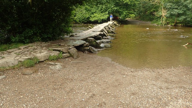
This was only around 9:30 in the morning and I was surprised to find so many people around the clapper bridge and the river. I’ve walked across Tarr Steps several times now. In 2019, this was the starting point for our adventure. Before that, the stones had been washed away in a storm.


Many will only come so far for a day out. While I had many miles left to cover in my day. Still following the Two Moors Way, I made my way steeply up towards Parsonage Farm and then on towards the next road at Westwater Farm.
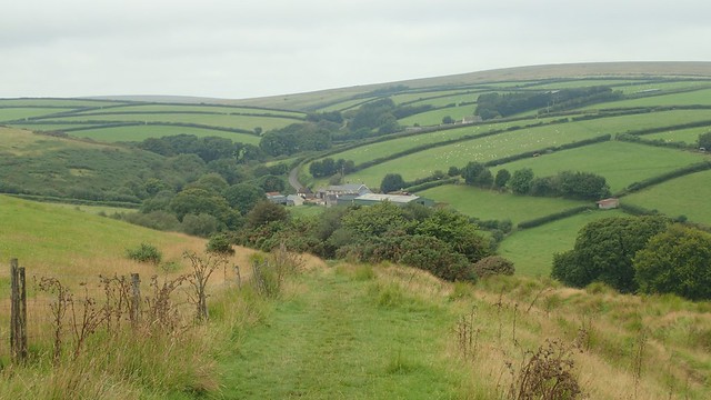

Across the Barle Valley, I could see Winsford Hill.

Up along the next road, I crossed a cattle grid and walked left on to Withypool Common. I’d ignore Withypool Hill to the north. Still walking west and with the intention of crossing the next road. I did go a bit off-course, or so I soon found out. But it was hard to go completely out of the way and get lost. This is only Exmoor, not Dartmoor.


I’d crossed the road near to Green Barrow and would follow vehicles tracks north to the trig point. There’s no public right of way from this point. But it is open access land and all part of the adventure!

I’d hoped to stop for my first break of the day up here. But had settled for a more immediate stop back on the common. This was only my second visit but I do like coming here. I imagine few others make the same effort. Yet I also found it a bit odd that Ordnance Survey decided to insert a great lump of concrete in to one of Brightworthy Barrows!

From the trig point, I had only a few options. “Paths” ran off in different directions from this high point. But there’s no right of way on the map… Last time, we forged our way east and to the top of Withypool Hill. This time, I wanted to head down the northern side of the hill. Then west a bit. In the hope of reaching Landacre Bridge…

I took a bearing with my compass and followed the “path” that most closely ran along this line. It had probably been forged by a horse, initially. Down through the heather, gorse and bracken, I did end up where I wanted to be. It was quite challenging and very much off-piste.

I could hear the crowds and noise before I could see all the people enjoying the water. But the Medieval bridge was there. Undeniable. I’d held thoughts about stopping there for lunch. But with so much going on, I didn’t feel at all comfortable even approaching it for some better photos.
Another time, maybe.

I was on a public footpath, heading east towards Brightworthy. Beneath me was the River Barle once again and these would act as my guide back to Withypool. While the Two Moors Way runs parallel and to the north of this river.

I left one footpath before Waterhouse Farm and took a different route heading uphill. I could’ve followed the river further but thought I’d plotted a ‘shortcut’ to my next bridleway, across access land… Until I saw cattle grazing ahead and, slightly out of character, bottled it and followed the road back down to the village.

A couple of cows were lingering further up this next hill. One too close to an Audi; the other in the way of the gate I was hoping to pass through!

Walking down the narrow bridleway, I gave way to an oncoming Land Rover; the owner of which kindly informed me of the diversion ahead (as it was when we walked here in 2019). I assumed that he’s the owner of the house just beyond the bridleway.

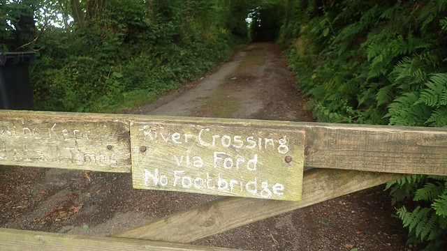
Here I was, back at the infamous stepping stones, without a warning sign that is now to be ignored!

Last time out, I followed a friend across the first three of four stones, only to find myself then wading through the water. Not only are the middle stones wet but their tops are not level. Honestly, I wouldn’t recommend anyone attempts to cross these unless the stones are somehow raised and levelled.

This time, I removed my shoes, ankle gaiters and socks. Rolled up my trousers and ploughed on barefoot; following the bridleway slightly further downstream from these treacherous stones.

As I got to the halfway point, crossing the River Barle, the water level suddenly leapt up above my knees and, carrying my shoes in one hand, camera in the other; I ALMOST lost my balance and fell in!
It was a great experience. Proper adventure! Refreshing. Cooling and, while I allowed myself to dry off, I stopped to have my lunch.


After lunch, I followed the Barle further on towards Tarr Steps. Passing a few people and couples – some who stopped me to ask how long it had taken to walk from Withypool… I didn’t speak of my true adventure and shared the guesstimate of ‘half an hour?’. Some were less keen to walk on. There is of course a dry-foot alternative to facing those stones.

For the final time on this trip, I left the Two Moors Way and began heading uphill towards Great Bradley.
From a narrow path, farmers’ fields and a quiet road, I was back on to the common land of Winsford Hill.

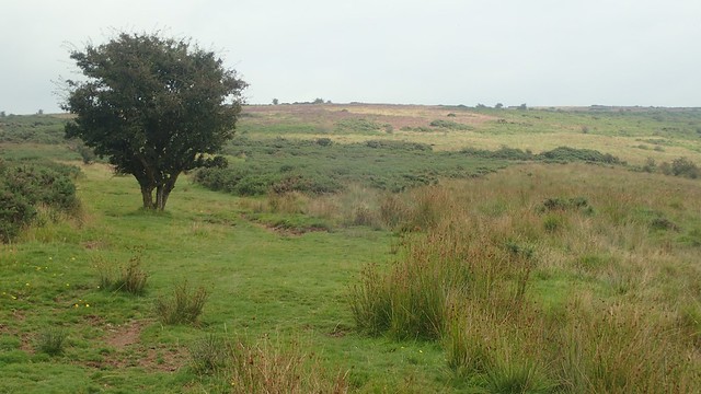
Above, you can see Withypool Hill (left) and Brightworthy Barrows (right).

I crossed back over the B-road close to a disused quarry and followed an uncharted track towards the trig point; walking parallel to that road and the cyclists who passed me.

I kept my distance from the trig point, having seen it here the last time. It was surprisingly busy; walkers and cyclists gathered around in conversation. Good for them but I didn’t see a need to linger.
Instead, I passed by a natural feature called the Punchbowl, which you can see above. These are often formed by some kind of glacier over time. In one of the valleys beyond, you could find the farm where Boris Johnson spent some of his youth…..
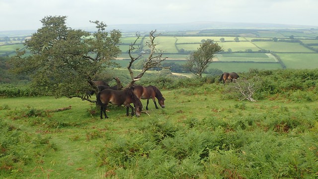
Exmoor ponies graze this land and road signs warn drivers of their presence, asking people to slow down.

A bit further on and I could see the well-maintained campsite of Halse Farm. Much of the grey had lifted by now but it wasn’t quite a sunny day and neither had I required sun cream.
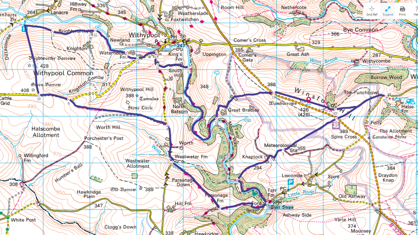
Length of this walk = 15 miles
Thanks for reading.
