
Sunday 13th November 2022
At the time of this walk, Brunel Walking Group was away up in the Peak District. I’d passed on the opportunity to go away with them and didn’t want to waste what free time I had to myself. So, I crossed the border in to South Wales and set off on another walk that was new to me; destined for the summit of Twmbarlwm.

I parked at the Mountain Air car park above Upper Cwmbran. It’s not marked on OS Maps but you can see the semi-circular layby at grid reference ST 277 980.

I’d like to express some thanks to Andrew, a long term reader and follower of this blog, who shared a couple of his own favourite routes to and from Twmbarlwm. I took them in to consideration, looking to create something at least ten miles in length and also browsed a few other routes on line. In short: I’d have this walk in mind for a good number of years. I don’t believe I’d even heard of Twmbarlwm before Andrew first e-mailed me.

As you can see, this was set to be quite a misty day with visibility slightly impaired. Through the morning, I was unable to see any of the towns further beneath me. Although I could just hear one of the A-roads.

I set off in an anxious frenzy to get walking and making progress on this walk. Having studied the map with one eye open and paid little attention to the basics of navigation, I soon found myself following a dead-end path and having to beat my way through bracken to get to a more recognised footpath!


Such misdirection had allowed me to answer the call of nature without being seen. From the main right of way, I continued in to the woodland, having joined the Cambrian Way path.

That’s Cambrian. Not Cwmbran or Cumbrian. At 298 miles along, running from Cardiff to Conwy, it is the longest inland route that crosses Wales, having only been recognised fully and established in recent years.


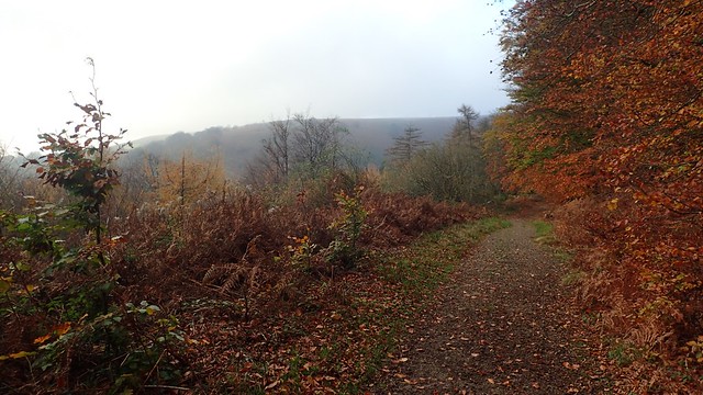
A truly beautiful time of year to be doing this walk. For all that I couldn’t see beneath me, the leaves were alive with colour.

My walk continued around Blaen Bran reservoir but wouldn’t descend to the edge of it.


I did stumble upon some concrete structures that had been put in place to control and direct the water that feeds the reservoir but this was a minor detour from my intended route.


This was very close to the site of a World War Memorial Bench. I don’t know the story of why the bench was positioned here but I can imagine many local people had given and lost their lives to this cause.


Around the bend and I would begin my first steep climb of the day. Many loose stones beneath my feet; it was far from easy. There was no sign post for this, as far as I can recall.

Near the top, I arrived at the site of a former quarry, feeling a little bit uncertain of where the path continues from here. To my right and overlooking the cliffs below, I found the remnants of a fire.


I followed a narrow and uncertain path in what appeared to be the right direction. Somewhere beyond here, I found my way back on track.
In writing this, I’ve realised that I’ve put my name down to take a group out on this walk soon and I cannot quite remember whether this was worth persevering with or, whether I should follow an alternative route!
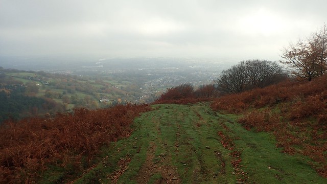
I would climb higher along a broad path and with greater views of modern civilisation below.


I passed what might’ve been a couple of boundary stones, as I climbed on to higher ground.

From the presence of these pylons, I could gauge my position on the map and, knowing that I’d need to pass beneath them, assure myself of the way forward.
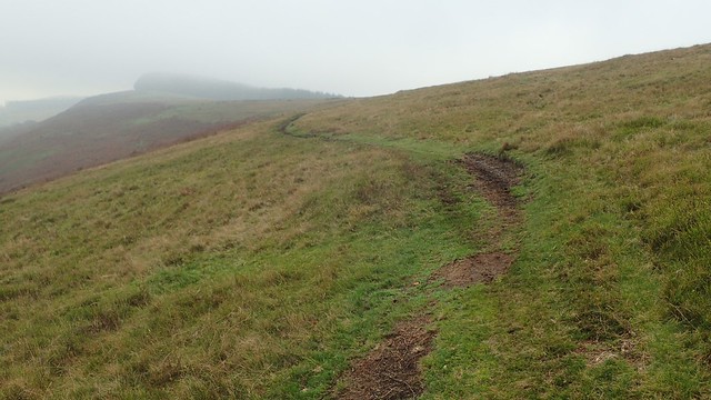

Even with low visibility, I could see the woods of Pwll Tra and know that I was walking the correct way, to follow their souther-eastern edge. I’d see and hear a small number of mountain bikers around here; some of whom would overtake me. There was even a group of teenagers on motorised bikes – one of whom spectacularly face-planted in to the mud!
(Being young, of course, he only bounced, nothing broken and got back on his bike with nothing worse than embarrassment.)

Twmbarlwm was almost clearing in to view ahead of me.

I admire the large stones either side of the wooden fencing and metal kissing gate. I imagined these would’ve been installed with the original gateway.


I didn’t actually follow other people on the ascent to the top of the mound. It was pretty busy on the summit and I’m saving that experience for my group outing in several weeks’ time!


There is a trig point on this Iron Age hillfort, with a recorded height of 419m above sea level. I don’t think I photographed it very clearly but, looking south-west across the vale of Risca, you could see Mynydd Machen, which is a hill I’d previously climbed and written about, on a walk from the village of Machen.

There was a cold wind up on the hilltops. I was hungry, wanting a cup of tea and tucked myself in to ramparts of this fort, ahead of what would then be a descent towards Cwm Carn.
I’ll continue this walk in my next post.
Thanks for reading.

Hi Olly.
Another interesting walk, going to places no doubt unknown to many others.
Have a great day. 👍
LikeLike