Saturday 11th – Sunday 12th November 2017
I’ve just spent the past few days in Pembrokeshire, towards the south-west of Wales. Last weekend, I crossed the Severn Bridge to attend a walk leader and navigation course in the Brecon Beacons.
This is something that Brunel Walking Group organise at this time every year (I was supposed to go in 2013 or 2014 but cancelled) and the course is led by Andy Cummings of Manzoku; an experienced mountain leader, hill walker and climber.
This course is designed for us to achieve the Bronze National Navigation Award..
Day One: In the Classroom
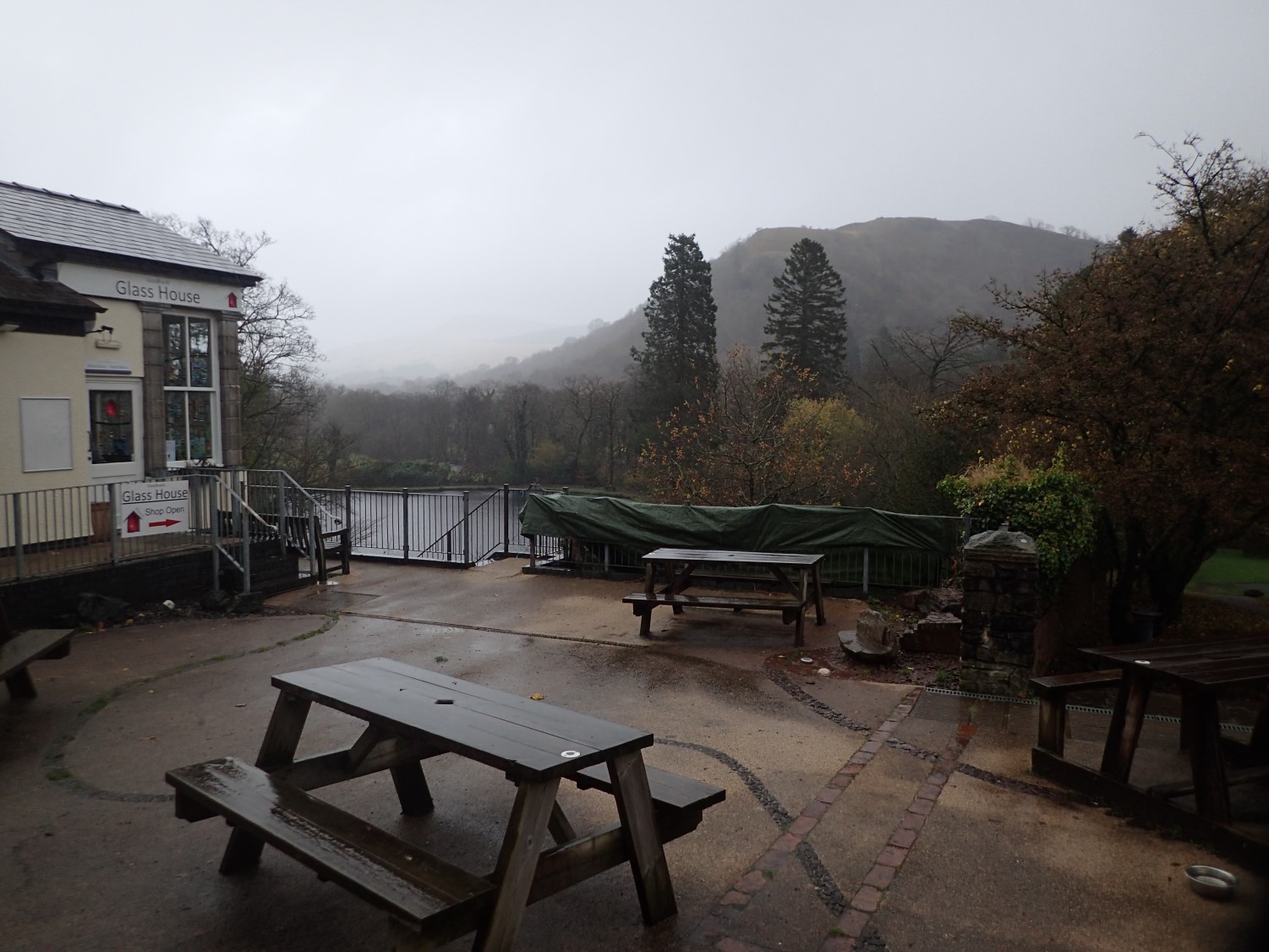
Four of us (Jo, Sarah, Katharine and myself) shared the journey across the Severn from Bristol and arrived at the Llangorse Multi-Activity Centre with time to spare.
There were two others (Jackie and Claire – I may have misspelt their names) who had also been booked on to the course and raised the total of our group to six (plus the leader).
After initial introductions about who we were, what we’d done and what we were personally hoping to gain from the weekend, we formulated a flexible syllabus of topics and skills to cover. From there, Andy opened his 38lt rucksack and shared what he typically carries at this time of year…

There was a lot to consider.
Jackets – I remember seeing three of them; one he was wearing, one to provide to someone in an emergency situation and a third, oversized, that could be pulled on over everything else in the event of a snack stop. I am a fan and practitioner of layering but, when I take one layer on to provide another underneath, I’m releasing much of the body heat I’ve been holding on to.
I’m not likely to go out and spend £100 on an XL jacket (my normal size if Medium) but I may look for something at the lower end of the market in Mountain Warehouse.
Gloves – in Andy’s opinion, you have to spend close to £200 for a decent pair of waterproof gloves. My £35 Sealskinz don’t let water through but I don’t find them to be as warm as basic thin gloves and, as Andy pointed out, they’re a pain to get on (thanks to the sewn-in lining) when your hands are even slightly damp.
From now on, I’ll be carrying several pairs of gloves (waterproof or not) and switching as one pair begins to soak through.
Emergency Supplies – I already carry a small First Aid kit with me and, I’m pleased to say, I’ve never had to use it on myself or anyone else… But, neither am I trained in First Aid and I believe this is the same for the majority of walk leaders within our group in Bristol (this is an issue I may raise). Andy also carries emergency contact details, torches, electrolyte energy gels – you get the idea but all sealed within a waterproof wallet in the hood of his pack.
We also talked more about waterproofing in general, different types of footwear, when to use them and what to buy… I won’t go in to it all, here.
Weather Watching
We were introduced to the Met Office’s weather forecast system and gradually studied the cause and effects of cold fronts, warm fronts, wind direction and how to interpret a detailed forecast for a day on high ground.
In short: a BBC Weather forecast may be good for a day in the town but, 600m up and you could feel like you’re in a different part of the world.
Contours and Compass Work
We studied contours and worked to determine where rivers and streams would flow, the most practical means of reaching a summit and pin pointing and valleys and ridge lines.
While compass skills and point-to-point navigation are worth learning, Andy was also keen to emphasise his belief in the “heads up, eyes open” approach, where some people get too bogged down in the wealth of information available on an Ordnance Survey map; eyes glued to the page and not appreciating or understanding their surroundings.
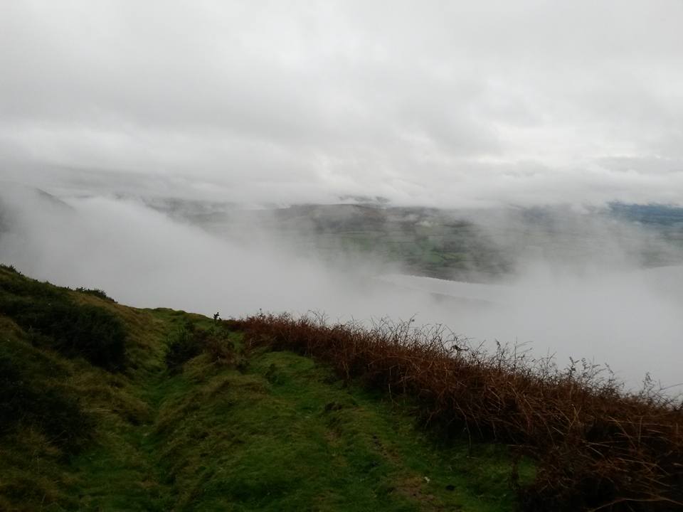
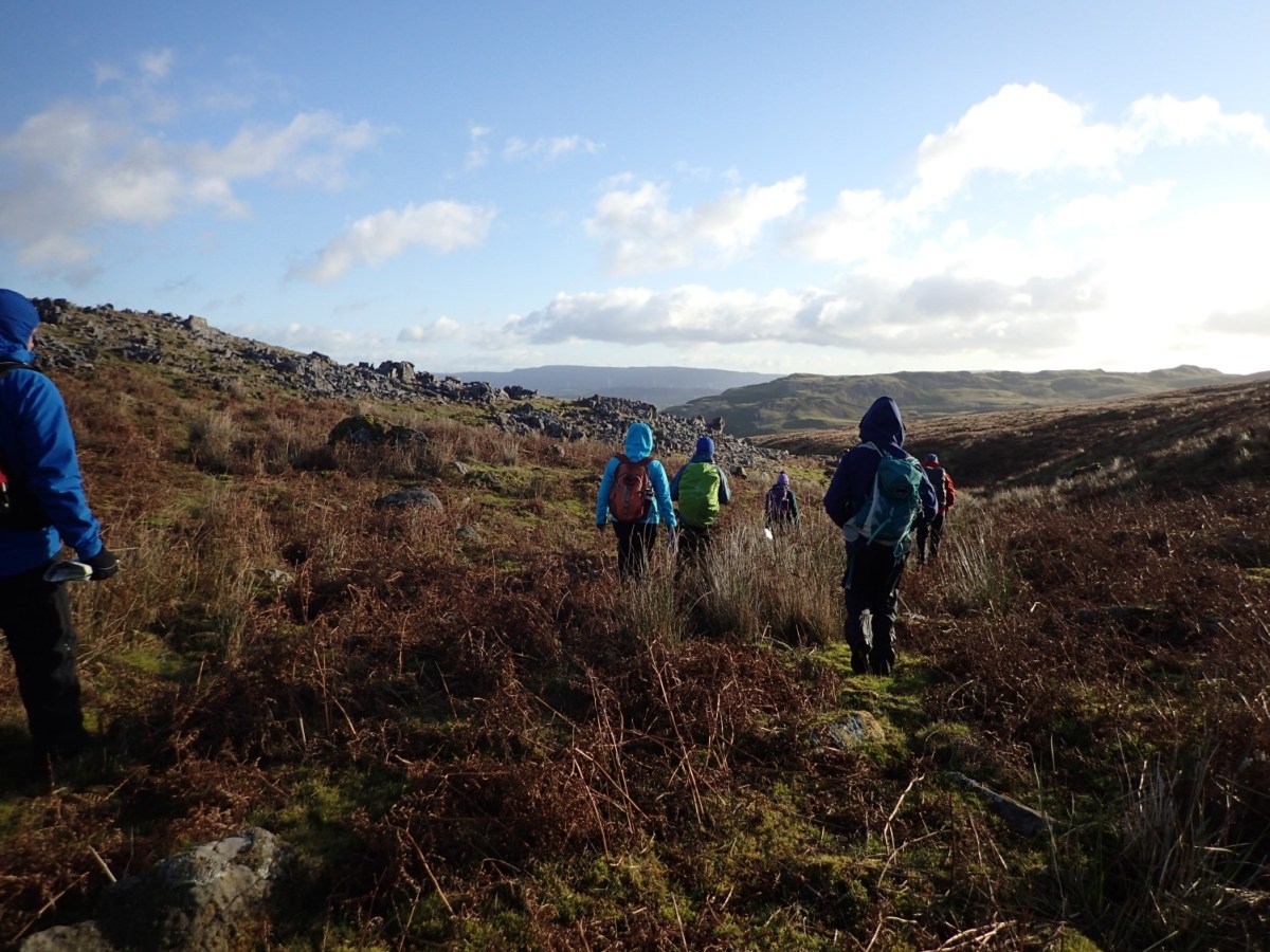
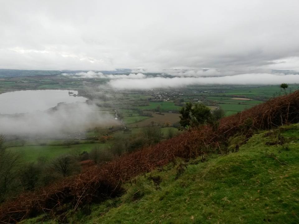
Before the sun would set, we put our boots on, grabbed a map and compass each and began climbing Mynydd Llangorse, which is just over the road from the centre. This was where we began to take some of those classroom skills and apply them to real world situations… As the low cloud cast over and beneath us, it only added to the learning and experience.
Overnight Accommodation
There are several options available to anyone looking to spend a weekend at the centre in Llangorse. Some of the local hostels and bunkhouses were already booked but, with many thanks to Sarah for organising, we were able to stay in one of two six-bed dorms to the rear of The New Inn, which was only a ten-minute drive away.
See, Beacons Backpackers for more.
This was in the town or village of Bwlch. Translated in to English, it means ‘pass’. But, for some reason, the Welsh don’t always like to use vowels [‘vwls’, to them] and, in order to avoid the mistake of saying ‘Bilch’, you have to start with “Ball” but end with a sound somewhere between a ‘H’ and a ‘K’.
We had a table booked inside the pub for our meal, which was slightly interrupted by Wales beating Australia at their national sport (if they weren’t winning, I’d hate to be in there when they were). But the food was great, we had access to the kitchen area the next morning for breakfast and our own private bathroom.
Day 2: Swansea Valley
Leaving The New Inn, we drove for around forty-five minutes and down in to the Swansea Valley, where we would meet Andy and the other group attendees at the pay-and-display car park for Craig-Y-Nos Country Park. We were also joined by Neil, who was training for his own mountain leader award and also learning course leadership skills from shadowing Andy.
Straight away, we put our waterproofs on, each packing a spare layer and warm drink for later, as per our prior instruction. We’d studied the forecast for this day on the Saturday and, although the morning would be anything but pleasant, we could place faith in meeting with a brighter afternoon.
Over the road and we began climbing Cribarth. Our intention was not to reach the summit or its trig point, but to demonstrate our individual and shared abilities to navigate.
Initially, we were following Andy’s lead. At our first stopping point, we were asked to withdraw our maps and determine our current location, by mentally retracing our steps and relating our visual surroundings to the lines on paper. From there on, it was time for each member to lead, in turn – and, of course, I was selected as the first to lead us to a designated feature, which Andy referred to as a “thumb print” (SN 833 149, if you’re interested).

It was raining. A cold wind blew from the north – this is referred to as a northerly wind, where I’d spent the past thirty-two years of my life believing that meant the same as ‘northwards’. We found our first shake hole, settled down inside for a partially-sheltered tea break and, before the sun would break out, we would continue to use point-to-point compass bearings and pacing, moving from one shake hole to the next; away from all footpaths and the beaten track.
We succeeded in a team effort to discover a finger like ridge at SN 832 166 – a feature that even navigators of a higher standard have struggled and failed to identify. Before long, we were heading back down from the hill, with thoughts of soon holding on to a warm cup of tea and shedding any wet layers.
What Have I learned?
Along with the essential practise of compass work and an improved understanding of contour recognition, that I can do more for my group as a walk leader and, on a personal level, that I can survive a dorm and bunkbed sleeping situation, if only for one night so far.
I’ve also qualified for the Bronze National Navigation Award and currently await the arrival of my certificate.

I’d love to do this. I’m a whizz with a GPS but otherwise would love to learn more. I’m a hands on learner so it doesn’t matter how many times I go over the theory it’s never going to really sink in unless I do something like this.
LikeLiked by 1 person
Sounds like you’d really enjoy one of these courses, Clare. I hope you get to give it a go. 🙂
LikeLike
It looks like it was a very interesting course with a lot of useful information. I should do something like this.
LikeLike
We climbed Mynydd Llangorse on Easter Sunday 2018. We parked the car at the Llangorse Multi-activity centre and pretty much headed up the steep western slope of the mountain. We picked our own track to the top which was fairly strenuous. As it was so steep the views back towards Llangorse Lake just got better with every step we took. When we reached the top of the ridge we were then rewarded with super views out to the east also, taking in the Usk Valley and the Black Mountains. The return trip only took us 2 hours but what a satisfying 2 hours it was!
LikeLiked by 1 person
Hi Gavin, sounds like you had a great day of it!
I regret to say that I’ve still not been back, although it remains on my to-do list for this year. I’m pleased to hear that you were able to park at the centre without any trouble (I guess people pop in their to use the cafe) as I’m not aware of any other parking spaces apart from down beside the lake.
All the best and hope you have a great weekend (in spite of the likely weather).
LikeLike