
Sunday 3rd September 2017
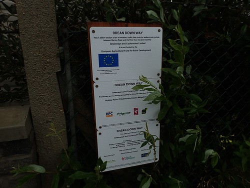
Earlier this year, a combined footpath and cycle route, known as the Brean Down Way, was opened in North Somerset and now provides a link between the seaside towns of Brean and Weston-super-Mare.
At the time of writing, this is the most appropriate route for coastal walkers passing through Somerset. On this day, I drove down to Brean to explore it for myself.
I arrived at the car park for Brean Down which, as a National Trust member, I am able to use without paying extra. From there, I would cut through the cars and on to the beach.
This uninterrupted stretch of sand – running past Berrow and on to Burnham-on-Sea, where it meets the estuary of the rivers Brue and Parrett – is the second longest in the whole of Europe.
This was hardly a fine day for a stretch of coastal walking and would set a precedent for much of the rest of September.
But this 1.5 mile long route along the beach remains firm higher up, with the tide out, so that people can cycle along.

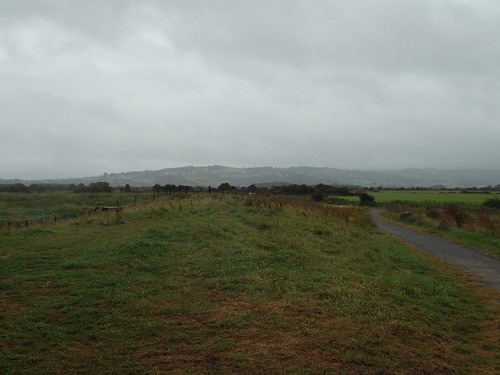
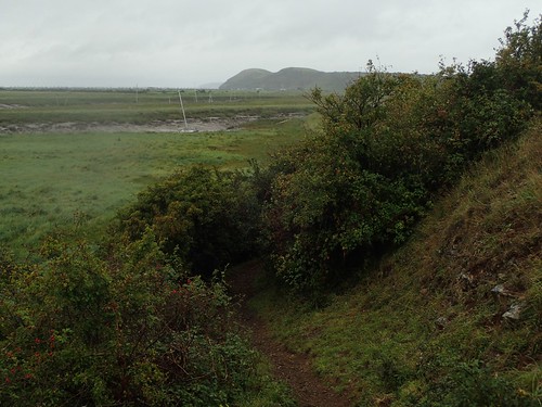
Although the rain continued, I was able to turn left and escape the wind between dunes, destined for a road with a convenient toilet stop on the right.
Passing Warren Farm on the left, I continued to follow the Brean Down Way.
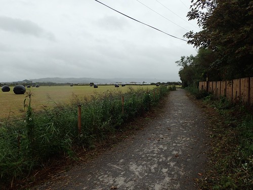
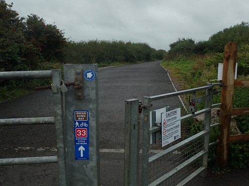
From Diamond Farm (another caravan park), I could join the newly-opened cycle path… So now, in fact, that it still does not feature on the Ordnance Survey maps.
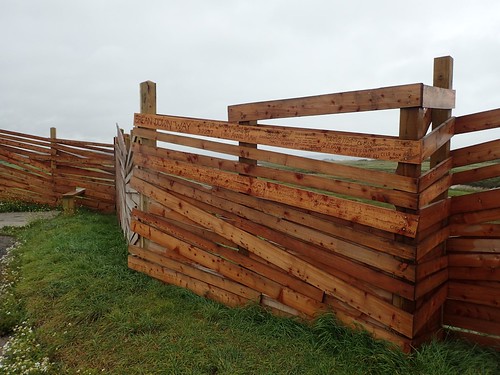
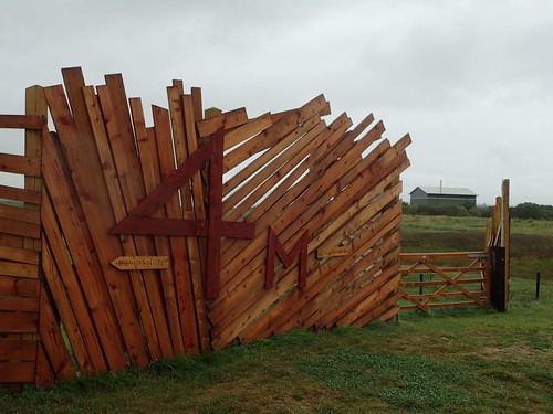
Before reaching the River Axe, I’d come to what’s known as the Great Bird Screen of Brean. I can remember reading about this in the local paper, months ago. A team of volunteers did all the work and were able to sing their names on the wood.
…Along with a few local politicians, who aren’t the most popular of folk at the moment, with the whole of North Somerset under threat from excessive housebuilding around an already suffocated infrastructure and road network.
.
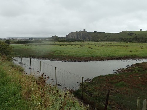
A sluice gate now provides direct access over the River Axe. Before now, this was strictly private property. It’s possible we’ll see a similar solution in place to complete a coastal walk between Weston-super-Mare and Clevedon, where there currently is no right of way beside the sea.
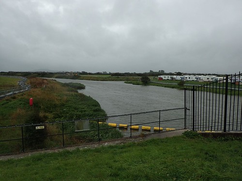
From here, the River Axe looks mighty.
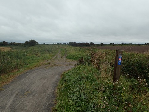
Still following the gravel track, I passed around a water treatment works before linking up with a series of existing paths on the western edge of Bleadon Levels Nature Reserve.
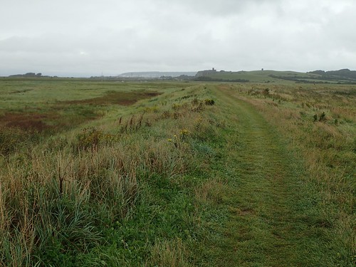
Here, I chose to leave the cycle path behind and climb up on to the bank of the River Axe, which would lead me in to Uphill.
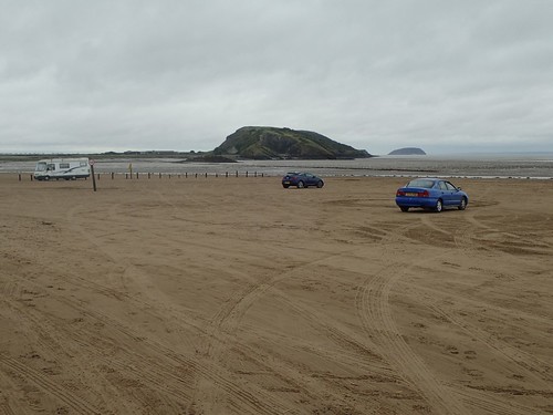
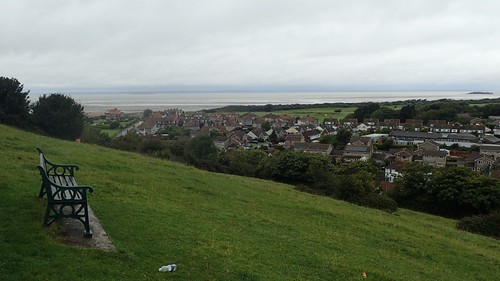
Brean Down could be seen, away to the north-west. It’s a shame that the Brean Down Way doesn’t run directly to Brean Down but, with no England Coast Path markers in place, I remain quietly confident that we will see a proper coastal route installed within two-years.
This path lead me to Walborough, another nature reserve marked by a reasonably sized hill.
Keeping to the lower contours along the western edge of this hill, I was soon able to rejoin my riverside walk.
Away to my right was the iconic church of Uphill village. I know this sight too well, having followed the West Mendip Way through here on several occasions.
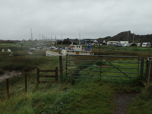
Ahead of me was the marina and a gathering of moored boats. Suddenly, the River Axe had all but dried up, only a few hundred metres from meeting the sea.
Waymarking was a absent, here, but the stiles indicated the way forward. Upon reaching the road, I crossed the River Axe and began walking southwards along the opposite bank.

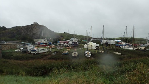
Another footpath in this local area that I’d not previously explored. While the grass was long, the raised path was quite clear and easy to follow, if some distance from the muddy mouth of the river.
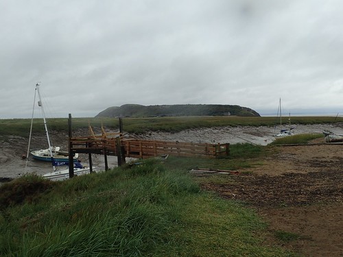
Beyond Slimeridge Farm, I found yachts stuck in the mud, with a wooden platform that presumably allows sailors to board them, when the tide is high.
Warning signs are in place to discourage people from attempting to wade through. From the Brean side of the river, I’ve seen hand-scrawled warning signs from the local farmer…

I like to think that the England Coast Path will utilise this, somehow. A footbridge is surely out of the question, as it would not allow the yachts to pass through. A manned toll boat could work… But that’s also dependant on the water level (or water-to-mud ratio).
You may also be interested in these accounts from Ruth Livingstone and Jon Combe.

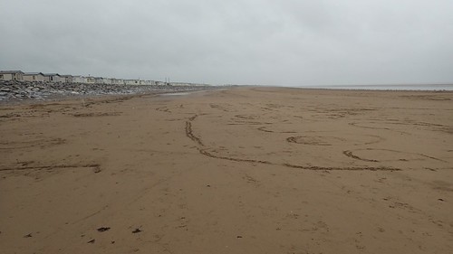
Just around the corner was Weston-super-Mare, as I continued on to Uphill Beach.
This southern end of Weston Beach is rarely as busy as the tourist trap a few hundred metres to the north.
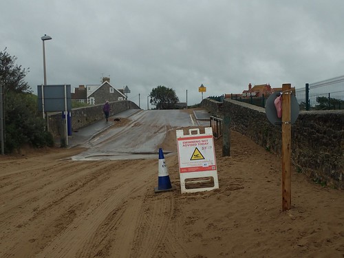
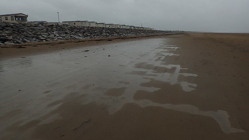
On this day – possibly in the wake of cross-Atlantic storms – signs were in place to deter swimmers from the water… As if the colour and texture aren’t enough on their own!
Before retracing my steps to the cycle path, I decided to head up Uphill Hill (yes, that’s what it’s called) for the first time. Again, I’ve walked and driven beneath this so many times while completing the West Mendip Way.
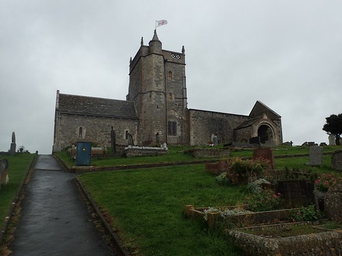
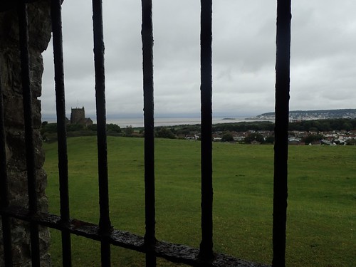
St. Nicholas’ Church resides at the top… If you look carefully, you’ll notice the roof missing from the annexe to the right of the tower.
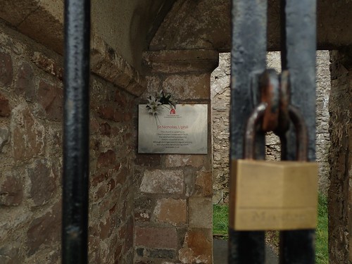
There was some irony in this sign, I thought; stating that the church remains “open for all”… Perhaps it refers only to the elements?
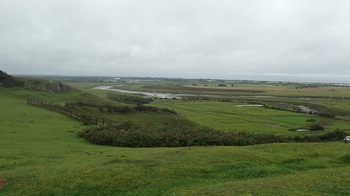
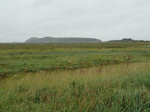
Away from the village view and town beyond, you get a really good wide-angle view of Bleadon Levels, where the River Axe runs close to full strength.
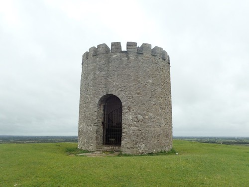
South-east of the church now lies a tower that marks the site of a former windmill. On the maps, you’ll see a windmill icon, which may lead to some disappointment if you don’t already know what to expect.
But the gate was open! I could go inside and climb a spiral staircase to the top.
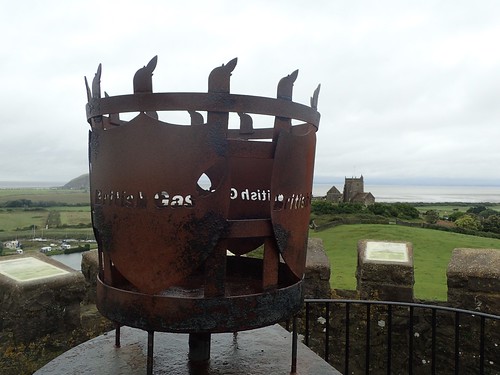
I think this tower has previously been used as a signal beacon. Trust British Gas to get their name on it, though.
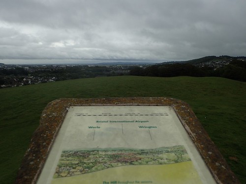
Plaques all around highlight the features, towns and local villages. I’m always pleased to see a referral to the village I currently live in.

It was getting close to lunch time by now and I was looking to head back to Brean.
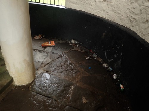
Before leaving the tower, I couldn’t help but to feel disgust at the sight of the mess surrounding the foot of the staircase.
If people can carry so much up one hill, why can’t they carry their waste away with them?!
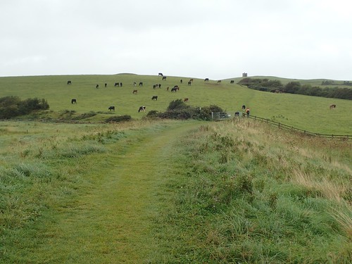
On my return journey, I briefly joined the West Mendip Way before latching on to the cycle path.
In 2015, Anna and I completed the only practicable (and legal) coastal route through this area, where we walked on a head, in the photo above. Now though, the Brean Down Way turns right and offers a bramble-free option.

Before returning to the sand, I’d take a slight diversion inland to visit a small church that I had only noticed on the drive that morning.
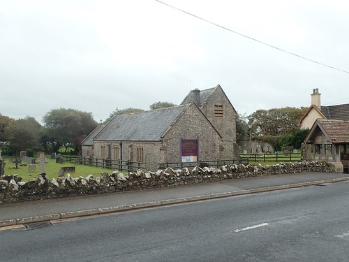
This is St. Bridget’s Church in Brean.
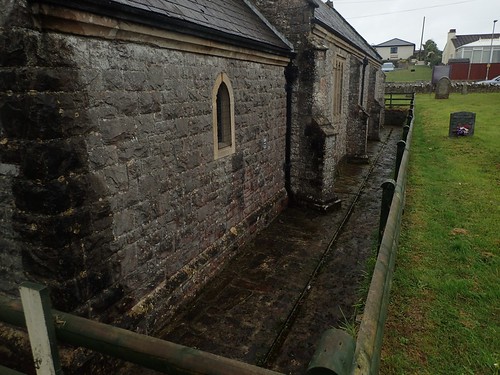
It was strange to find the ground level sunk almost two feet beneath the surrounding land and coast road.To my mind, this makes it more vulnerable to flooding.
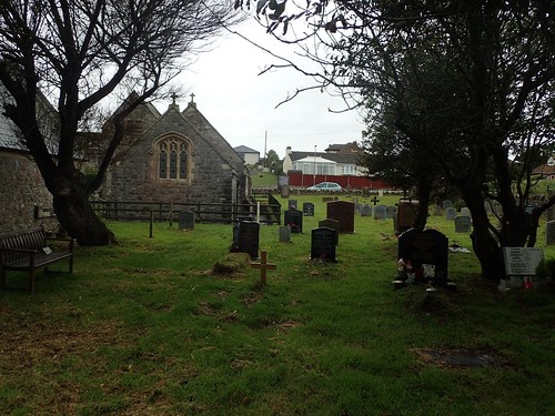
Despite being metres away from an active road, I found this to be quite a peaceful and unpolluted place.
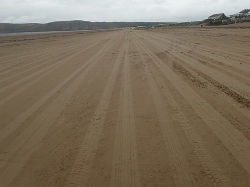
Another 1.5 miles north along the sand and I’d be back at my car. For people wishing to park on the beach, there are two possible entry points; both of which have manned toll booths… I could swear that some people pay to park there just for the thrill of driving along the sand in their oversized vehicles…
They’re possibly the same folk who frequently have to call upon the emergency services when caught up by the incoming tide!

An interesting read, and thanks for the link too. I am interested to see the route of this new path, but I can’t seem to find it online. Do you know if there is a map somewhere that shows it? I tried the official website but I couldn’t see a map, only a link to the Sustrans National Cycleway website which it says this is route 33 – but that website shows this route entirely on roads (including the A370) which does not seem to match the route you went.
LikeLike
Hi Jon,
On this page you’ll find the map that I used as a guide to get started. It’s not quite as detailes as OS would be:
http://www.thewestonmercury.co.uk/news/everything-you-need-to-know-about-the-weston-super-mare-to-brean-down-cycle-path-1-4995400
It basically crosses the sluice gate that you encountered; cutting past the caravans on one side and on to the nature reserve on the other.
I hope it helps.
Olly
LikeLike
Glad you tried out the new route, Olly. Sounds like a change for the better.
LikeLiked by 1 person
It certainly is. I still look forward to seeing the proper coast path completed, if even we have to pay to cross the river via a ferry.
LikeLike