
Tuesday 17th July 2018
Forty-eight hours earlier, we’d conquered Tryfan and the Glyderau. A day of scrambling and hiking across less-familiar terrain. It’s almost as if that was in preparation for our final adventure in North Wales.
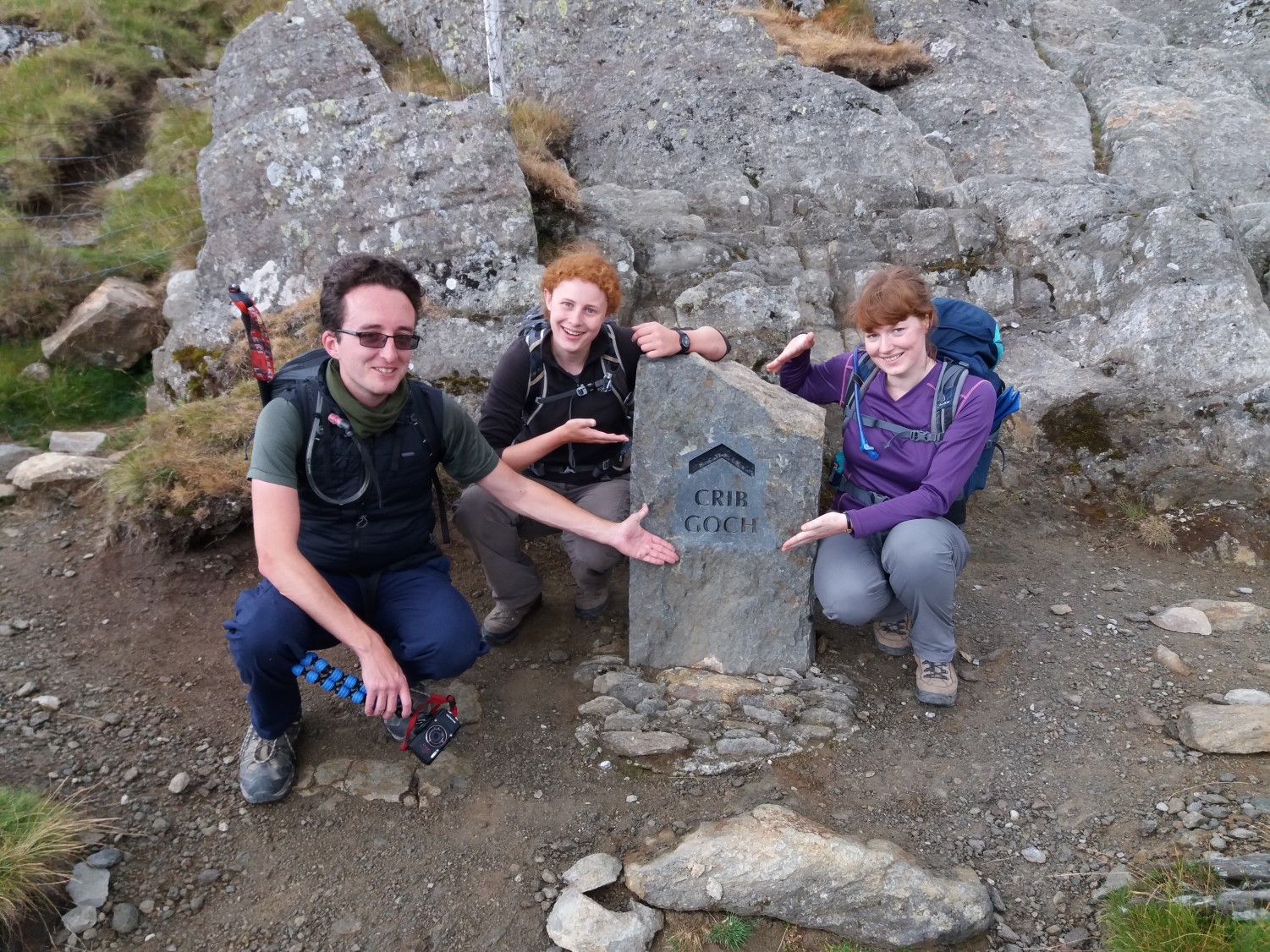
This was our last full day, ahead of our final night and then, heading home on the Wednesday. We drove in to Snowdonia for the second time in three days. We were destined to climb Snowdon. Not only that, we would journey there along the perilous knife-edge ridge of Crib Goch!
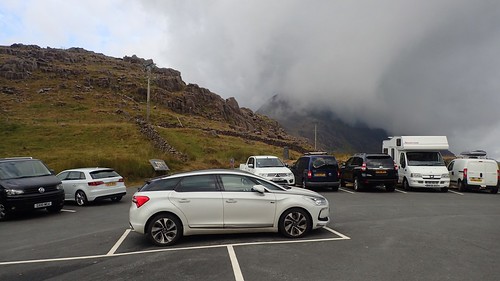
We reached the Pen-Y-Pass car park close to 8am, having deliberately awoken and left early, so that we could be confident of finding a parking space.
I passed here once before on a weekend in October… Cars had been left all down the road! This was now a Tuesday morning, before all of the schools had broken up. There weren’t many spaces left but we managed to find one.
In case you’re not already aware, the fees for parking here have double since 2017. It now costs £10 to park for an entire day or £5 for four hours. I think you can even pay by card – which is ideal, because nobody today would carry £10 in loose change.
Pen-Y-Pass is a popular area because a number of summit-bound trails begin and at end this point. Without a doubt, the appeal of Snowdon is attracting more people (from home and abroad) every year. While I’m sure there’s revenue to be gained from the charge increase, I wonder at what point they might look at enlarging the existing capacity or creating a new parking area altogether?
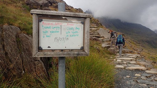
Our route following the Snowdon Horseshoe would begin along the Pyg Track. I hadn’t expected to find this information board stating the forecast weather… Having just spent £10 to park though, we might’ve hoped they’d have either got the date right or updated the board after two-days.
I wonder if they do this on Ben Nevis? I hope to find out next summer!
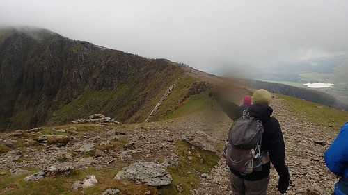
If you’re looking for a decent route up to the summit of Snowdon, the Pyg Track is probably a good bet. Far less busy that the Llanberis route, easy to follow and yet, not quite as ‘wheelchair friendly’ as the Miners’ Track. There’s also the Watkin Path, which begins at different car park to the south.

Having started close to 350m above sea level, you climb steadily to an elevation of around 570m, before leaving the Pyg Track to head for Crib Goch. This is basically at point at which you’re closing in on the minimum height (609m) of a recognise mountain in the UK.
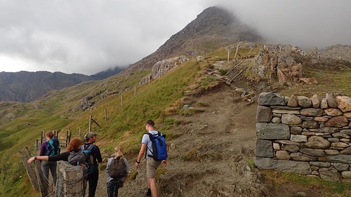
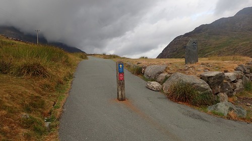
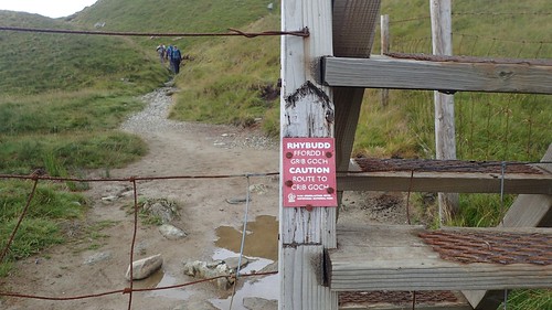
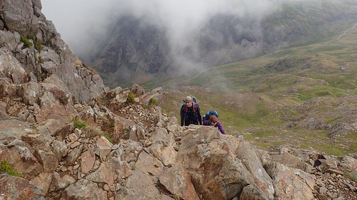
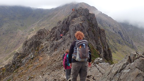
This was our junction. The Pyg Track continues over the stile and along the lower path, while the route to Crib Goch (which isn’t signed at this point) climbs up and away, beside the (currently) fallen fence.

It seems clear to me, that the authorities are keen to direct ‘unprepared’ people away from the danger of Crib Goch… Which is no bad thing. In a ‘facepalm’ moment, someone asked if the (clearly vertical) path we were following was the easy route to the summit… We directed him along the Pyg Track, in his trainers and possibly jeans as well.
It’s only once you climb a bit higher that the first waymarker for Crib Goch can be found.

This wasn’t a particularly windy day. But neither was it forecast to be warm and sunny. I liked the atmosphere of our surroundings and was able to put aside those fears of the ‘tourist trap’ that we would likely discover at the very top.
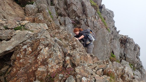
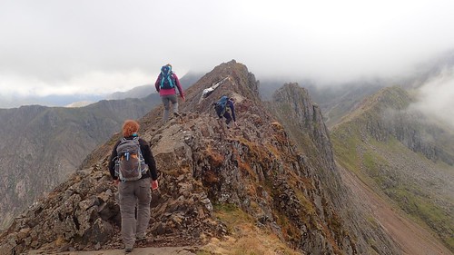
Crib Goch is a knife-edge ridge with full exposure that has claimed the lives of a small number of people in the last twelve-months.

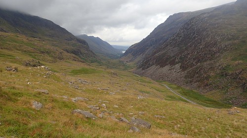
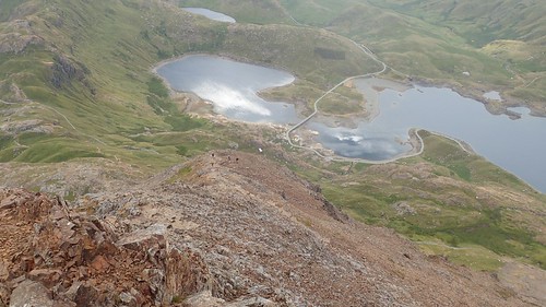
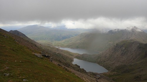
Llyn Llydaw sat far beneath us.
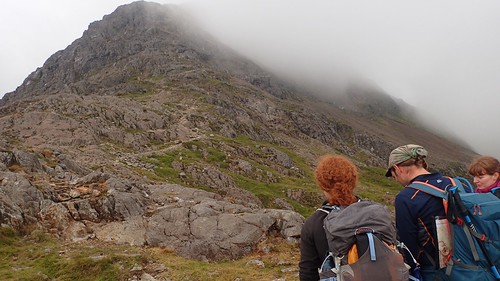
This is something I wasn’t full aware of before watching YouTube videos on Crib Goch but, you have to climb up to it before you can scramble along it… Which makes sense, really, considering that the ridge is close to 900m above sea level in places and Snowdon’s summit is then less than 200m higher still.

There was a young lady ahead of us, on her own, who had apparently come down from this ascent, having encountered second thoughts about halfway up. There’s something to be said for scrambling: don’t climb up something you cannot climb back down, should you need to.
Slowly but surely, we made our way up; gaining around 300m in elevation across 500m or so in longitude. So far, this wasn’t proving too be too terrifying and you could say that our day on Tryfan and the Glyderau had prepared us well.
If you’re ever in any doubt of the way and the visibility is decent, look out for stone cairns.

Cloud and mist would pass almost as quickly as it would arrive, leaving a temperature just about right for scrambling at a decent pace without rushing.
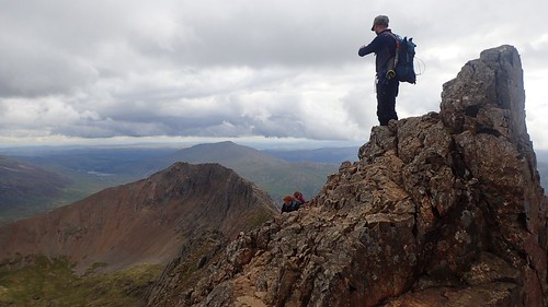
As we reached the end of our climb, I took one look down and realised we were beyond the point of turning back! For further reference, there are said to be ‘escape routes’ off of Crib Goch. But I wouldn’t like to say which or where, as it wasn’t plainly obvious to my less-experiences eyes.
This was it. For the next kilometre, we’d be on all fours.
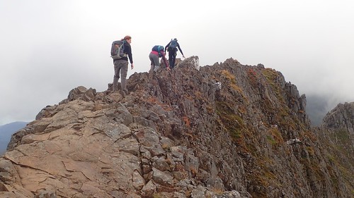
Although I haven’t photographed it, there is often an actual footpath running beside the ridge, meaning that you can walk along the physically handrail the rock with assured footing. I think we all did this for as much of the way as possible.
There are no prizes for anyone who successfully balance their way along the top on two legs. Equally, you stand to lose a lot if you should fallen from either side. A group of climbers (they were wearing climbing shoes, devoid of ankle support) soon caught up with us, having travelled quickly along Crib Goch in just this fashion!
At a convenient moment, we stood aside and allowed them to rush on by. If you want a real fright, there are a few videos on YouTube depicting “eccentric” types RUNNING along this route!!
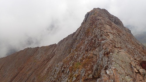
Like many ridges, Crib Goch will undulated. There are sections where you will have to climb up, down or possible sneak around certain pinnacles. It is not a level route in one direction and not to be attempted in wet conditions or with high wind.
Initially, following the ridge, I wasn’t scared. Somewhere along the way, that fear kicked in for a couple of minutes. Beyond that, I could appreciate what I was doing and the challenge we were overcoming.
Many say that Crib Goch is the most dangerous ridge-walk in the UK. Up in the Lake District, Striding Edge is (apparently) equally exposed but, the path is said to broad, by comparison.
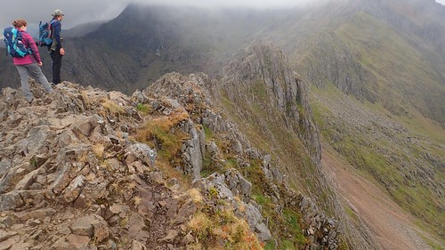
Beyond our horizontal scramble, we could see the cloud-covered summit of Snowdon.

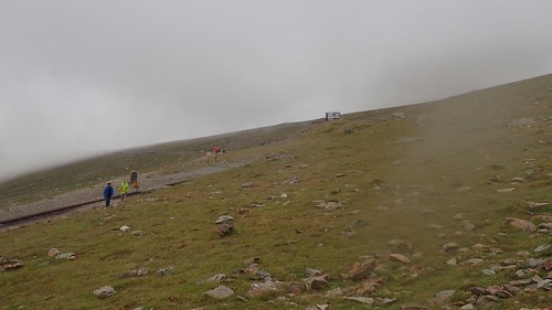
On from the horizontal section, the path widens with fewer short sections of ascent and descent.
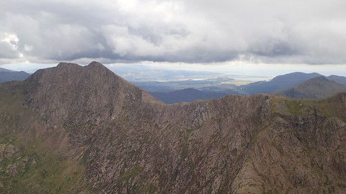
Looking south across the valley to Y Lliwedd and the ridge we’d be following towards the car park from beyond the summit.
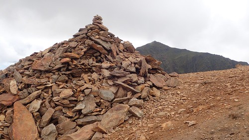
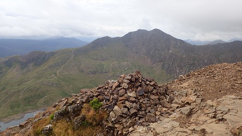
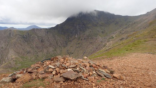
There was a section of the walk that I was encouraged to lead, since everyone else had taken their turn and I’d been happy to linger near the back taken photos and video footage along the way. This led us up to a mighty stone cairn, from which we could again admire fear the highest point in Wales.
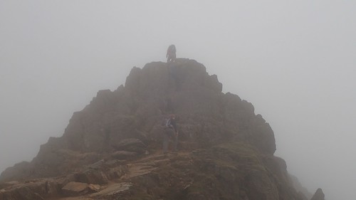
Climbing just a little bit higher, we were no longer able to evade the cloud.
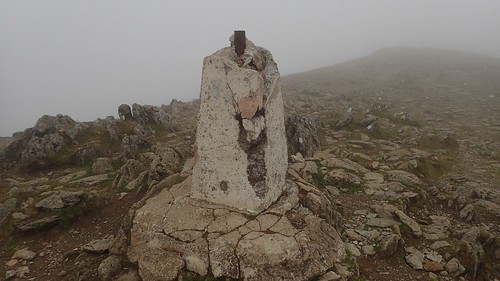
We reached the summit of Garnedd Ugain. 1065m above sea level – and, more importantly, just 20m beneath Snowdon. I wonder how long this trig pillar will survive for. This one is part of the Snowdon Massif.
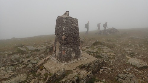
While we were beginning to feel the chill, we took this calm and people-free opportunity to stop for lunch beside the cairn. A couple of walkers passed us by in all this time. There was a dampness to the cloud that hung all around us. But we were pleased to have travelled to this point and been rewarded with the excellent views.
This cloud only dissipated to reveal Bwlch Glas; the point at which several routes coverage in to one final push for the summit. This includes the Snowdon Ranger Path from the west, the Llanberis Path (aka. “The Motorway”) from the north and the Pyg/Miners’ Track from the east, in addition to our most-adventurous way.
Views. In moments of madness, always appreciate your surroundings.
Then there’s the Snowdon Mountain Railway line and, wouldn’t you know it, the latest train was just about to join us for the final bit. I commented on how slowly it moves, while Jenny sensibly retorted that it wouldn’t be sensible if it was to travel at a speed on a par with the national lines on lower ground.
Just imagine…
A rollercoaster finish on your three-minute journey to the top of Snowdon…

I’d always wanted to believe that this train was first installed to help the miners working on this mountain. But the truth seems to be different. Just like the café that exists further up, it was constructed with tourism in mind.
I recently noticed that there are ski-slopes and chair-lifts on the north-eastern edge of Ben Nevis. At least they’re away from the summit and, to be fair, that mountain is said to be covered in snow through much of the year. It kind of makes sense!

On the one hand, this train provides a means for ‘less-able’ people to climb the second-highest mountain in the United Kingdom. But the smell of diesel and the image of people waving at your during that final push… It’s more befitting a seaside resort, in my opinion.

Then, there’s the café and visitor centre. That bunker-like structure that definitely looks out of place…
I’ll save my experiences of the summit for my next post, which will also feature the conclusion to the Snowdon Horseshoe route.

3 thoughts on “Snowdon via. Crib Goch”