Sunday 19th May 2019
Less than a year after my first walk in the Western Brecon Beacons, I returned to the same area with a near-identical group of people. New peaks to be bagged, cairns to be spotted and a chance to visit ‘The Other Lake’, after wading knee-deep in to one of the pair, last summer.
Following a drive of around one-hundred minutes from Bristol, we parked up along the slip-road close to the Gwyn Arms but without occupying or obstructing any spaces reserved for patrons of the pub.
 We weren’t the only walkers to do this. Last year, we parked closer to another pub, Tafarn-y-Garreg, where I believe you can also pay to use their car park, if you’re going for a walk and not a pub-goer. While this area will be much quieter than the Central Beacons of Pen y Fan et al, I’ve noticed that parking spaces can be occupied quickly on a bright weekend.

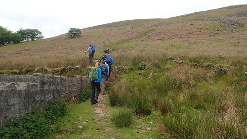
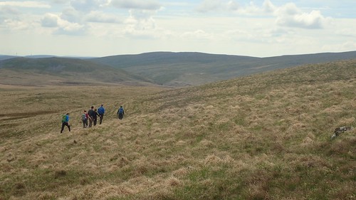
Crossing the A4067, we would look to join the Beacons Way long-distance trail. Initially following the river, we then began climbing up from Ty Henry.
I don’t personally know anyone who’s walked the Beacons Way, except for the odd person on social media. In this area is an example of where you have the option between a high route (crossing the mountains tops) or a low route, which may be preferable in unkind weather conditions. Similar aspects can be found along Wainwright’s infamous Coast to Coast trek and probably others as well.

Looking east across the valley, we could see Fan Gyhirych and those of us who were on last year’s walk could remember the near-vertical drop we took in descending its western fringe from the trig point.

But here on this day, we were making progress steadily towards Fan Hir, via Allt Fach and of course, the higher of two available routes.

Fan Hir peaks at around 760m above sea level. We probably gained a good 400m vertically in order to reach this point.

But there is no ‘peak’, as such. From a gentle incline, the route levels off with a perilous drop to the eastern side.

To the north and north-west, we could see other peaks that we might be bagging as the day would progress.

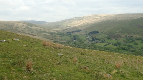
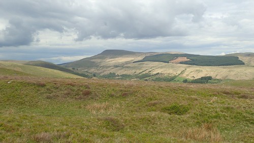
Away to the east, Pen y Fan and Corn Du stand proud of the Central Brecons Beacons. There are a number of mountains and hills in between here and there that I’ve still yet to explore. What is it about the familiarity for which I decide to keep revisiting the same routes?

We would descend to the pass of Bwlch Giedd and seek shelter for our first stop of the day. Although this was a day for suncream almost-T-shirt-weather, the wind was chilled enough to add discomfort to any time spent sitting still.
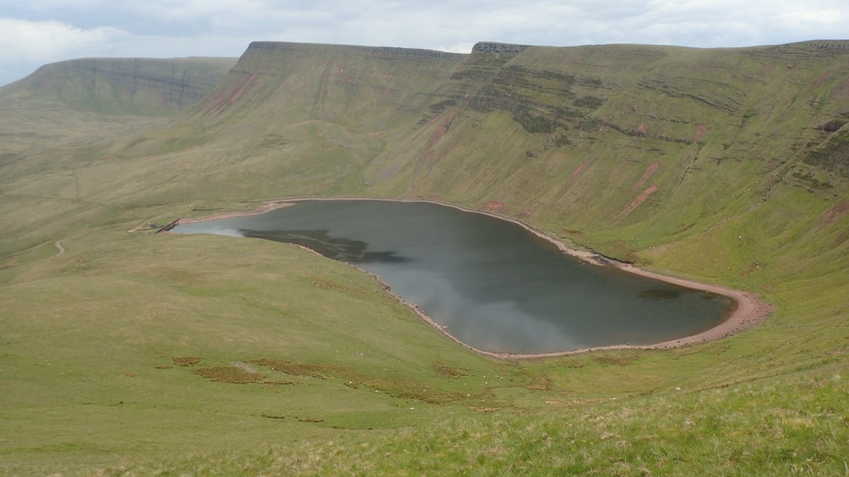
Down beneath us was Llyn y Fan Fawr (lake of the big place). A few of us present on this walk went for a barefoot paddle in those waters last August. Others were wild swimming and, or so I heard, fish also inhabit the area.

On with our current walk and we’d climb again, to the 802m summit of Fan Brycheiniog; the highest point of Y Mynydd Du (the Black Mountain).

We wouldn’t take advantage of the nearby wind shelter. Instead, I believe that was soon occupied by a smaller group of passing walkers. For those who’d not been here before, there was a chance to bag the trig point, before swiftly moving on at these windswept heights.

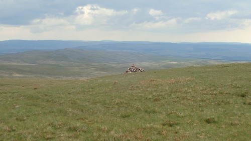
This cairn sits at the top of Fan Foel. A first visit for me, 781m above sea level. Most walkers are more interested in concrete pillars than ominous stacks of stone, from what I’ve observed over the last seven years.

Actually, it’s possible that the more impressive cairn was found at Twr y Fan Foel, while the one above was situated on the higher point.

Our next descent led us to the pass of Bwlch Blaen-Twrch (if I’m reading this correctly, that translates in to “pass of the wild boar’s head”, or something similar).

To then reach the 749m summit of Picws Du was by far the most challenging ascent of our day. Even Matt, our leader for the day and no stranger to difficult terrain, was heard saying ‘I hate this one’.

This summit cairn was under occupation of a group of kids (I’m only in my mid-thirties…), as we quietly passed by.
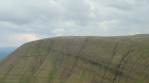


A spectacular walk along higher ground.

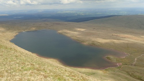
Beneath us now was Llyn y Fan Fach (lake of the small place) and the one of two neighbour water-bodies that I’d not previously been to.

Another cairn, near Bannau Sir Gaer. Oddly, this one isn’t mentioned on the OS map.

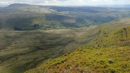
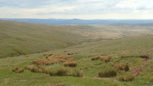
A long descent would follow. From this reduced vantage point, one might easily mistake these peaks for Cribyn, Pen y Fan and Corn Du of the Central Beacons.


We sacrificed our elevation in the knowledge that we’d have to regain a portion of it after visiting the lake.

Of course, we stopped for lunch close to the edge of the water. We’d passed a few other walkers around Picws Du but this spot was by far the busiest we’d encountered on this walk. People sitting and loitering around the lake; some taking a brave dip in to the deep.
If you study the Ordnance Survey map closely, you’ll see a track trailing north and away from this lake, before it joins minor road. There’s apparently a car parking opportunity along the way, which may explain a lot.

After lunch, we turned back on ourselves, parallel to the man-made dam and infamous bothy.

We were following that alternate stretch of the Beacons Way (the lower route) as we followed a green dam alongside a stream.

Crossing the stream without incident, we’d head east towards a mountain pass we had crossed along a higher level.

Our way forward was blatant and easy to follow. I’ve often found this is the case with the Beacons Way, which isn’t known for consistent or regular waymarking.

A slightly alarming climb up around the cliffs followed, before we’d soon arrive at the top of Pant y Bwlch, somewhat breathless.
From this mountain pass, we would now follow a south-south-eastward bearing towards the cars… There was no path on the ground. No lines on the map to follow. Navigating across open moorland is a speciality and feature of Matt’s longer walks, where the terrain and landscape allow.

Some who were present on this day also attempted to follow the same route one day last year, when the Heavens opened in the morning and remained so until closing hours.
I was pleased that no drops were scheduled to fall on this day. Most of the peat was passable and we all crossed those final few miles with relatively dry feet. Last year, I believed they’d had to alter the route due to wind conditions on higher ground. I was surprised that Matt chose not to cancel or postpone that one.

Initially, we were following a course of water away to out left, which is often a good aid in navigating. Then, we would cross it close to weir-like waterfalls and continue across Carnau Gwys.
A random white post in the middle of the moor made little sense to me. Although we soon met with an actual track and found ourselves passing through a landscape that was dotted with shake holes.

It was amongst this landscape that my second day of a navigation course was set, back in November 2017. Moving from point-to-point, taking and following compass bearings, identifying landscape features and shake holes… It was a great learning experience, in spite of the bitterly Welsh weather.
Another distant view of Fan Gyhirych. A familiar sight, signalling that the end might be near.

A steep descent towards the Swansea Valley would lead us to more familiar surroundings.

Just up the road from the Dan-yr-Ogof show caves, this was the same track that we followed towards the end of our second navigation day, en route back to the cars (and a warm drink).

We would continue to cross the rock-laden Cwm Haffes. Back in November 2017, we were advised to never attempt river crossings as they’re not worth the risk… Which may challenge a more widespread believe that all Mountain Leaders are thrill-seeking adventure junkies!
On this day, the water was tame, rocks dry and safe enough to cross over. We then finished with a drink at the Gwyn Arms, opting to sit outside, ahead of the long drive back to Bristol.
