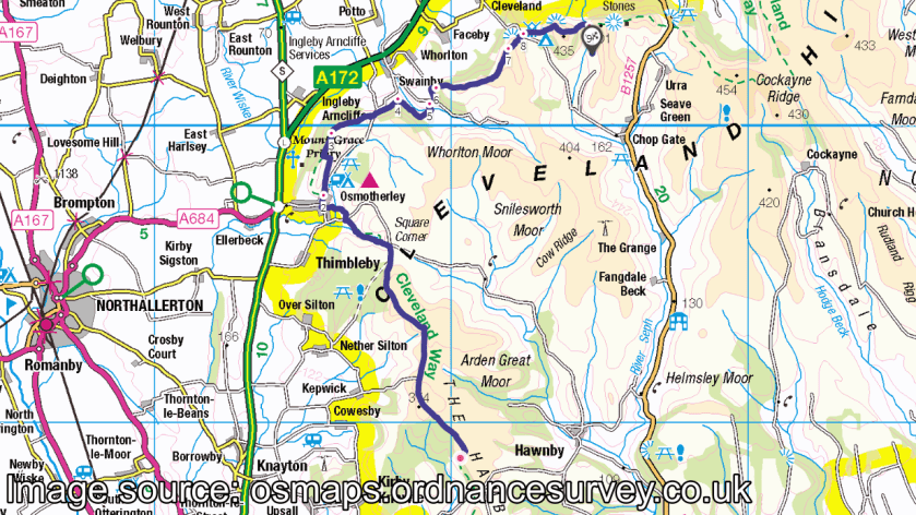
High Paradise Farm to Beak Hills (17 miles)
Monday 13th September 2021
My first day on the Cleveland Way had offered quite a challenge. A long drive from early in the morning. Heading for somewhere new. Finding a place to park and safely leave my car for several days. Dealing with the thoughts and fears that can surround the reality of venturing off alone.
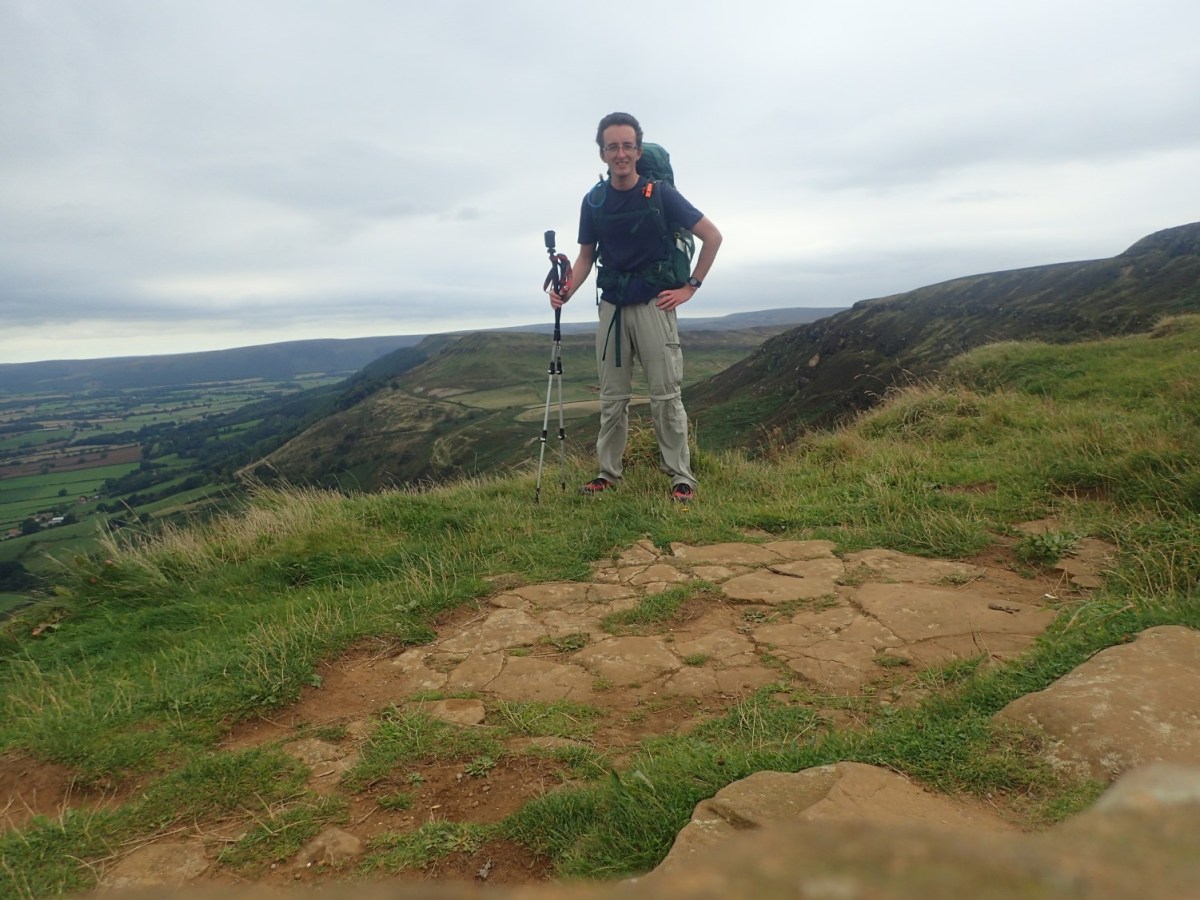
But I’d overcome all of this to make it to my first night of camping at High Paradise Farm. The next morning, I would pack away my kit and resume my walk across the North York Moors.

In only a matter of steps from where I’d pitched, I was back on the Cleveland Way. At the next path junction with Hambleton Road, I met a young guy called Alex, who was also walking this National Trail. He must’ve passed my rucksack while I was in the toilet…
Alex told me about how he lived locally in Thirsk (I pretended to know where that was) and had just set off from Sutton Bank that morning, with the intention of seeing how far he could get in three days. Had he not needed to turn back to the campsite and replenish his water supplies, we might’ve walked together beyond this point.

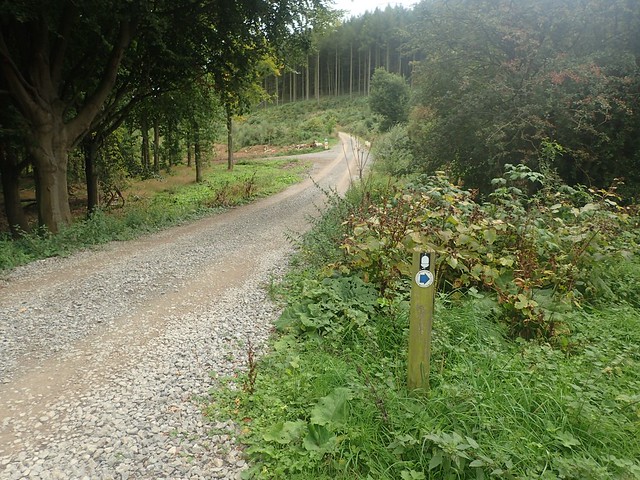
There was a bit of confusion as to which path was the correct one here. Above, you can see the track that Alex encouraged me to follow, while he briefly turned back. Based on the guidance of Google Maps. It was heading in the right direction… But I soon rejoined the cycle-friendly section of this National Trail at Steeple Cross.

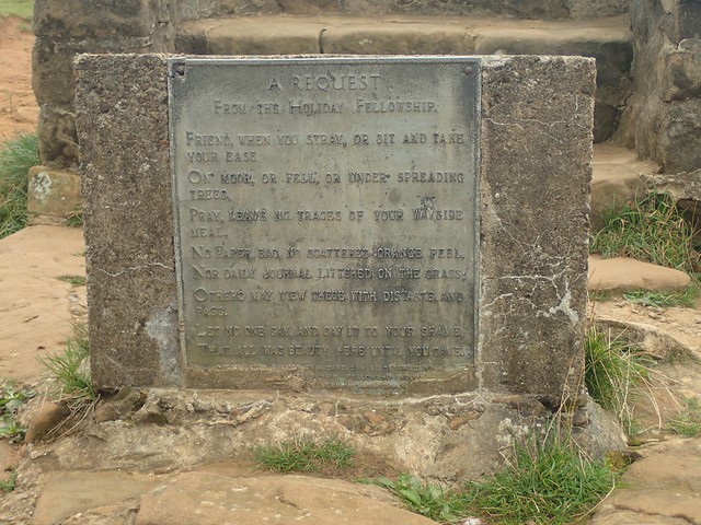
I haven’t read too much about this marker or boundary stone but it’s clearly stood in place for some time. Neither would it be the only example of its kind along my second day.

This walk would take me through the town of Osmotherly – the first town I’d have seen since leaving Helmsley on the previous morning.
I soon passed a pair of north-eastern walkers heading in the opposite direction. They told me how they were walking the Cleveland Way (that’s 109 miles) in only FOUR DAYS… And would be finishing in a few hours! Fair play to them. They spotted the action camera on my walking pole (as Alex had done) and commented on my “canny” Harvey’s waterproof map before we went our separate ways.


I was feeling a bit better about being on the National Trail by this point. I still have five days of walking to follow this one and, to be honest, that was quite a daunting thought. But I was trying to take each day as it came; one at a time. Today was ‘Day 2’. I knew there would be a campsite at the end and that’s what I was focused on. Day 3 was also going to hold uncertainties but I would deal with that then.

I was intrigued to pass signs for the National Cycle Network, just on from Black Hambleton (where I could’ve taken a detour to find a trig point). I’ve been getting in to cycling a bit more recently and, who knows, perhaps I’ll revisit these moors one day with my bike. Over the course of the week, I did find this landscape to be busy with mountain bikers and, as I may’ve said last time; they are working towards creating a more cycle-friendly Cleveland Way.


I soon arrived at a car park and passed one of the National Park Rangers heading through one gate. I’ve explored a number of the UK’s National Parks in my time as a walker but I’ve rarely seen them as frequently as I would do during this week. Just after this, I’d turn away and start descending towards Osmotherly.
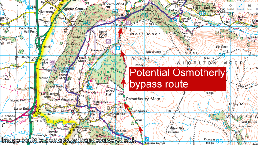
Above, you can see a potential means of bypassing the town and taking a direct move towards resuming the trail. It might avoid some of the undulation. But I was trying to do this trek honestly.

From Square Corner, I began to descend past Oak Dale Reservoir. I’ve just read that it’s been decommissioned over the years – so, you can understand why I didn’t try to photograph it! But I did take the opportunity to stop on some stone steps and have something to eat for ten minutes.


There was an unexpected and sharp ascent up from the reservoir before I’d finally descend in to Osmotherly.
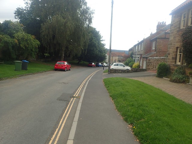
I failed to take any noteworthy photos while passing through this town and despite having to follow a narrow passageway between houses and with a covering overhead, before popping out near the town centre. Beyond that, I was eagerly following the direction of a yellow arrow; then pondering which left turn might be the correct one.

I passed the first footpath leading to Lady Chapel as I didn’t really fancy taking a detour with my rucksack still bearing a fair old weight.

Then I arrived at a newly-installed fingerpost, where a new path had been directed, following the Cleveland Way but also offering another option to visit the Lady Chapel.


There was no option to take a look inside and a couple of people had occupied one of the benches for lunch. It looks to be in good order, though. Certainly far from a ruin.


Just after this I’d meet a lady who was walking the Coast to Coast in sections and she was joining the Cleveland Way, having started over at St. Bees in the west. But she wasn’t certain of the way forward… She’s taken a different route to her husband (who’d tried to forge his way around Osmotherly) and decided to follow me for a while until she felt more comfortable with the direction.


I was glad to be able to help her on her way, even though I was no more familiar with the area than she was – this trip was still my first visit to the North York Moors.

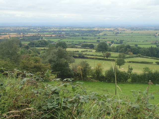
Just left of centre in the photo above, the triangular hill is the iconic landmark known as Roseberry Topping. It’s a hill I’d had my eye on for a number of years, having seen photos of it on social media. I wouldn’t reach it on this day but it would be a part of Day 3. Yet it still seemed to very far away.


I passed another Park Ranger team near the mast beside Arncliffe Wood and then made my way over the next road and down through Clain Wood.


At Scugdale Beck was where my almost-follower was supposed to meet up with her husband. I didn’t see either of them again but hopefully they were reunited and have gone on to complete the Coast to Coast walk at Robin Hood’s Bay.

I must’ve stopped and had lunch by this point. I remember a bench before descending to the river (beck) and how the lady I mentioned before overtook me (which also perhaps explains why I didn’t see them again). Beyond that, I would return to the higher open moorland until the end of my day.


At the next hill beyond the cairn in the photo above, I would reach the trig point above Carlton Bank. I’ve really scrimped on taking photos during this trip – and the ones I have captured, frustratingly, were in a 4:3 format and not my usual 16:9. I was far too occupied with filming and vlogging my experiences.

I did indeed make it to the trig point and touched it… But the evidence only exists in video format. On top of that, a couple where hidden beneath the brow of the hill while I vlogged up there – I hate it when people sneak up on you like that.


Down and over the otherside of this hill, I passed a potential campsite at Lordstones (I think I could even smell the food being cooked). But tomorrow was already going to be a long day and stopping here would’ve only increased that duration.

One last climb up to Cringle Moor and the hardest part of this day would be done. I met four other walkers on the way up who’d decided not to traverse any further. Or, they’d just come down and were still recovering!


Quite the view looking north from the top of this one and I had the stone bench to myself. If only it hadn’t been so windy.


I took a slow and steady descent in to the next pass between hills – it was as cruel and steep as the way up had been. Also knowing that my campsite would be within reach.

On the morning of Day Three, I would begin with the ascent of THAT!

But for this evening, Beak Hills was my destination and a sign literally pointed the way! From there, a clear track led me down to the farmyard and buildings.

There was no-one about when I arrived, although the small camping area was clear. I tried knocking on both doors (without realising one half is reserved for the B&B guests) and then decided to wait. Not long after, the owners arrived, having had to rush off and restore order to their free-roaming cattle!

They asked only £4 for me to spend the night in their well-kept field. Again, I had the space to myself and a choice from two picnic benches! A shower block/washroom and outdoor toilet exist across the track and outside the farmhouse.

There were a couple of ladies staying in the B&B that evening. Also walking the Cleveland Way but in a more sensible manner (no heavy rucksacks). I’d see them briefly the next morning.

It was a nice and quiet setting. But with the wind still tearing down the valley, I resigned myself to the cover of my tent quite early on and wrapped up for the night. After dinner, I read my second letter from my friend and wrote a reply. Day three was coming and I’d be ready for it.
Length of this walk = 17 miles
Thanks for reading.

Always a pleasurable read Olly
LikeLike